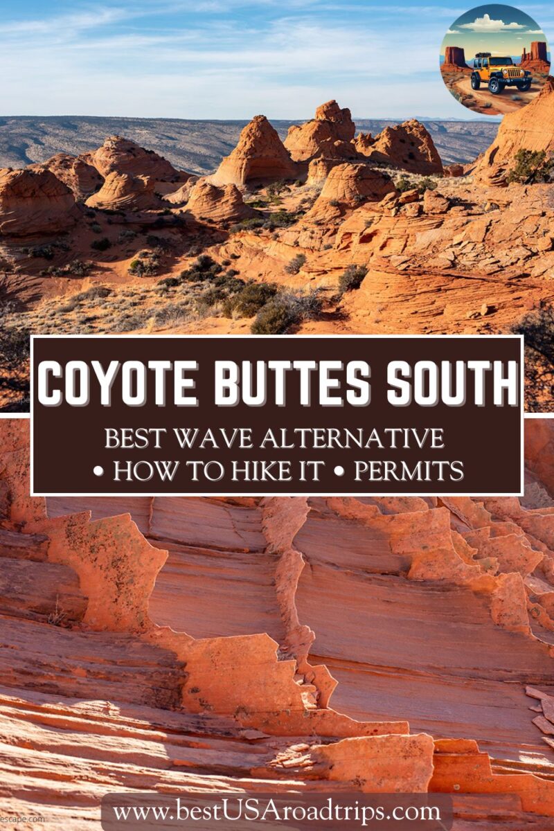
Coyote Buttes South Hike Guide: Permits, Trail Tips, and the Best Wave Alternative
Coyote Buttes South is one of the most beautiful and underrated places on the Utah–Arizona border. Many travelers focus only on the Wave, but the southern part of Coyote Buttes offers even more color, variety, and open desert scenery. Reaching it takes effort, and the area feels remote and wild, which makes it an incredible day adventure if you’re staying in Kanab or Page. In this guide, we explain how the Coyote Buttes South hike works, how to get the required permit, what to expect on the trail, and how to prepare for the deep sand, sun exposure, and fragile rock formations.
This article may contain affiliate / compensated links. For full information, please see our disclaimer here.
Coyote Buttes South Hike – Our Experiences
Chris and I hiked Coyote Buttes South during one of our trips to Kanab. We were trying for the Wave lottery at the time, and like many travelers, we didn’t get lucky that day.
Instead of giving up, we used the chance to explore Coyote Buttes South, which turned out to be an incredible alternative with fewer people and more room to wander.
The drive to the trailhead was the first challenge. We had our camper truck, and even with high clearance and four-wheel drive, we decided not to risk driving the final sandy section. We parked at the Lone Tree area and walked the remaining 2.5 miles through deep sand to Paw Hole. That decision saved us from getting stuck—we saw another pickup buried in soft sand soon after.
Once we reached the formations, we knew the long approach was worth it. The colors were intense, and the rock layers were delicate and sculpted into shapes we hadn’t seen anywhere else in the Southwest. The entire area felt remote, quiet, and untouched. We spent hours wandering among hoodoos, ridges, and thin sandstone fins, taking photos and exploring at our own pace.
This hike was harder than we expected because there are no marked trails, no shade, and no cell coverage. But the scenery was unforgettable, and we left feeling like we had discovered a part of the desert that most people never see. If you enjoy solitude and unique rock formations, Coyote Buttes South is one of the best day adventures in this region.
Coyote Buttes North vs South: What’s the Difference?
Most people hear about Coyote Buttes because of the Wave. That famous formation sits in Coyote Buttes North, and it’s the reason thousands of visitors enter the lottery each day. The hike to the Wave is shorter, the route is clearer, and the goal is singular—everyone hikes there to see one iconic feature.
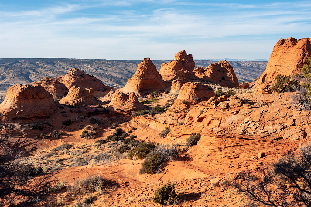
Coyote Buttes South is different. It covers a larger area with far more variety. Here, you explore colorful teepees, ridges, fins, bowls, and delicate layers spread across open desert terrain. There is no single destination point. Instead, you spend the day wandering between formations and discovering new shapes around every corner.
South Coyote Buttes is also harder to reach. You need a high-clearance 4WD vehicle to drive the deep sandy roads, and many hikers choose to walk the last section from Lone Tree to avoid getting stuck. Because it feels more remote and harder to access, the area sees far fewer visitors.
The permit system is also easier. While Coyote Buttes North is extremely competitive, you have a much better chance of securing a permit for Coyote Buttes South, especially through the Daily Lottery.
Both areas are stunning, but if you want more space, more variety, and fewer people, Coyote Buttes South offers an unforgettable backcountry experience.
Where Is Coyote Buttes?
Coyote Buttes sits inside the Paria Canyon–Vermilion Cliffs Wilderness, a protected area spanning the Utah–Arizona border. The formations lie south of US 89, about halfway between Kanab, Utah, and Page, Arizona. Even though the area is inside Arizona, most hikers stay in Kanab because it’s closer to the permit offices and offers easier access to House Rock Valley Road.
Coyote Buttes is managed by the Bureau of Land Management (BLM). There are no marked trails, no facilities, and no cell coverage. The landscape is pure backcountry, with rolling sand, fragile sandstone, and exposed terrain that can feel extremely remote once you leave the trailhead.
The wilderness is divided into two zones:
- Coyote Buttes North, home to the Wave
- Coyote Buttes South, the larger and more varied section
Both require permits, and both have strict daily limits. Because these areas are fragile, every visitor must plan carefully, carry enough water, and be ready for a full day in open desert.
We included this location in our Arizona travel guide, where we break down the best regions and must-see spots.
What Makes Coyote Buttes South Unique?
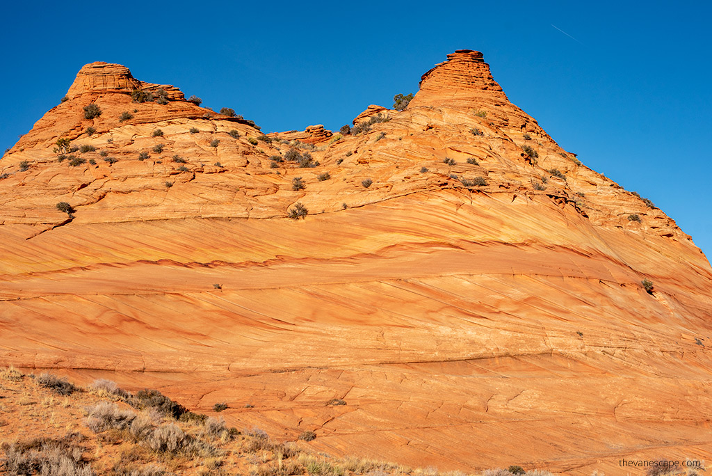
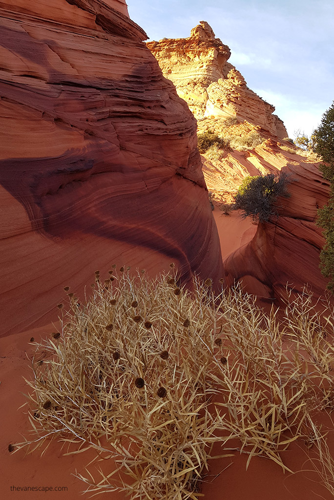
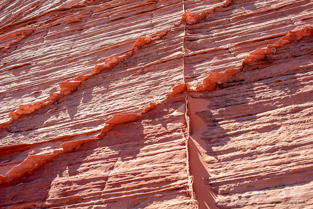
Coyote Buttes South is one of the most colorful and delicate sandstone landscapes in the Southwest. The formations here come from Jurassic Navajo sandstone, shaped by wind and erosion into cones, teepees, ridges, fins, bowls, and thin layers that look almost unreal. The colors range from deep reds and oranges to yellows, pinks, and even touches of green created by different iron oxide pigments in the rock.
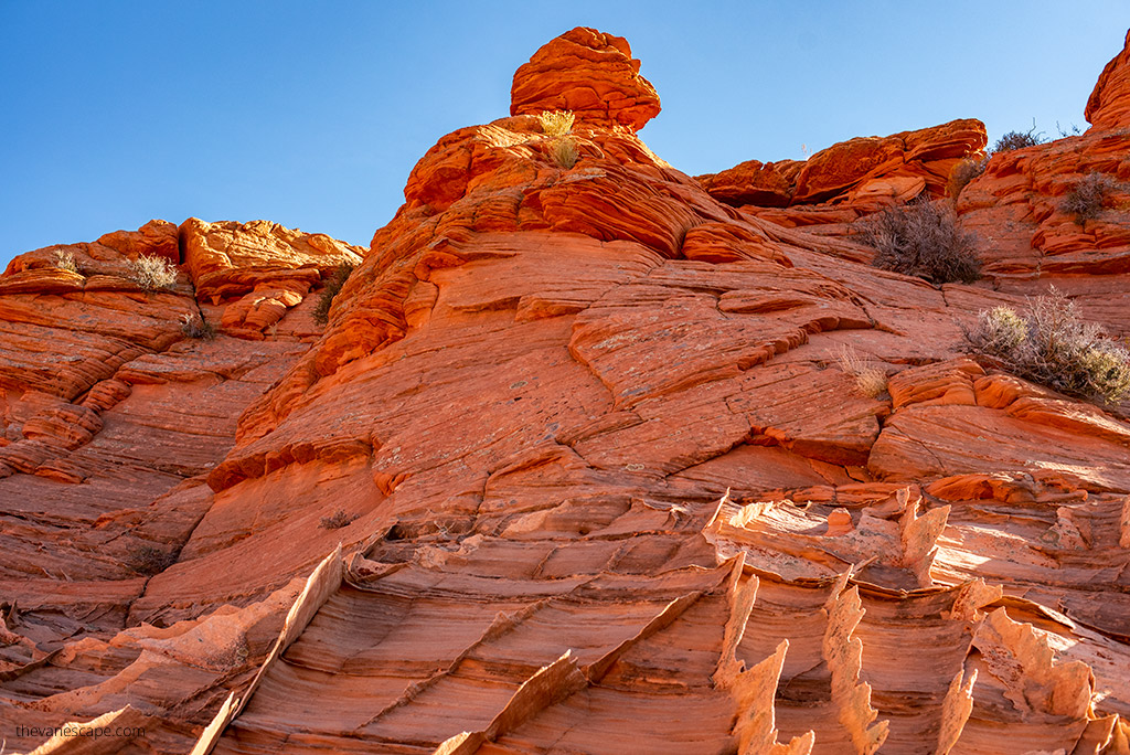
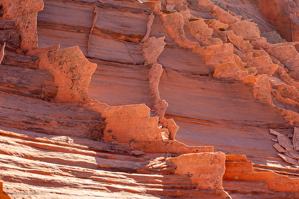
The variety is what makes this area special. Instead of one destination point, you explore a wide open space filled with formations in every direction. Many of the layers are paper-thin and fragile, so you must walk carefully and avoid stepping on edges or climbing on delicate structures. Some formations look sharp and solid, while others crumble under only a little pressure.
This part of the wilderness feels quiet and untouched. Most hikers never make it here, and the limited number of daily permits protects the landscape. The open desert, colorful rock, and total silence create a unique experience, especially if you enjoy photography or exploring natural shapes.
Coyote Buttes South feels like a place from another world, and that’s what makes it worth the effort.
Coyote Buttes South Areas: Paw Hole vs Cottonwood Cove
Coyote Buttes South is divided into two main zones: Paw Hole and Cottonwood Cove. Both areas require the same permit, but they offer different scenery and a different level of access.
Paw Hole
Paw Hole is often the first stop for most hikers. The formations rise right from the parking area, so you can start exploring immediately. Hoodoos, teepees, gentle bowls, and swirling layers fill the landscape. The colors here are intense, and many of the rock layers are thin and fragile. You can spend hours walking from one formation to another, taking photos and following the natural lines of the sandstone.
The biggest challenge is reaching the trailhead. The deep sand on the final stretch makes this drive difficult even with a high-clearance 4WD. Many hikers leave their car at Lone Tree and walk the last 2.5 miles to avoid getting stuck.
Cottonwood Cove
Cottonwood Cove sits farther north and offers even more dramatic formations. The Cottonwood Teepees rise from the desert like a cluster of giant sandstone cones. The area feels more open than Paw Hole and has larger structures spread across rolling sand and ridges.
You can reach Cottonwood Cove in two ways:
- hiking from Paw Hole across the desert, or
- driving from the main road to the Cottonwood Teepee trailhead, which also requires a capable 4WD.
Both areas are fragile and remote. If you only have time for one, many hikers choose Paw Hole because it provides immediate access to stunning formations. But if you enjoy exploring for a full day and conditions are good, visiting both areas makes the hike even more rewarding.
Coyote Buttes South Permits: How the System Works
Coyote Buttes South is a protected wilderness area with fragile formations, so access is limited. Every visitor needs a permit, and only 20 people per day are allowed to enter. The system is strict, but it’s much easier to secure a permit here than for the Wave in Coyote Buttes North.
There are two ways to get a permit:
1. Daily Lottery (Geofence System)
This is the best option if you’re already staying in Kanab or Page.
The old walk-in lottery is gone. The new system works through Recreation.gov, and you must be physically inside the geofence area to apply.
Here’s how it works:
- Day 1 – Apply:
Apply between 6 a.m. and 6 p.m., two days before your hike. This must be done on a mobile device—computers won’t work.
You receive lottery results around 7:15 p.m. the same day. - Day 2 – Accept & Pick Up Permit:
If you win, you must accept the permit and pay the recreation fee by 8 a.m. Utah time.
You must also attend a short safety briefing at 9 a.m. local time.
Note: During daylight savings, Utah and Arizona are in different time zones, except within the Navajo Nation. - Day 3 – Hike Day:
This is your permit day. You can explore Paw Hole, Cottonwood Cove, or both.
Lottery limits:
- 10 people or 4 groups per day (whichever fills first)
Fees:
- $9 non-refundable application fee
- $5 recreation fee per person or dog (all ages must be listed)
2. Advanced Permit (Online, 4 Months Ahead)
If you like planning early, this option gives you the best chance at securing a permit.
- Permits are released on the 1st of each month at 12:00 p.m. (noon) Mountain Time
- They open for the third month ahead
(Example: May permits open on February 1)
Advanced permits often stay available longer than those for the Wave, but spring and fall dates can still fill quickly.

Best Time to Hike Coyote Buttes South
The best seasons for the Coyote Buttes South hike are spring, fall, and winter. Temperatures are milder, the sun feels less intense, and the deep sand is easier to manage when it’s not scorching hot. These cooler months also make the long approach to Paw Hole or Cottonwood Cove far more comfortable.
Summer is the toughest time to visit. There is almost no shade, and the sand reflects heat, making the hike feel even hotter. Temperatures can climb well above 100°F, and hikers often underestimate how draining the exposure can be. Monsoon storms in late summer can also create dangerous road and trail conditions.
Flash floods can wash out sections of House Rock Valley Road, and the clay becomes slick and impassable when wet. Before your hike, it’s smart to stop by or call the BLM Kanab Visitor Center for updated road and weather information.
Start early in the day, no matter the season. Light is better, the air is cooler, and you’ll have more time to explore both areas if conditions allow. Clear skies and low wind create the best photography conditions, especially for the colorful hoodoos and teepees.
How to Get to Coyote Buttes South Trailheads
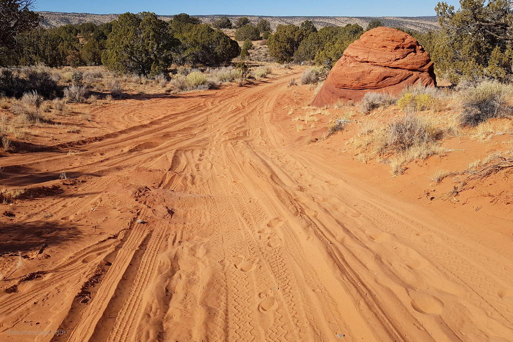
Reaching Coyote Buttes South is part of the adventure. The area is remote, and the final stretch to the trailheads crosses deep sand and rough desert roads. You need a high-clearance 4WD vehicle, and even then, conditions change with every storm. Many visitors choose to park earlier and walk the remaining distance to avoid getting stuck.
The main access road is House Rock Valley Road, which runs north–south between US 89 in Utah and US 89A in Arizona. Once you cross the state line, it’s called House Rock Road, but it’s the same route. The road is dirt the entire way and can become impassable when wet due to clay.
From Kanab and Page
The directions from Kanab and Page are similar:
- Drive 40 miles east on US-89 from Kanab
- Or a similar distance west from Page
- Look for the turn onto House Rock Road between mile markers 25 and 26
- Turn just before a guardrail and a sweeping curve in the highway
From this point, expect 17 miles of rough desert road.
You’ll pass the Wire Pass parking lot at 8.3 miles, then cross into Arizona. Near mile 17, look for an unmarked turnoff on the left. There’s a small parking area at Lone Tree just before this turn.
Paw Hole Access
The Paw Hole Trailhead sits 2.5 miles past the turnoff, but this final section has extremely deep sand. Even experienced drivers in capable 4WD vehicles get stuck here. If you are unsure about your driving skills—or if the road looks chewed up—park at Lone Tree and walk the 2.5 miles to the trailhead.
This is what we did with our camper truck, and it was the right choice. We saw another pickup buried in soft sand only a short distance beyond Lone Tree.
Cottonwood Cove Access
To reach Cottonwood Cove, continue north past the windmill and old structures. The road becomes rougher and eventually impassable for many vehicles. When the road ends, park and explore on foot. The Cottonwood Teepees rise just beyond the parking area.
Important Notes
- High-clearance 4WD is required
- Do not attempt these roads when wet
- Walk the final stretch if you’re unsure
- Let someone know your plans before you go
- Start early to avoid hiking back in the dark
Once you reach the trailheads, the formations are close by, and you can begin exploring the colorful sandstone landscape.
Paw Hole Trailhead: What to Expect
Paw Hole is the most accessible starting point for exploring Coyote Buttes South, especially if you enjoy wandering through formations without following a set trail. The scenery begins right at the parking area, so once you arrive, you’re already surrounded by colorful teepees, thin layered rock, and delicate fins.
From the parking area, look for a small arch near the top of the first hoodoo. This area gives you a good sense of the fragile textures you’ll see throughout the day. There are no trail markers, so the hike becomes a natural exploration—walking from one formation to another and choosing the lines that feel the most interesting.
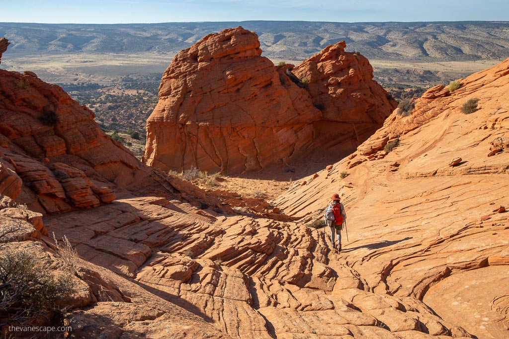
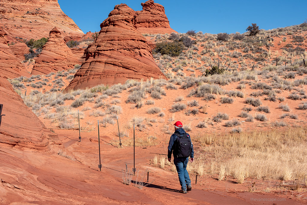
A short fence sits near the trailhead. Pass through it and head toward the buttes. You’ll hike across sand dunes and around a wide sandstone bowl that glows beautifully in morning light. From here, continue toward the hoodoos to the northeast. The sandstone layers are thin and very fragile, so step carefully and avoid climbing on delicate edges.
If you continue west and climb a low ridge, you’ll get a sweeping view of House Rock Road and the surrounding desert. The ridge area has some of the most intricate formations, including twisted fins and ridges shaped by wind over thousands of years.
The sand is deep throughout this area, and the rock is sharp but breakable. Expect slow, steady hiking with plenty of stops for photos.
Paw Hole is ideal for visitors who want great scenery right away, especially if you only have a few hours to explore.
Cottonwood Cove: What to Expect
Cottonwood Cove sits north of Paw Hole and offers some of the largest and most dramatic formations in Coyote Buttes South. The Cottonwood Teepees rise in clusters across the sand, creating a landscape filled with tall cones, ridges, bowls, and colorful layered walls. The area feels open and expansive, with formations spreading in every direction.
Reaching Cottonwood Cove can be done two ways:
- hiking cross-country from Paw Hole, or
- driving to the Cottonwood Teepee parking area if the road is dry and you have a capable 4WD.
Once you arrive, exploring is straightforward. You walk across soft desert sand and circle around the base of the teepees, finding new shapes and colors with each turn. The sandstone layers here are thicker than at Paw Hole, but still fragile. The ridges catch the light beautifully in the early morning and late afternoon.
This part of Coyote Buttes South is ideal for photography. You can capture sweeping views, abstract close-ups, and dramatic color contrasts. The space is wide, so you can spread out and discover your own routes without seeing many other hikers.
Cottonwood Cove and Paw Hole each have a distinct character. If you have the time and the conditions are good, visiting both gives you the full Coyote Buttes South experience.
How the Coyote Buttes South Hike Works
The Coyote Buttes South hike is not a standard trail. There are no signs, no marked routes, and no fixed destinations. Instead, you explore open desert terrain filled with sandstone formations in every direction. The experience feels more like wandering through a natural gallery than following a set pathway.
Most visitors start at Paw Hole, explore the immediate formations, and then continue outward to ridges, bowls, and teepees scattered across the landscape. You decide how far to go and which lines to follow. The terrain is a mix of deep sand and fragile rock, so your pace will be slower than on typical desert hikes.
If you want to see Cottonwood Cove, you can hike cross-country from Paw Hole or drive there separately if the road is dry and you have the right vehicle. Hikers who combine both areas should plan for a full day and start early.
Because the area is unmarked, navigation can be tricky. You need a GPS device, offline maps, or a detailed topographic map. Cell service is nonexistent. The sun exposure is intense, and the sand reflects heat, so carrying enough water is crucial.
Expect a long, slow, beautiful day filled with color and silence. The freedom to explore and the variety of formations are what make this hike so memorable.
Elevation Details
Coyote Buttes South sits at a moderate desert elevation, but the terrain rises and falls as you move between ridges, bowls, and teepees. The elevation changes are gradual rather than steep, yet the deep sand can make the hike feel more strenuous than the numbers suggest.
Here are the key elevation points:
- South Coyote Buttes overall elevation: 5,789 feet
- Top of the Cottonwood Teepees: 5,933 feet
- Paw Hole starting elevation: 5,950 feet
- Paw Hole highest elevation: about 6,350 feet
These elevations mean cooler mornings and strong temperature swings between day and night. The thin desert air and sun exposure can make the hike feel harder, so pacing yourself and drinking water regularly is important.
Hiking Tips for Coyote Buttes South
Coyote Buttes South is beautiful, but conditions can be harsh. The combination of deep sand, full sun exposure, no cell service, and no marked trails makes preparation essential. These tips help you stay safe and enjoy your day in this remote desert landscape.
Bring Plenty of Water
Carry at least one gallon (3.7 liters) of water per person. Even in cooler months, the sand and sun drain energy quickly. We hiked here in late November, and temperatures still climbed into the high 70s. Start hydrating the day before your hike so you don’t begin the day already behind.
Eat Regularly
Balance water with salty snacks and high-energy foods. Over-hydration without electrolytes can lead to hyponatremia. Bring items like trail mix, jerky, nuts, and protein bars, and take breaks to eat even if you don’t feel hungry.
Protect Yourself from the Sun
There is almost no shade. Wear:
- a sun hat
- sunscreen
- sunglasses
- long, breathable layers
Light colors help reflect the heat, and quick-dry fabrics are best.
Watch Your Body
Desert hiking can be unpredictable. If you feel dizzy, nauseated, or fatigued, take a break in whatever shade you can find, drink water, and eat something salty. If you feel cold or start shivering, add extra layers immediately.
Know the Signs of Heat Illness
Heat cramps, dizziness, nausea, and headaches are early warnings. If you feel any of these, rest and cool down. Heat stroke is life-threatening and happens faster than most hikers realize, especially when hiking through deep sand.
Know the Signs of Hyponatremia
Hyponatremia happens when you drink too much water without replacing sodium. Symptoms include nausea, confusion, headache, and difficulty walking. The solution is rest, salty snacks, and balanced fluids—not drinking more water alone.
Know the Signs of Hypothermia
Cold desert nights can be dangerous if you get delayed or lost. Uncontrolled shivering, exhaustion, and confusion are red flags. Carry an extra layer, a warm hat, and an emergency blanket or bivy.
Plan for Route-Finding
There are no marked trails. Bring:
- offline GPS
- a detailed topo map
- a navigation watch or handheld GPS
Always let someone know where you’re going and when you expect to return.
Start Early
The best light is in the morning, the temperatures are cooler, and you’ll have plenty of time to explore both Paw Hole and Cottonwood Cove if the conditions are right.

Packing List for Coyote Buttes South
Coyote Buttes South is remote and exposed, so you must pack as if you’re spending a full day in backcountry desert terrain. There are no services, no water sources, and no cell coverage. These essentials help keep you safe and comfortable.
- Water reservoir: Carry at least one gallon of water per person.
- Electrolytes and salty snacks: Balance hydration with food to avoid hyponatremia.
- Sun protection: Wide-brim hat, sunscreen, sunglasses, long sleeves, and lightweight long pants.
- Navigation tools: Offline GPS, topo map, and a backup navigation device.
- First-aid kit: Include blister care, bandages, tape, pain relief, and any personal medications.
- Extra layers: A warm layer for cooling winds or unexpected weather changes.
- Emergency gear: Emergency blanket or bivy, whistle, and a small fire starter.
- Sturdy footwear: Hiking shoes with good traction for sand and fragile rock.
- Camera gear: Extra batteries, lens cloths, and protective cases.
- Snacks and food: High-energy items like jerky, bars, nuts, and sandwiches.
- Pack with some structure: A comfortable daypack that distributes weight evenly.
Packing well is essential for a safe and enjoyable day in this remote wilderness.
Nearby Attractions
Coyote Buttes South sits between Kanab and Page, making it easy to pair with other scenic spots in the region. If you have extra time, these nearby stops are perfect additions to your trip.
- Horseshoe Bend. A short walk near Page leads to one of the most iconic viewpoints on the Colorado River. Sunrise and sunset are especially beautiful here.
- Antelope Canyon. Upper Antelope Canyon, Lower Antelope Canyon, and Antelope Canyon X are all close to Page. Each offers narrow slots, glowing walls, and guided tours.
- Toadstool Hoodoos. This easy hike off US-89 takes you to photogenic hoodoos and balanced rock formations. It’s a quick stop on the way to or from Coyote Buttes.
- Great Chamber at Cutler Point. A popular adventure starting near Kanab. Tours can take you to a huge sand-filled alcove with a dramatic view.
- Grand Canyon North and South Rim. Both rims are only a couple of hours away. If you’re on a longer Arizona road trip, this region pairs well with a Grand Canyon visit.
- Zebra Slot Canyon. A narrow, striped slot canyon near Escalante. It’s farther away but fits well into a larger Utah road trip.
These attractions showcase the diversity of the region and make Kanab and Page great bases for exploring the desert.
Final Thoughts
Coyote Buttes South is one of the most rewarding day adventures on the Utah–Arizona border. The hike feels remote, quiet, and full of color, and the variety of formations makes it a photographer’s dream. The area takes effort to reach and requires careful planning, but that’s what keeps it so untouched.
If you want a stunning alternative to the Wave with fewer people and more freedom to explore, this is one of the best places to add to your Kanab or Page itinerary.
Do You Like It? Pin It For Later!