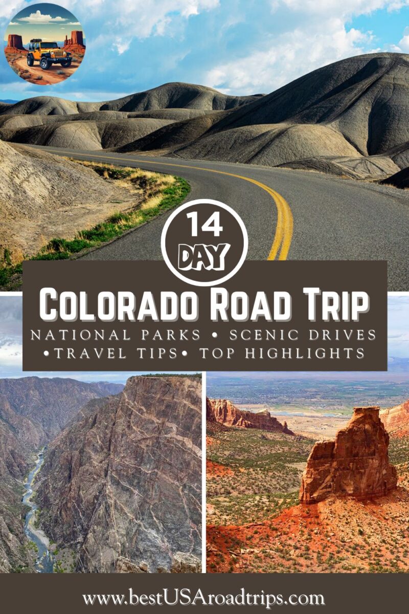
Colorado Road Trip Itinerary for 2026: 2 Weeks for First-Time Visitors
Planning a Colorado road trip in 2026? This 14-day itinerary is a step-by-step guide to planning your Colorado adventure on your own — perfect for first-time visitors. You’ll explore the state’s greatest highlights and a few hidden gems along the way. This route takes you through four Colorado national parks, along iconic scenic byways, and into mountain towns, hot springs, alpine trails, and desert canyons. You’ll find detailed tips on what to see, where to stay and eat, and how to organize each day efficiently — so you can experience the very best of Colorado with confidence and ease.
This article may contain affiliate / compensated links. For full information, please see our disclaimer here.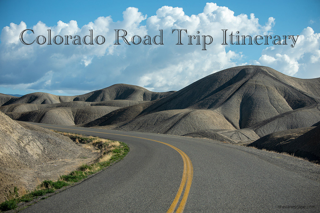
About This Colorado itinerary
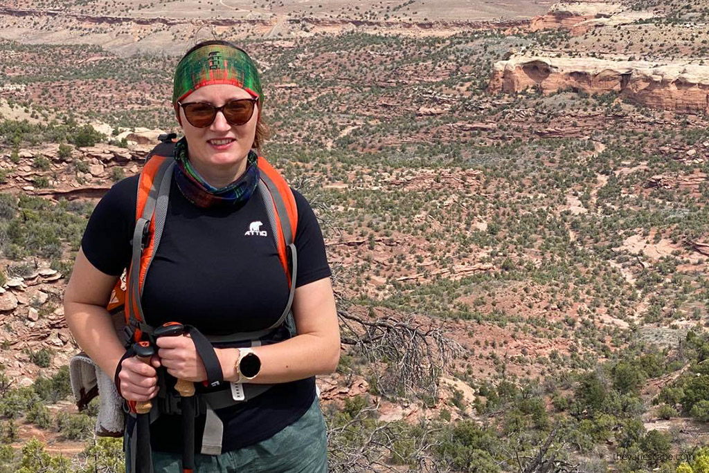
Chris and I have personally driven this entire Colorado route, exploring every stop along the way. We visited four national parks:
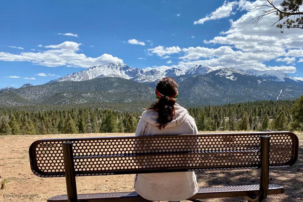
Rocky Mountain,
Black Canyon of the Gunnison,
Mesa Verde, and
Great Sand Dunes—plus scenic towns, mountain passes, and hidden gems that few travelers reach. Everything in this itinerary is based on our own first-hand experiences, from hikes we loved to places we’d happily stay again.
This Colorado itinerary is full and fast-paced, but absolutely doable. We began each day early to make the most of daylight and avoid crowds. Before you hit the road, review each detail and adjust the plan to match your own travel style and pace.
After completing this two-week loop ourselves, we later returned to explore many of these places in depth — and honestly, every destination in this guide deserves at least a few days on its own.
That’s why this itinerary is perfect for first-time visitors: it offers a true taste of Colorado’s best national parks, scenic drives, and mountain towns, helping you decide which spots you’ll want to come back to and experience more deeply.
How Long You Need
Two weeks is the sweet spot for this Colorado road trip itinerary, giving you enough time to see the state’s most iconic parks, towns, and scenic drives without feeling rushed.
If you have only 10 days, you can easily shorten the route by skipping Grand Junction and the Rattlesnake Arches Trail, or trimming your time in the San Juan Mountains. You can also visit just the North Rim of the Black Canyon of the Gunnison, which offers the most dramatic viewpoints and captures the park’s essence in less time. So, skip the South Rim.
When To Go
Best windows: late May–October for open mountain passes and long hiking days. Winter delivers world-class skiing and snowshoeing, but several roads and sites close seasonally (including Trail Ridge Road across Rocky Mountain National Park). Trail Ridge typically opens late May and closes mid-October, weather permitting.
This itinerary is designed for the summer season, from late May through early October, when all national parks are open and roads are fully accessible. It follows the exact route Chris and I drove ourselves in late May.

14-Day Colorado Loop: Quick Overview
- Day 1: Arrive Denver
- Day 2: Estes Park & Rocky Mountain National Park (east side)
- Day 3: Trail Ridge Road to Grand Lake → Winter Park
- Day 4: Aspen & Maroon Bells
- Day 5: Black Canyon of the Gunnison NP — North Rim
- Day 6: Colorado National Monument & Grand Junction
- Day 7: Rattlesnake Arches (hidden gem)
- Day 8: Black Canyon — South Rim → Montrose
- Day 9: San Juan Skyway → Mesa Verde NP
- Day 10: Million Dollar Highway → Durango
- Day 11: Pagosa Springs → Great Sand Dunes NP
- Day 12: Westcliffe → Colorado Springs
- Day 13: Pikes Peak Highway → Manitou Springs → Garden of the Gods
- Day 14: Denver and fly out

Key 2026 Planning Notes (Permits, Reservations, and Logistics)
This Colorado itinerary requires a bit of planning ahead, as several popular parks and attractions now use reservation or permit systems—so take a look at our key 2026 tips before you go.
Rocky Mountain National Park — Timed Entry System
Rocky Mountain National Park is among the US National Parks Requiring Reservations in 2026. Park requires a Timed Entry Permit from late May through mid-October during peak daytime hours. This system helps reduce traffic and overcrowding inside the park.
There are two types of permits, and it’s important to understand the difference:
- Bear Lake Road Corridor Permit:
- Required to access the Bear Lake Road area (including Bear Lake, Sprague Lake, and Moraine Park).
- This permit also allows you to explore the rest of the park.
- Valid for entry during a specific two-hour window, usually between 5 a.m. and 6 p.m.
- “Rest of the Park” Permit:
- Covers all other areas of Rocky Mountain National Park except Bear Lake Road.
- Typically required between 9 a.m. and 2 p.m.
You can enter at any time during your reserved window and stay as long as you want that day.
Permits must be purchased in advance through Recreation.gov and are released in stages:
- Most permits open about one month ahead of each date.
- A limited number of next-day permits are released daily at 5 p.m. (Mountain Time).
If you arrive before 5 a.m. or after 6 p.m., no permit is needed—but you’ll still need a valid park entrance pass.
If you can’t get a timed entry permit, consider parking in Estes Park and using the park shuttle buses that operate during the summer season.
Maroon Bells — Reservation Required
To visit the scenic Maroon Bells near Aspen, you must have a reservation for either:
- The RFTA shuttle from Aspen Highlands to Maroon Lake (most visitors use this), or
- A private vehicle parking reservation for limited spaces at Maroon Lake.
The system runs roughly May through October, and spaces sell out quickly—book early.
Mesa Verde National Park — Cliff Dwelling Tours
Most cliff dwellings in Mesa Verde are accessible only on ranger-led tours, which require a ticket purchased in advance on Recreation.gov. Tickets open 14 days before your visit at 8 a.m. (Mountain Time) and often sell out within minutes.
The only site you can explore on your own is Step House on Wetherill Mesa. Even without tour tickets, you can still enjoy the park’s scenic overlooks, self-guided loops, and archaeological sites.
In this itinerary, we focus on a self-guided driving tour of the park without ranger-led options, so plan to spend about half a day (4–5 hours) exploring the main overlooks and short trails at your own pace.
Trail Ridge Road (U.S. 34)
This famous highway crosses the Continental Divide through Rocky Mountain National Park. It’s one of the highest paved roads in North America—reaching over 12,000 feet.
It’s typically open from late May to mid-October, depending on snow and weather conditions. Always check current road status before you travel.
Rattlesnake Arches Trail (Grand Junction Area)
The access road to this remote trail is high-clearance 4WD only and often closes after heavy rain or snow. You can also hike in from the lower Pollock Bench trailhead year-round (14-mile round trip). Check local conditions before heading out.
Entrance Fees at Colorado National Parks in 2026
This Colorado road trip includes four national parks, and entrance fees in US national parks vary slightly in 2026 depending on the park and your residency status.
At Rocky Mountain National Park, international visitors pay higher entrance costs. In 2026, non-US residents must pay an additional $100 non-resident fee per person on top of the standard entrance fee. Fees for US citizens and residents remain unchanged.
The other parks on this itinerary—Black Canyon of the Gunnison, Mesa Verde, and Great Sand Dunes—do not have increased entrance fees in 2026 and continue to follow standard national park pricing.
For international travelers, this difference is important when budgeting a Colorado road trip, as Rocky Mountain National Park is the only stop on this route with higher entrance costs.
For this reason, international travelers may find the $250 non-resident America the Beautiful Pass useful, while US citizens and residents continue to pay $80.
Smart Trip Tips (High Elevation & Crowds)
- Hydrate and pace yourself. Much of this route sits between 6,000–12,000+ feet. Start drinking more water a few days before your trip and build altitude gradually.
- Start early. You’ll beat trailhead parking crunches and summer thunderstorms.
- Pack lunch most days. Inside many parks, food options are limited or time-consuming.
- Wildlife etiquette. Keep your distance, don’t feed animals, and follow Leave No Trace.
Day 1 — Arrive in Denver (Start of the Loop)
Denver is the perfect place to begin your Colorado adventure. The city has the best flight connections in the state, a wide selection of rental cars, and quick highway access to the mountains.
Once you arrive, pick up your rental vehicle—ideally a mid-size SUV or 4×4. The extra clearance makes driving scenic byways and gravel roads much easier. Before leaving the lot, check the tires and make sure the spare is in good condition.
If you have time after your flight, spend a few relaxing hours exploring Denver. How much you can see depends on your arrival time, but even a short stroll downtown gives you a great first taste of the Mile High City before you hit the road.


If You Have Only a Few Hours
- Larimer Square. Historic storefronts, lights overhead, great first walk.
- 16th Street Mall. Pedestrian-only, free shuttle, quick bites.
- Colorado State Capitol. Snap the “mile-high” step. Great skyline view.
If You Have Most of a Day
- Denver Art Museum or Museum of Nature & Science.
- Denver Botanic Gardens. Calm paths after a travel day.
- Coors Field tour (in season). Baseball history and city views.
Where to Eat (Our Picks)
- Jax Fish House. Consistently great seafood.
- 3 Margaritas on 16th Street. Casual Mexican and strong cocktails.
Where to Sleep
Pick a downtown hotel for a car-free evening, or stay near I-25 for an easy morning exit. We’ve had good stays at Comfort Suites Near Denver Downtown for value and location.
Practical tips for Day 1
- Hydrate more than usual. You’re already at 5,280 feet.
- Lay out tomorrow’s hiking clothes and snacks now. Mornings run smoother.
- If you land late, skip downtown. Eat near your hotel and sleep early.

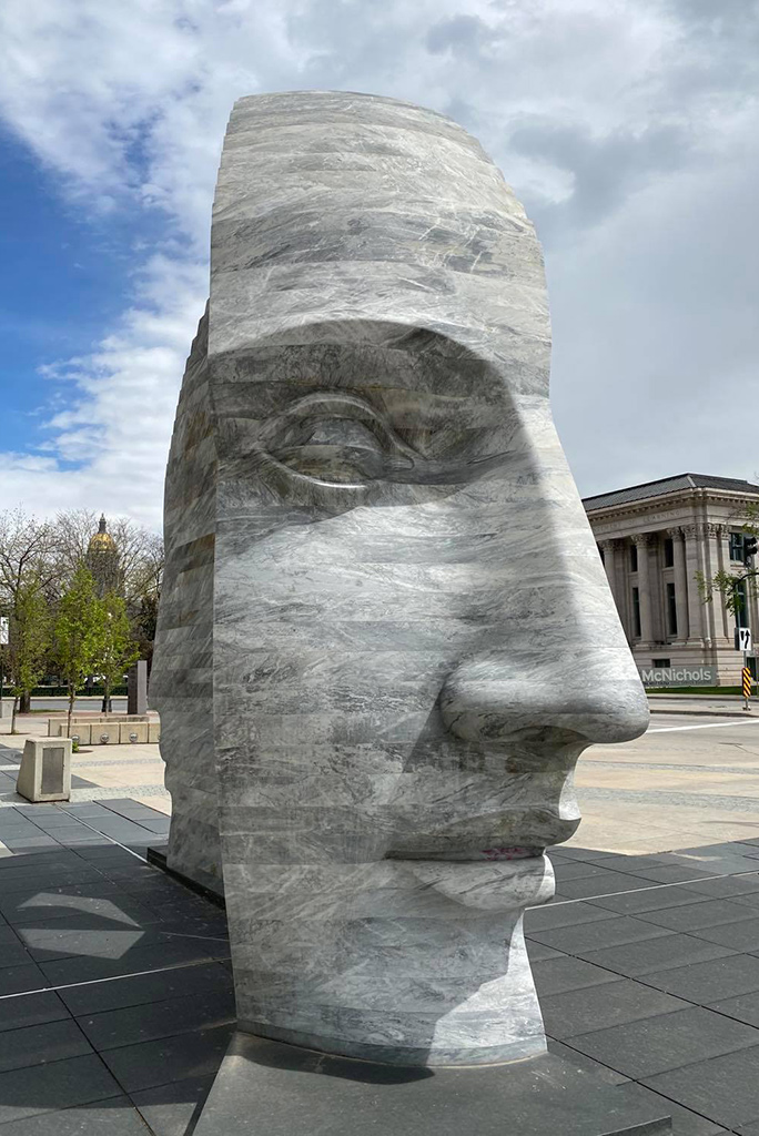

Day 2 – Estes Park and Rocky Mountain National Park
Start your morning early and head for the mountains. The drive from Denver to Estes Park takes about 1.5 hours (roughly 64 miles) via US-36, and it’s one of the prettiest approaches to the Rockies.
Estes Park is the eastern gateway to Rocky Mountain National Park, so plan to spend your day exploring its alpine lakes, meadows, and scenic overlooks.
Entering the Park
Arrive at the Beaver Meadows Entrance Station as early as possible to make the most of the day and avoid crowds. Be sure you already have both your Timed Entry Permit and your America the Beautiful Pass ready. Early mornings are calm, wildlife is active, and parking fills up quickly on popular trails.
Bear Lake Road Highlights
From the Beaver Meadows entrance, turn left onto Bear Lake Road—one of the park’s most scenic drives. Along this corridor, you’ll find some of the best short hikes in Colorado:
- Bear Lake Trail – an easy 0.6-mile loop with postcard views.
- Sprague Lake Trail – a flat 0.8-mile walk around a glassy alpine lake.
- Bierstadt Lake Trail – a moderate 3-mile round trip with a beautiful overlook.
These trails are ideal for your first day at altitude. Choose one or two depending on your energy after travel. Remember to wear layers—temperatures can drop fast, even in summer—and carry plenty of water and snacks.
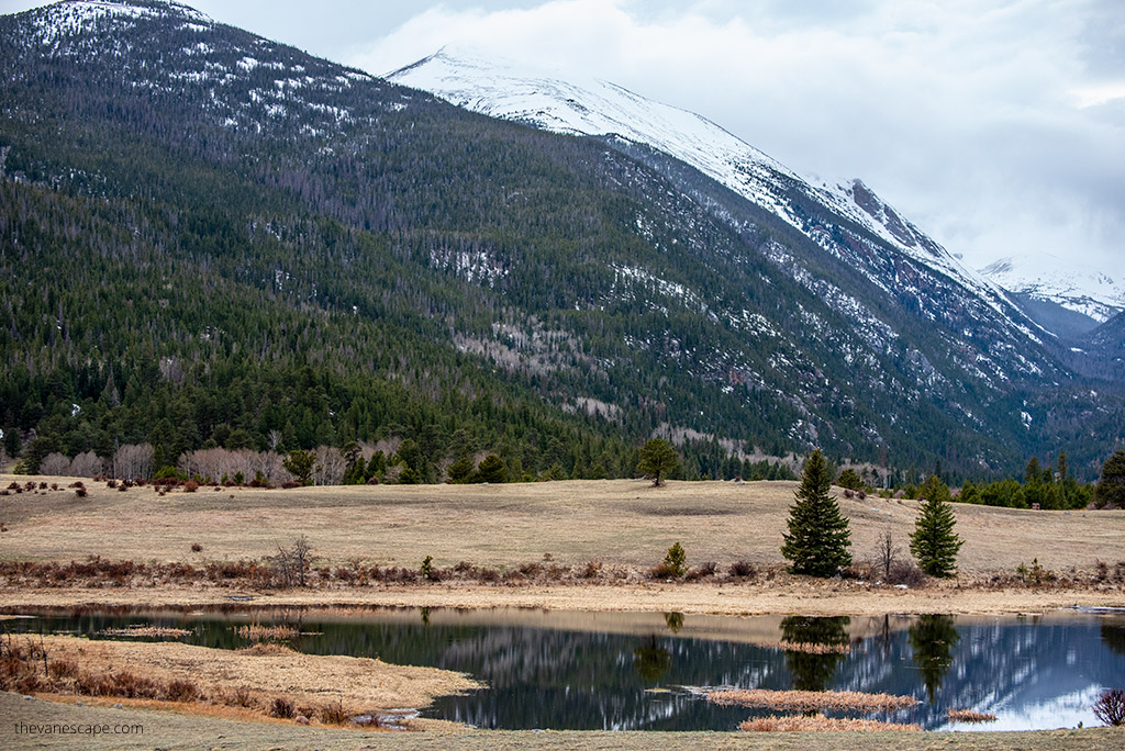
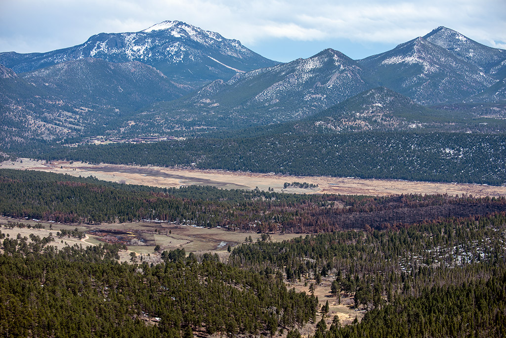
Scenic Stops and Short Drives
After exploring Bear Lake Road, head toward Deer Ridge Junction and the Fall River area for wide valley views and easy wildlife spotting. Elk, mule deer, and marmots are often visible near the roadside. If you have extra time, drive south to the Wild Basin area near Allenspark for quieter trails and waterfalls.
Evening in Estes Park
Spend the night in the charming mountain town of Estes Park. Browse the local shops, pick up souvenirs, and enjoy a well-deserved dinner after your first full day in Colorado.
Where to Eat
- Twin Owls Steakhouse – hearty mountain fare in a rustic setting.
- Peppers Mexican Grill – casual and flavorful after a long hike.
- Bob & Tony’s Pizza – a local favorite for a relaxed evening.


Where to Stay
- The Stanley Hotel – historic, elegant, and famous for inspiring The Shining.
- Historic Crag’s Lodge by Diamond Resorts – comfortable, great views, and more budget-friendly.
Tomorrow, you’ll cross the Continental Divide on one of America’s most spectacular mountain roads—the Trail Ridge Road—as your adventure continues toward Grand Lake and Winter Park.
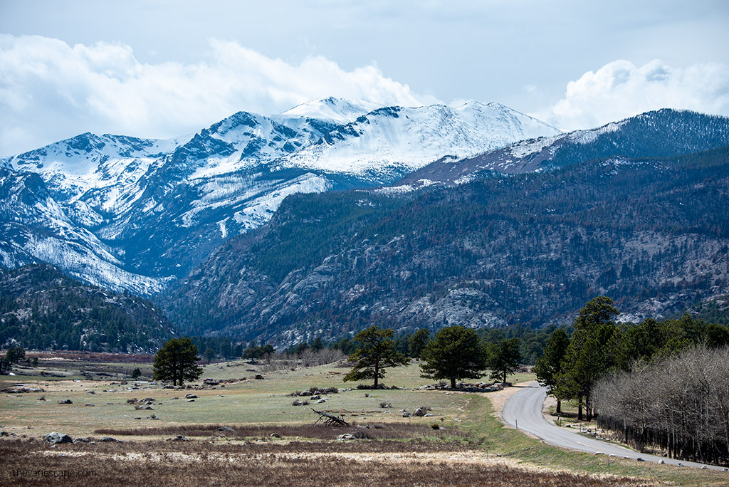
Day 3 – Trail Ridge Road to Grand Lake and Winter Park
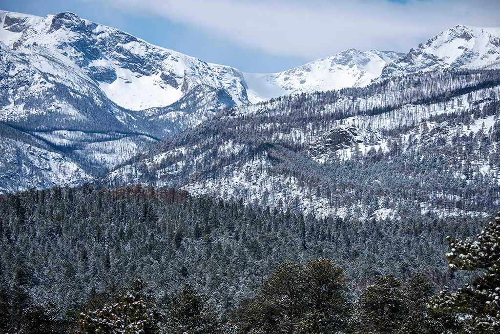
This part of your Colorado itinerary takes you along one of the most breathtaking mountain drives in the United States—the legendary Trail Ridge Road (U.S. Highway 34). It’s the highest continuous paved highway in America, reaching over 12,000 feet, and crossing the Continental Divide inside Rocky Mountain National Park.
Trail Ridge Road Drive
After breakfast in Estes Park, enter the park again through the Beaver Meadows Entrance Station and follow signs for Highway 34. The full drive from Estes Park on the east to Grand Lake on the west is 48 miles. Without stops, it takes about two hours, but plan for at least four hours to fully enjoy the viewpoints and short walks.
The scenery changes dramatically as you climb above the treeline. You’ll pass subalpine forests, alpine tundra, and sweeping views of snowcapped peaks. The road’s highest point is 12,183 feet (3,713 meters), where the air is thin and the wind brisk, even in summer. Dress in warm layers, as it can feel like winter up here—even in July.
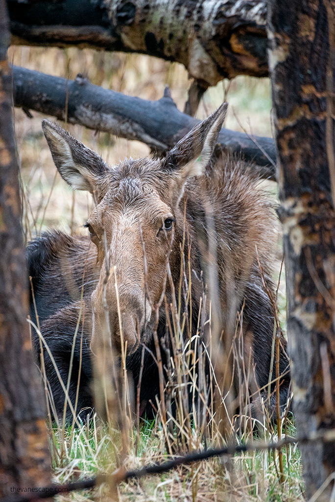
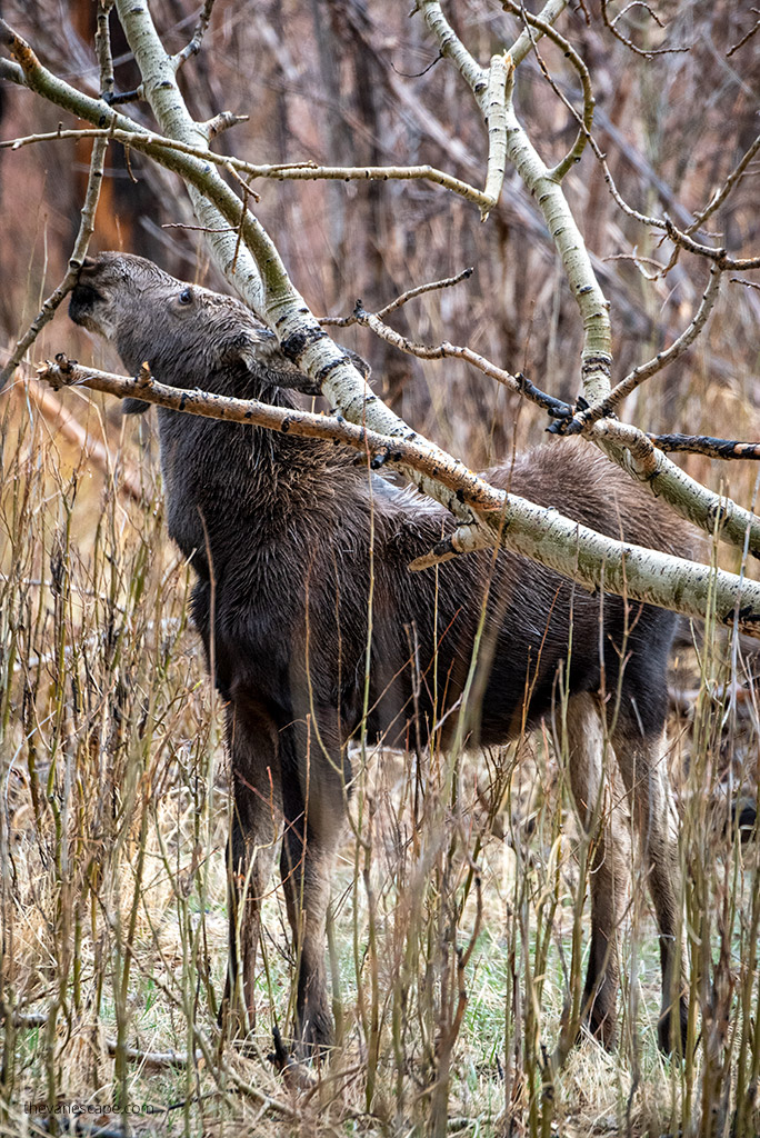
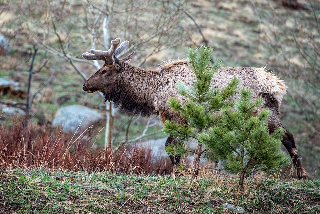
Keep your camera ready for wildlife. Elk, moose, marmots, and bighorn sheep often graze near the roadside. Drive carefully—sharp turns and sudden stops are common when drivers pull over for photos.
If you feel the effects of altitude, take it slow and drink plenty of water. Altitude sickness can appear suddenly at this elevation.


When the Road Is Open
Trail Ridge Road is open seasonally, usually from late May to mid-October, depending on snow conditions. If it’s still closed during your travel dates, follow the scenic detour south through Allenspark, Idaho Springs, and Berthoud Falls to reach Grand Lake and Winter Park. It’s about 143 miles and roughly 3.5 hours of driving—longer, but still very scenic.
Visiting Grand Lake, Fraser, and Winter Park
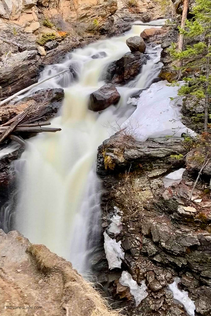
After descending from the high peaks, stop in Grand Lake, a charming lakeside town at the park’s western edge. Stretch your legs on the Adams Falls Trail, an easy half-mile walk with a beautiful waterfall view. Then continue toward Fraser and Winter Park, both surrounded by mountains and outdoor trails.


Where to Eat
- Sagebrush BBQ & Grill (Grand Lake) – hearty comfort food and local beers.
- The Wake Coffee Shop (Grand Lake) – great stop for coffee and pastries.
- Hernando’s Pizza Pub (Fraser) – cozy spot with a friendly local vibe.
Where to Stay
We spent one night in this area before continuing our Colorado itinerary toward Aspen.
- Spirit Lake Lodge & Snowmobile Rentals (Grand Lake) – simple, clean, and close to town.
- Holiday Inn Express Hotel & Suites Fraser – Winter Park Area – comfortable and reliable, perfect for a restful night.
Tomorrow’s route will take you through beautiful mountain passes toward Aspen and one of Colorado’s most photographed spots—Maroon Bells.
Day 4 – Aspen and Maroon Bells
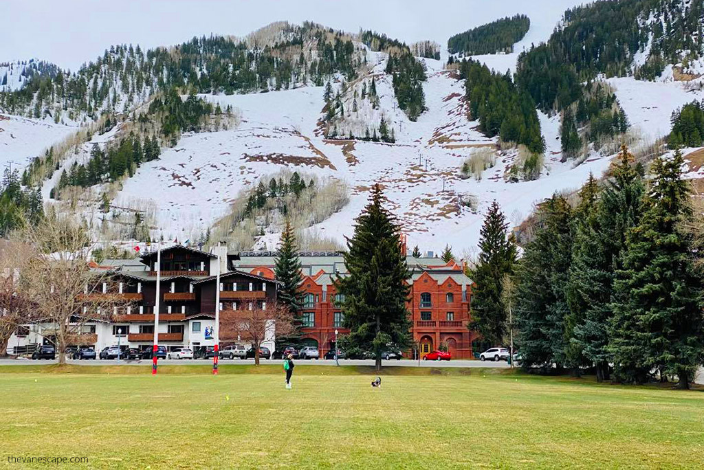
Day 4 of your Colorado itinerary brings you to one of the most famous mountain destinations in the state—Aspen. This upscale alpine town offers a blend of world-class scenery, luxury charm, and outdoor adventure. The highlight of the day will be your visit to the Maroon Bells, often called the most photographed peaks in Colorado.
Driving to Aspen
From Winter Park, it’s about 145 miles to Aspen via I-70 E and CO-82 E (around 3.5 hours).
If you start in Grand Lake, the distance is 164 miles via I-70 W and CO-82 E, taking roughly the same time.
On the way, stop in Glenwood Springs—a perfect halfway break. This charming town sits at the confluence of the Roaring Fork and Colorado Rivers and is famous for its hot springs. A one-hour soak at the Glenwood Hot Springs Pool feels wonderful after a long mountain drive.

Visiting the Maroon Bells
The twin peaks of the Maroon Bells rise dramatically above Maroon Lake, creating one of Colorado’s most iconic views. Because of its popularity, a reservation is required to visit—either for the RFTA shuttle bus from Aspen Highlands or for limited private parking near Maroon Lake.
The shuttle operates daily from mid-June through mid-October, running every 15 minutes between 8 a.m. and 5 p.m. If you drive, you must have a timed parking permit for your chosen entry window.
Once at the lake, you can enjoy short walks or longer hikes.
- Maroon Lake Scenic Trail – easy and flat, perfect for photography.
- Crater Lake Trail – moderate 3.6-mile round trip, leading closer to the Bells.
Even if you’re not hiking far, plan at least 2–3 hours here to soak up the views and take photos. Morning light is best for reflections on the lake.
Evening in Aspen
After visiting the Maroon Bells, return to Aspen for a relaxing evening. The town itself is small and walkable, with designer shops, galleries, and excellent restaurants. Prices are high, but the atmosphere is unforgettable.
Where to Eat
- Meat & Cheese Restaurant and Farm Shop – farm-to-table dishes with mountain charm.
- The White House Tavern – cozy spot for burgers and cocktails.
- Spring Café – fresh, healthy options for breakfast or brunch.
Where to Stay
Aspen accommodations fill fast, especially in summer. Book early or consider staying in Glenwood Springs for more affordable options.
- Hotel Aspen – comfortable and central.
- Aspen Square Condominium Hotel – great for longer stays.
- Glenwood Springs Hotel Colorado – historic charm if you prefer to stay en route.
Tomorrow, your Colorado itinerary continues west toward the rugged landscapes of the Black Canyon of the Gunnison National Park, one of Colorado’s most dramatic and lesser-known natural wonders.

Day 5 – North Rim of Black Canyon of the Gunnison National Park
On Day 5 of your Colorado itinerary, you’ll leave the high-end resort feel of Aspen behind and dive into one of the state’s most dramatic and lesser-known landscapes — the Black Canyon of the Gunnison National Park.
Today focuses on the North Rim, a quiet, remote area offering breathtaking overlooks and short hikes with almost no crowds.
Getting There
From Aspen, it’s about 119 miles (roughly 3 hours) via CO-133 S. This is a stunning drive that takes you past towering peaks, aspen groves, and winding mountain rivers. Take your time — it’s one of the most scenic stretches of your entire Colorado road trip.
Along the way, small towns like Carbondale, Redstone, and Paonia are great for coffee breaks or quick photo stops.
Exploring the North Rim
The North Rim Road is open seasonally, typically from mid-April to mid-October, and closes in winter due to snow. It’s a gravel road but usually well maintained. The route is quiet and wild — you’ll likely share the viewpoints with only a few other travelers.
Start at the North Rim Ranger Station, then follow the North Rim Road, which ends about 7 miles later at Kneeling Camel Viewpoint. There are only a handful of overlooks, but each one reveals a jaw-dropping perspective of the canyon’s sheer, dark cliffs carved by the Gunnison River thousands of feet below.
Top viewpoints include:
- Chasm View – the most famous overlook, right next to the campground.
- The Narrows View – shows the tightest section of the canyon.
- Balanced Rock View – a striking rock formation on the rim.
- Island Peaks View – layered rock walls that glow at sunset.
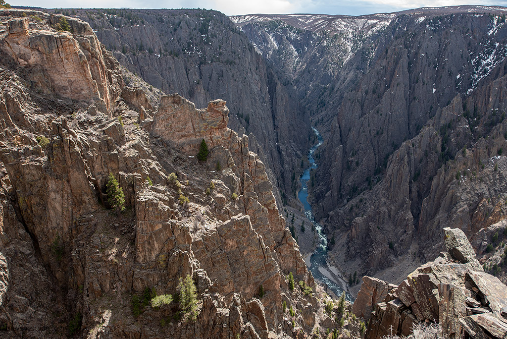
If you have time for one trail, make it Exclamation Point. It’s a moderate 3-mile round-trip hike from the North Vista Trailhead near the ranger station, and the payoff is incredible. You’ll stand at the edge of a vertical cliff with the Gunnison River roaring far below — one of the most stunning viewpoints in the entire park.
Where to Stay
There are no lodges inside the North Rim, only the North Rim Campground, which offers primitive sites with unbeatable views. For hotels, stay in one of the nearby small towns:
- Hotchkiss – quiet, with a few motels and local diners.
- Delta – larger, with more restaurant choices and affordable hotels.
We stayed overnight in Delta, as it offered more options and made a good base before continuing to Grand Junction the next morning.
Where to Eat
- Pat’s Bar & Grill (Hotchkiss) – friendly spot for burgers and cold drinks.
- Daveto’s Italian Restaurant (Delta) – hearty pasta and pizza after a long day outdoors.
- El Tapatio (Delta) – classic Mexican food with generous portions.
Tomorrow, your Colorado itinerary continues west into red-rock country. You’ll explore the spectacular Colorado National Monument and the charming Grand Junction area — a perfect mix of desert scenery, hiking, and wineries.


Day 6 – Colorado National Monument and the Grand Junction Area
Day 6 of your Colorado itinerary brings a change in scenery. After the cool alpine passes and dark canyon walls, you’ll enter the warm red-rock landscapes of western Colorado.
Today’s highlights include driving through the Colorado National Monument and exploring the relaxed desert towns of Fruita and Grand Junction — a region known for its vineyards, scenic overlooks, and prehistoric history.
Getting There
From Delta, it’s about 40 miles (1 hour) to Fruita, the western entrance to the Colorado National Monument. This short drive makes for an easy morning. If you’re coming from Hotchkiss, add another 25 minutes.
Colorado National Monument
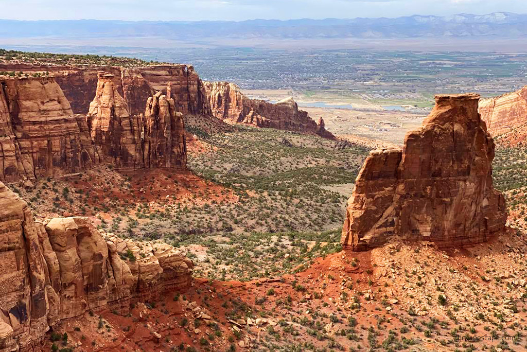
The Colorado National Monument is one of the most underrated gems in the state. Towering red cliffs, deep canyons, and massive monoliths form a landscape that rivals Utah’s national parks — but without the crowds.
The park’s scenic drive, Rim Rock Drive, stretches for 23 miles between Fruita and Grand Junction. You can enter from either side, but the Fruita entrance is the most impressive, climbing quickly into the canyons with sweeping views of the Grand Valley below.
Plan about 3 to 4 hours to complete the drive with photo stops and short walks. Some of the best overlooks include:
- Independence Monument View – the park’s signature rock spire.
- Grand View – incredible panorama of the red-rock formations.
- Coke Ovens Overlook – rounded sandstone domes shaped by centuries of erosion.
- Artist’s Point – perfect for sunrise or late-afternoon light.
If you want to stretch your legs, try a short trail such as Canyon Rim Trail (1 mile round trip) or Otto’s Trail (0.75 mile round trip). Both offer easy walks with huge payoffs.
Afternoon in Fruita and Grand Junction
After exiting the monument, spend the afternoon relaxing in Fruita or Grand Junction. The region is part of Colorado’s Wine Country, with several boutique vineyards surrounded by desert cliffs. We especially recommend visiting Mesa Park Vineyards — a small, family-run winery with great hospitality and beautiful valley views.
If you’re traveling with kids or love dinosaurs, don’t miss the Museum of Western Colorado: Dinosaur Journey Museum in Fruita. It’s fun, educational, and air-conditioned — a nice break from the heat.
Where to Eat
You’ll find plenty of great dining options in Grand Junction:
- Rockslide Restaurant & Brewery – excellent craft beer and burgers downtown.
- Spoons Bistro & Bakery – fresh, local ingredients in a cozy setting.
- Tacoparty – creative tacos and modern Southwestern cuisine.
Where to Stay
Stay one night in Grand Junction to rest and recharge before your next adventure.
- Days Inn by Wyndham Grand Junction – budget-friendly, clean, and convenient.
- SpringHill Suites by Marriott – modern comfort in the downtown area.
Tomorrow, your Colorado itinerary takes you off the beaten path to one of the state’s hidden gems — the Rattlesnake Arches Trail, home to the second-largest concentration of natural arches in the United States.

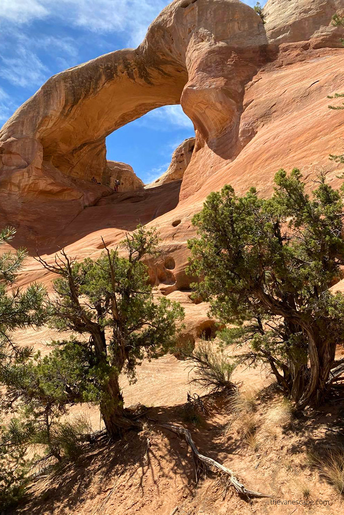
Day 7 – Rattlesnake Arches Trail (Colorado’s Hidden Gem)
Day 7 of your Colorado itinerary is all about adventure. Today you’ll explore one of Colorado’s best-kept secrets — the Rattlesnake Arches Trail.
This remote hike near Grand Junction reveals a spectacular cluster of natural sandstone arches, second in number only to Utah’s Arches National Park. It’s wild, rugged, and unforgettable.
Getting There
Rattlesnake Arches lies within the Black Ridge Canyons Wilderness, part of the McInnis Canyons National Conservation Area. There are two ways to reach it:
- Pollock Bench Trailhead – 14 miles round trip, open year-round. The trailhead is about 15 minutes from Fruita and accessible with any vehicle.
- Black Ridge Road (Upper Trailhead) – 6.2 miles round trip but much harder to reach. The access road is rough and requires a high-clearance 4×4 and dry conditions. This route is typically open mid-April through late October, depending on weather.
If you’re not confident in your off-road driving skills, take the longer hike from Pollock Bench. It’s strenuous but safer, and the scenery is stunning the entire way.
The Hike
The trail winds through slickrock canyons and open desert, leading to a natural gallery of stone arches. Some of the highlights include:
- First Arch – a perfect framing view to start your hike.
- East Rim Arch – narrow and graceful, overlooking the red canyon below.
- Cedar Tree Arch – a large arch with a tree growing through it, one of the most photographed spots.
- Rainbow Arch – the most famous, with a broad curve that glows orange in the afternoon light.
Bring plenty of water, snacks, and sun protection. There’s no shade, no services, and summer temperatures easily exceed 90°F.

Important Tips
- Check trail and road conditions at the BLM office in Grand Junction before you go. Rain can make the access roads impassable.
- Start early in the morning to avoid the heat.
- Carry a GPS app or offline map, as trail markings are minimal.
- Leave no trace — pack out everything you bring.
Alternative Options
If hiking Rattlesnake Arches sounds too demanding, you can spend another relaxing day around Grand Junction. Options include:
- More short hikes in the Colorado National Monument.
- A scenic drive along Unaweep Canyon.
- A visit to local wineries or orchards in Palisade, just east of Grand Junction.
Where to Eat
Return to Fruita or Grand Junction for dinner. A few of our favorite casual spots are:
- Hot Tomato Pizzeria (Fruita) – fun local vibe and excellent pizza.
- 626 on Rood (Grand Junction) – upscale dining with a great wine list.
Where to Stay
Stay another night in Grand Junction. You’ll want a good rest before heading into the mountains again tomorrow.
- Fairfield Inn & Suites – reliable comfort and breakfast included.
- Castle Creek Manor – cozy B&B with warm hospitality.
Tomorrow, your Colorado itinerary continues to the South Rim of Black Canyon of the Gunnison National Park, where the views plunge thousands of feet into one of the steepest canyons in North America.


Day 8 – South Rim of Black Canyon of the Gunnison National Park
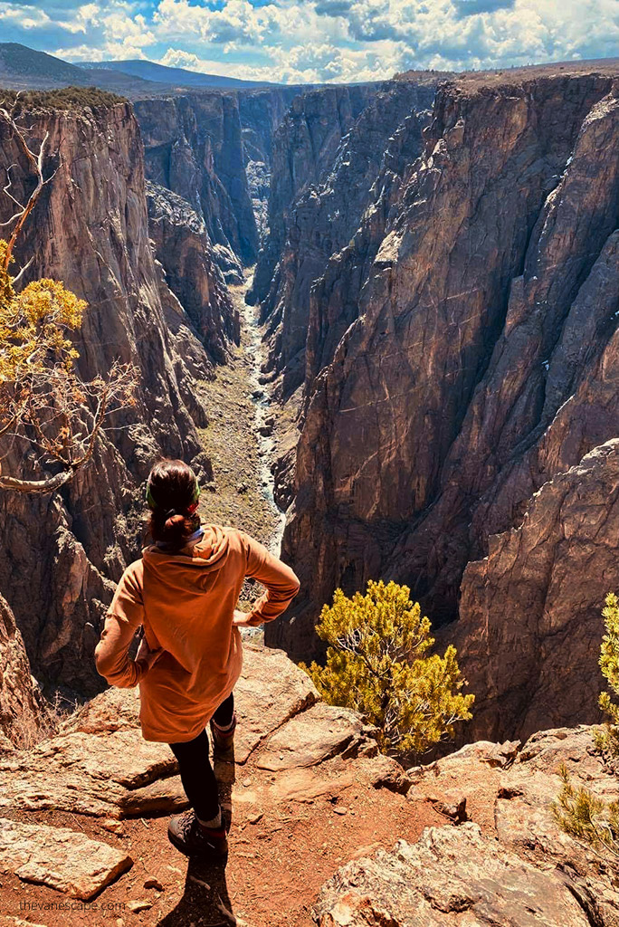
On Day 8 of your Colorado itinerary, you’ll revisit one of the state’s most dramatic natural wonders — the Black Canyon of the Gunnison National Park — but this time, you’ll explore its more accessible and developed side, the South Rim.
While the North Rim is peaceful and remote, the South Rim delivers deeper perspectives, more overlooks, and several short trails that reveal the canyon’s staggering depth and narrow shape.
Getting There
From Grand Junction to the South Rim Visitor Center near Montrose, it’s about 75 miles (1.5 hours) via US-50 E. Plan to arrive by mid-morning to enjoy good light for photography and to avoid the midday heat.
The South Rim sits at about 8,000 feet (2,400 meters) above sea level, so even though the weather can be warm, keep in mind that you’re still at high elevation.
South Rim Road Drive
The main scenic drive, South Rim Road, stretches for 7 miles and features 12 viewpoints, each offering a unique angle on the canyon’s vertical walls. Allow at least 3–4 hours to complete the drive with stops.
Some of the most spectacular overlooks include:
- Gunnison Point – right behind the Visitor Center, offering an instant “wow” view.
- Chasm View – one of the deepest and most dramatic sections of the canyon.
- Painted Wall View – the tallest cliff in Colorado at 2,250 feet (685 meters), streaked with pink and white pegmatite.
- Dragon Point – a twisting view of the Gunnison River carving through the dark stone.
The narrowness of the canyon gives it its name — some sections are only 40 feet wide at the bottom, yet drop nearly half a mile straight down.


Short Hikes on the South Rim
If you want to stretch your legs, try one or two of these short trails:
- Rim Rock Trail – 2 miles round trip, easy, following the canyon edge with great views.
- Oak Flat Loop Trail – moderate 2-mile loop that descends slightly into the canyon for a closer perspective.
- Warner Point Nature Trail – 1.5 miles round trip from High Point overlook, with panoramic views at the western edge of the park.
Where to Stay
The nearby town of Montrose is the best base for the night. It’s only 15 miles from the South Rim and offers restaurants, hotels, and gas stations.
- Hampton Inn Montrose – modern, comfortable, includes breakfast.
- GreenTree Inn Montrose – budget-friendly, clean, and convenient.
- South Rim Campground – inside the park for those with tents or RVs (reserve early).
Where to Eat
- Jimmer’s Steak-BBQ Bar & Grill – generous portions and a relaxed vibe.
- Camp Robber Restaurant – locally loved for creative dishes and friendly service.
Tomorrow, your Colorado itinerary takes you onto one of America’s most scenic drives — the San Juan Skyway — with jaw-dropping mountain views, charming historic towns, and a visit to the incredible Mesa Verde National Park.

Day 9 – The San Juan Skyway and Mesa Verde National Park
Day 9 of your Colorado itinerary will take you on one of the most spectacular drives in the American West — the San Juan Skyway Scenic Byway. This 236-mile loop through the San Juan Mountains is packed with alpine passes, waterfalls, mining towns, and sweeping views of more than one hundred 13,000-foot peaks.
Your main goal today is to follow part of this legendary route and visit the UNESCO-listed Mesa Verde National Park, home to some of the best-preserved Ancestral Puebloan cliff dwellings in the United States.
The Drive: Montrose to Mesa Verde via the San Juan Skyway
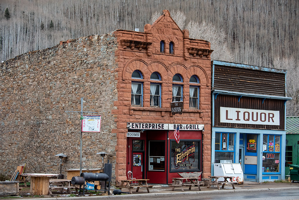
Start early from Montrose and head south on US-550 toward Ridgway and Ouray. The first part of the route is already stunning, climbing into the San Juan Mountains. Between Ouray and Silverton, the road becomes the famous Million Dollar Highway, carved into the cliffs with breathtaking drops and mountain views at every turn.
From Silverton, continue south to Durango, then west toward Cortez and Mesa Verde National Park. The total drive is about 200 miles and takes 6 hours with scenic stops along the way.
Take your time — this is not a day to rush. Stop at the overlooks, stretch your legs in the historic towns, and enjoy the beauty of one of the most unforgettable roads in Colorado.


Visiting Mesa Verde National Park
The Mesa Verde Visitor and Research Center is located just off Highway 160, about 10 miles east of Cortez. From there, it’s a steep, winding 21-mile drive to the main archaeological area on the Chapin Mesa.
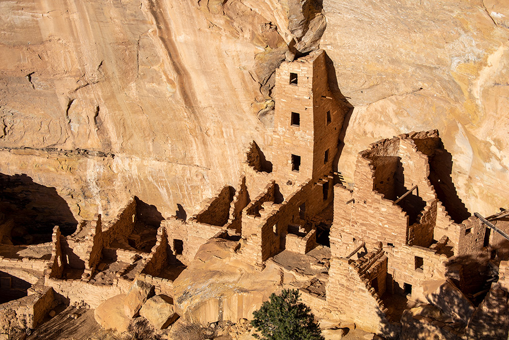
Mesa Verde showcases the remains of ancient cliff dwellings built between 600 and 1300 CE by the Ancestral Pueblo people. To fully appreciate the park, plan at least 3–5 hours for your visit.
Top Highlights:
- Cliff Palace Viewpoint – the park’s most iconic site, visible even without a guided tour.
- Spruce Tree House Overlook – one of the best-preserved dwellings in the park.
- Mesa Top Loop Road – a 6-mile scenic drive with short walks to overlooks and surface dwellings, including Square Tower House, Sun Temple, and Sun Point View.
- Far View Sites Complex – an easy, self-guided trail that connects several ancient pueblos and kivas.

Guided Cliff Dwelling Tours
Most cliff dwellings, including Cliff Palace, Balcony House, and Long House, are open only by ranger-led tours. Tickets are sold on Recreation.gov and usually open 14 days before your visit at 8 a.m. (Mountain Time). They sell out fast, so plan ahead.
If you can’t get tickets, don’t worry — there are plenty of overlooks and self-guided trails where you can still admire the ancient architecture from above.
Where to Eat
After exploring the park, head to Cortez for dinner.
- The Farm Bistro – creative dishes made with local ingredients.
- La Casita De Cortez – excellent Mexican food in a casual setting.
Where to Stay
Stay overnight in Cortez, just a short drive from the park entrance.
- Retro Inn at Mesa Verde – fun, vintage-style hotel with great reviews.
- Holiday Inn Express Mesa Verde-Cortez – comfortable, modern option with breakfast included.
Tomorrow, your Colorado itinerary continues along the most dramatic stretch of the San Juan Skyway — the Million Dollar Highway — with stops in Silverton, Ouray, and Durango, three of Colorado’s most scenic mountain towns.


Day 10 – The Million Dollar Highway and Durango
Day 10 of your Colorado itinerary features one of the most thrilling mountain drives in the United States — the Million Dollar Highway. This section of U.S. Route 550 connects Ouray, Silverton, and Durango, winding through the San Juan Mountains with dramatic drop-offs, hairpin turns, and nonstop alpine views. It’s a highlight of any Colorado road trip and one of our personal favorites.
Driving the Million Dollar Highway
From Cortez, drive about 2.5 hours (116 miles) to reach Ouray, following Highway 160 east to Durango, then north along the Million Dollar Highway. You’ll pass through the historic mining town of Silverton before reaching Ouray, often called the “Switzerland of America.”
If you have time, we recommend doing this drive in both directions — Durango to Ouray and back — to fully enjoy the scenery. The route climbs over several high passes, including Coal Bank Pass (10,640 feet), Molas Pass (10,910 feet), and Red Mountain Pass (11,018 feet). Every curve reveals a new photo opportunity.
Take it slow, pull over often, and enjoy the ride — this is mountain driving at its best.


Stops Along the Way
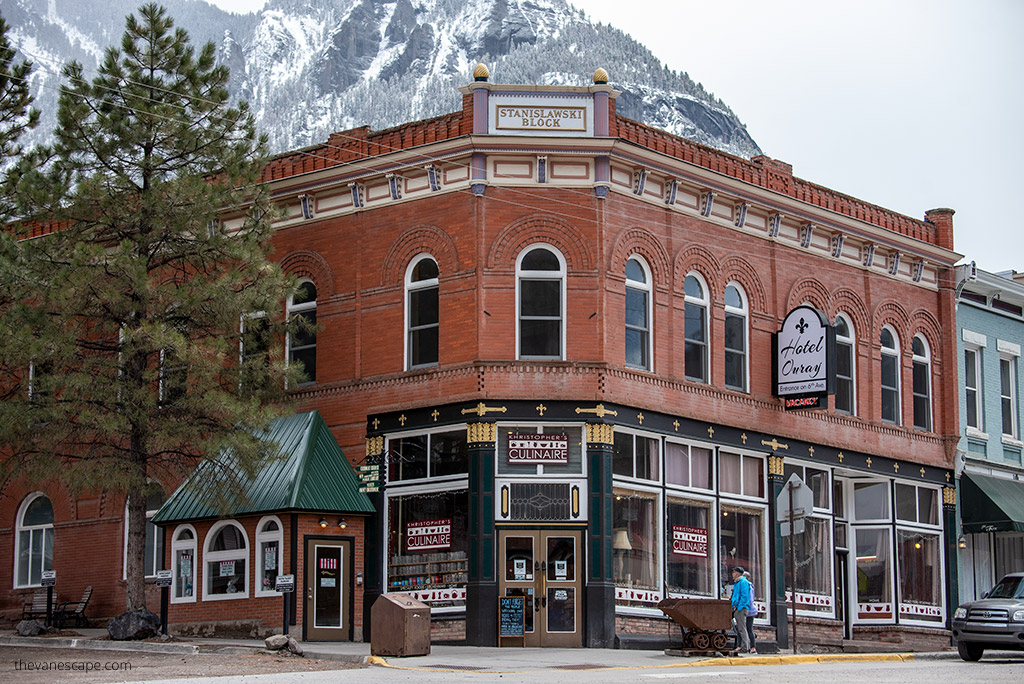
- Silverton – Once a booming mining town, now a charming mix of colorful buildings, restaurants, and shops surrounded by mountains. Great spot for lunch or coffee.
- Ouray – Famous for its natural hot springs and mountain views. If you have time, soak at the Ouray Hot Springs Pool for an hour or two. Admission is around $18 per adult and worth every penny after a day of driving.

Optional: Durango & Silverton Narrow Gauge Railroad
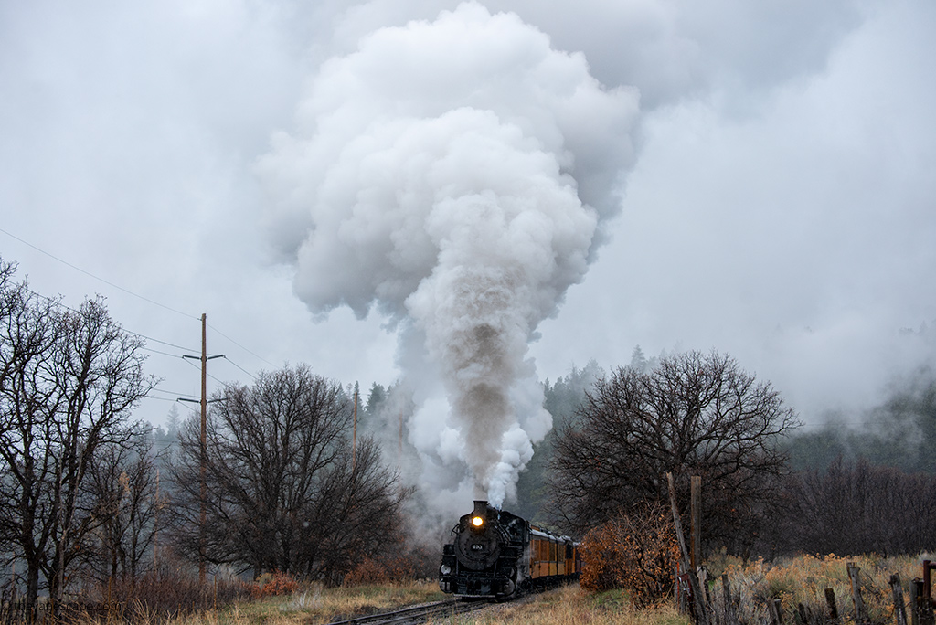
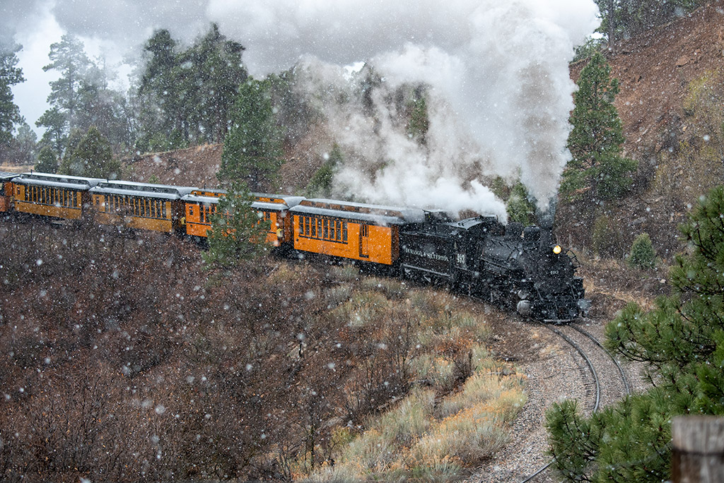
If you prefer to let someone else do the driving, consider taking the historic Durango & Silverton Narrow Gauge Railroad instead of (or in addition to) driving. This vintage steam train runs between Durango and Silverton, following the Animas River through deep canyons and pine forests.
- The full round trip takes about 7 hours, or you can ride one way and return by bus.
- Book tickets well in advance, as this is one of Colorado’s top attractions.
Rafting in Durango
Durango isn’t just about trains — it’s also one of the best places in Colorado for whitewater rafting. The Lower Animas River offers Class II–III rapids suitable for beginners and families. Half-day trips last about 2–3 hours and cost roughly $70–$90 per person.
Evening in Durango
Durango is one of our favorite towns in southern Colorado. Its historic downtown is full of great restaurants, lively bars, and Western charm. Walk along Main Avenue, peek into the old saloons, or just relax after your big day on the road.
Where to Eat
- Ken & Sue’s – excellent steaks and upscale comfort food.
- The Ore House – classic Durango steakhouse with a great wine list.
- Steamworks Brewing Company – casual spot with craft beer and hearty meals.
Where to Stay
- Adventure Inn Durango – clean, comfortable, and affordable.
- Fairfield Inn & Suites – modern, great breakfast, and close to downtown.
- Historic Strater Hotel – for a true Old West experience in the heart of Durango.
Tomorrow, your Colorado itinerary takes you east through Pagosa Springs, where you can soak in more hot springs, before reaching the towering dunes of Great Sand Dunes National Park — one of the most unique landscapes in the entire state.


Day 11 – Pagosa Springs and Great Sand Dunes National Park
Day 11 of your Colorado itinerary takes you from the rugged mountains to one of the most surprising landscapes in the entire state — the Great Sand Dunes National Park.
Along the way, you’ll pass through Pagosa Springs, a laid-back mountain town famous for its healing hot springs and beautiful mountain views.
Drive from Durango to Great Sand Dunes
From Durango, follow US-160 E toward Alamosa and Mosca. The drive covers about 169 miles and takes roughly 3.5 hours without stops. Plan to leave early to make the most of your day.
Stop at Pagosa Springs
About 60 miles east of Durango, you’ll reach Pagosa Springs, a perfect halfway stop. The town sits along the San Juan River and is best known for its geothermal pools.
If you’re in the mood to relax, spend an hour or two soaking at The Springs Resort & Spa, which has more than 20 pools overlooking the river. Admission is on the pricey side (around $65 per adult), but the mountain views make it worthwhile. If you’re short on time, simply walk the riverside trail or grab a coffee downtown before continuing your drive.

Visiting Great Sand Dunes National Park
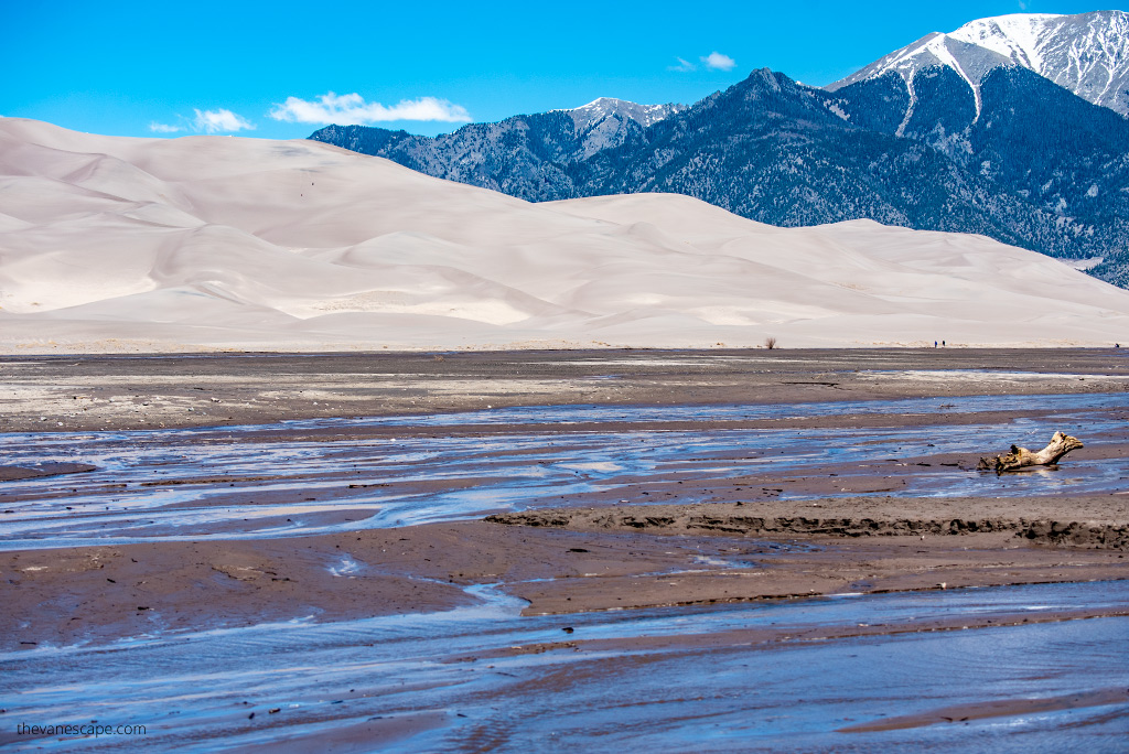
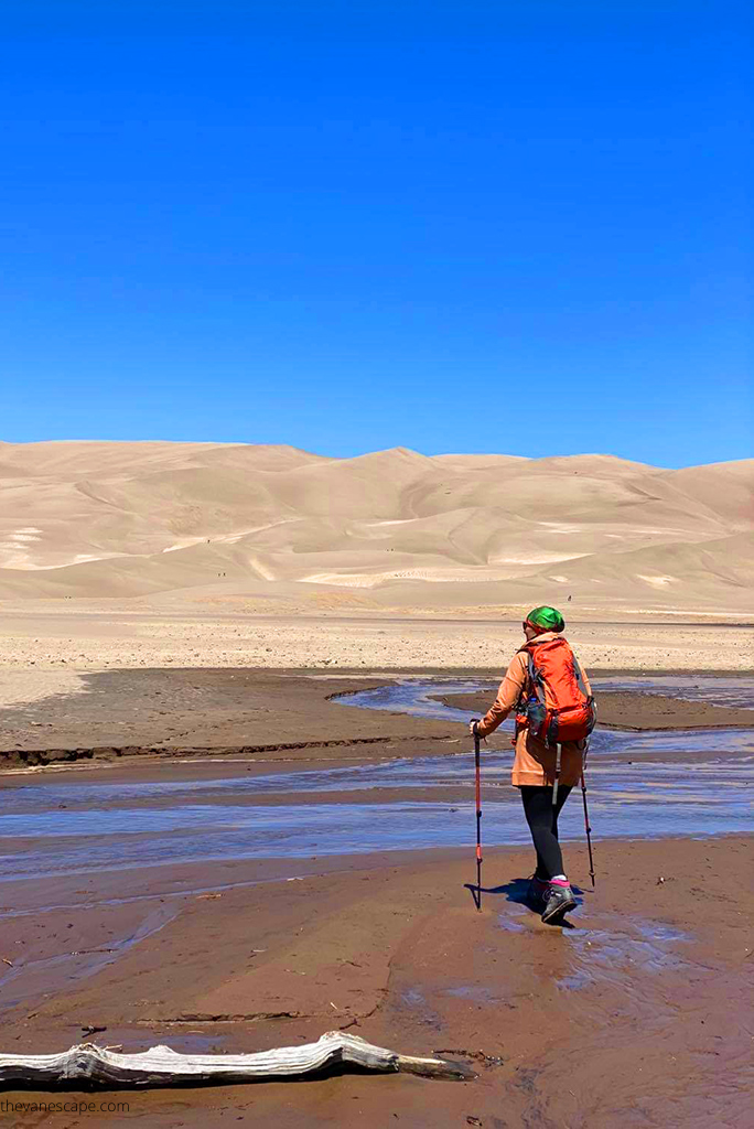
The moment you arrive at Great Sand Dunes National Park, the scenery shifts dramatically. Towering dunes rise sharply from the valley floor with snowcapped peaks of the Sangre de Cristo Mountains behind them — a striking contrast you won’t find anywhere else in Colorado.
The park doesn’t require reservations, and entrance is included with your America the Beautiful Pass. Plan to spend at least 3–5 hours exploring.

Top Things to Do:
- Hike the Dunes: Start from the main Dunes Parking Area. Climb as far as you want — even a short walk gives amazing views. Reaching the top of High Dune takes about 2 hours round trip.
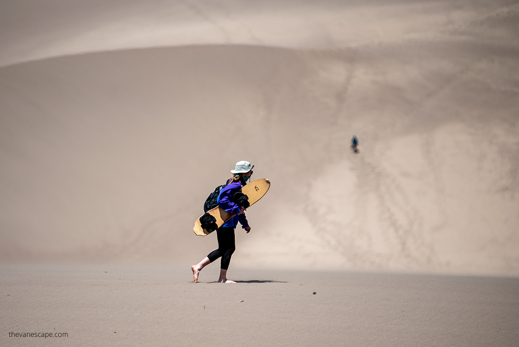
- Sandboarding or Sand Sledding: Rent boards or sleds in nearby Mosca or Alamosa. It’s one of the most fun ways to experience the dunes.
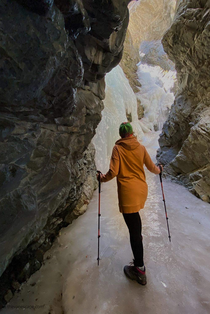
- Hike to Zapata Falls: Just 3 miles south of the park entrance, a short 0.8-mile round trip trail leads to a hidden 30-foot waterfall. The gravel access road is steep but passable for most cars.
Good to Know
- Bring plenty of water, sunscreen, sunglasses, and a hat — there’s no shade on the dunes.
- The sand can reach 150°F (65°C) in the heat of the day. Visit early morning or late afternoon for cooler temperatures and softer light.
- There are no restaurants inside the park, so pack lunch or snacks.

Where to Stay
You can stay inside the park or nearby in Alamosa, Mosca, or Fort Garland.
- Great Sand Dunes Lodge (Mosca) – closest accommodation with beautiful sunset views.
- Oasis Camping Cabins – simple cabins and tent sites near the park entrance.
- Hampton Inn Alamosa – comfortable, modern hotel with easy access to restaurants and shops.
Where to Eat
Head to Alamosa for dinner — it’s about 35 minutes from the dunes.
- San Luis Valley Brewing Company – great burgers and local beer.
- Calvillo’s Mexican Restaurant – hearty portions and family recipes.
Tomorrow, your Colorado itinerary continues north through scenic mountain valleys to Westcliffe and Colorado Springs, where dramatic peaks and charming small towns await.

Day 12 – Westcliffe and Colorado Springs
Day 12 of your Colorado itinerary takes you from the quiet beauty of the San Luis Valley to the vibrant city of Colorado Springs.
Along the way, you’ll discover one of Colorado’s most underrated mountain towns — Westcliffe — tucked between two stunning ranges: the Sangre de Cristo Mountains and the Wet Mountains. This day combines small-town charm, peaceful scenery, and the start of your return toward Denver.
Drive from Great Sand Dunes to Westcliffe
From Great Sand Dunes National Park, head north on CO-69. The drive to Westcliffe is about 93 miles (2 hours and 15 minutes) through open plains, winding roads, and panoramic mountain views. You’ll see why this stretch is one of the most scenic in southern Colorado.
Explore Picturesque Westcliffe
Westcliffe feels like stepping back in time — quiet streets, friendly locals, and dramatic peaks in every direction. The town is part of a certified Dark Sky Community, so if you stay here overnight, the stargazing is spectacular.
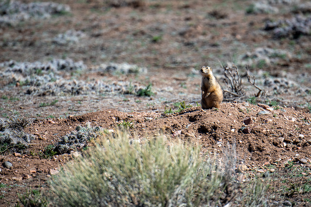
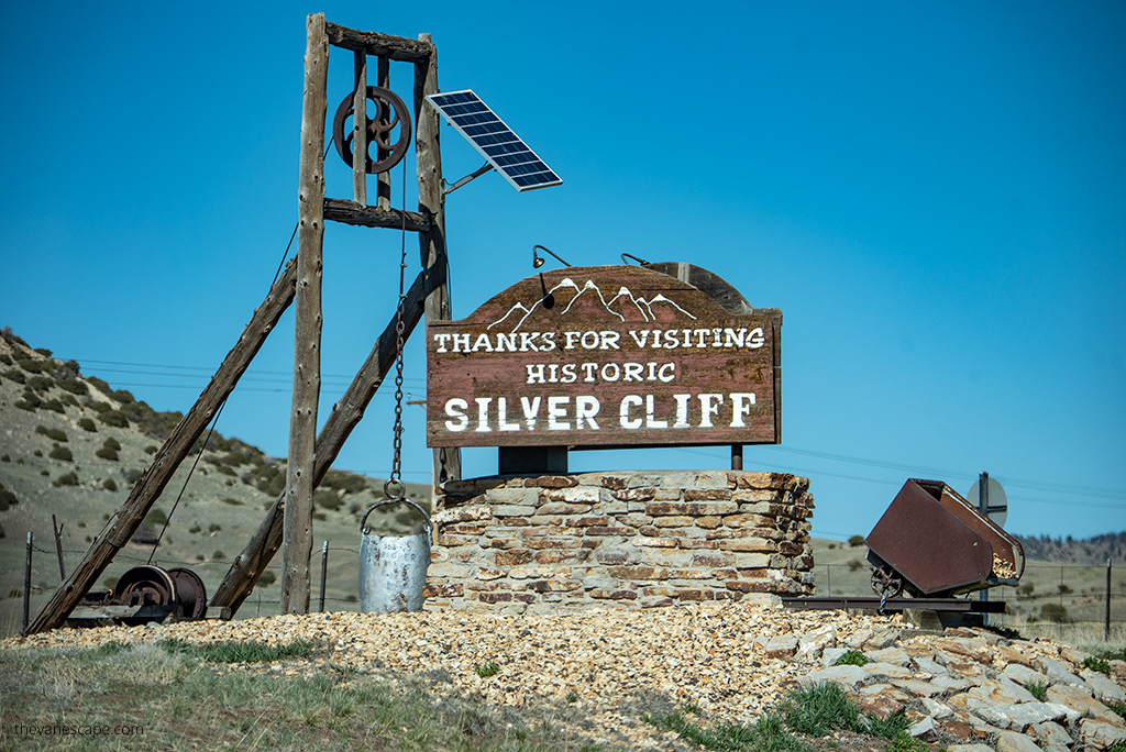
Spend an hour or two walking around downtown, browsing local shops, and enjoying the views of the Sangre de Cristo Range. Don’t miss the Silver Cliff Museum for a peek into the area’s mining history, or drive to DeWeese Reservoir for a peaceful picnic spot with mountain reflections on the water.

If you’re hungry, stop for lunch before continuing to Colorado Springs.
Where to Eat in Westcliffe:
- Tony’s Mountain Pizza – casual and friendly with a view.
- Sugar & Spice Mountain Bakery – fresh pastries and great coffee.
Drive to Colorado Springs
From Westcliffe, take CO-96 E and CO-115 N toward Colorado Springs. It’s about 77 miles (1.5 hours) of scenic driving. Along the way, make a quick stop at the Beaver Creek State Wildlife Area if you enjoy nature and birdwatching. It’s a quiet spot where you might see elk, bighorn sheep, or even a black bear from a safe distance.
Evening in Colorado Springs
Colorado Springs offers plenty to see and do, but after a full day of driving, a relaxed evening is best. Stroll through Old Colorado City, grab dinner downtown, or simply unwind with a view of Pikes Peak, which you’ll explore tomorrow.
Where to Eat
- Urban Egg – perfect for breakfast or brunch if you arrive early.
- Carlos’ Bistro – one of the city’s top-rated restaurants for dinner.
- Phantom Canyon Brewing Co. – casual spot for local beer and comfort food.
Where to Stay
- Mecca Motel – budget-friendly and close to Garden of the Gods.
- Kinship Landing – modern boutique hotel with local flair.
- Cheyenne Mountain Resort – upscale option with pools and mountain views.
Tomorrow, your Colorado itinerary wraps up with classic Colorado Springs highlights — the breathtaking Pikes Peak Highway, charming Manitou Springs, and the iconic Garden of the Gods before returning to Denver.

Day 13 – Pikes Peak, Manitou Springs, and Garden of the Gods
Day 13 of your Colorado itinerary brings you to some of the most famous and scenic landmarks in the Colorado Springs area. You’ll drive to the top of Pikes Peak, explore the charming town of Manitou Springs, and end your day among the red rock formations of the Garden of the Gods — a perfect finale before returning to Denver.
Drive the Pikes Peak Highway
Start early to beat the traffic and afternoon clouds. The entrance to the Pikes Peak Highway is in Cascade, just west of Colorado Springs. The road climbs 19 miles (31 km) to the 14,115-foot (4,302 m) summit of one of America’s most iconic mountains.
The drive is fully paved but steep, with dozens of sharp switchbacks and breathtaking drop-offs. It takes about 3–4 hours round trip, including photo stops and time at the summit. You can also ride the Pikes Peak Cog Railway if you prefer not to drive — it’s a spectacular ride and one of the highest cog railways in the world.
Pikes Peak Highway Fees (subject to change):
- $15 per adult (age 16+)
- $5 per child (ages 6–15)
- $50 per car (up to 5 passengers)
Tips for Visiting Pikes Peak:
- Dress warmly — even in July, temperatures at the summit can drop below freezing.
- Bring water and ascend slowly to avoid altitude sickness.
- Stop at pullouts like Crystal Reservoir Overlook and Glen Cove Inn for great views and restrooms.


Visit Manitou Springs
After descending from Pikes Peak, stop in Manitou Springs, a small, artistic town at the mountain’s base. Walk along Manitou Avenue, where you’ll find quirky shops, cafes, and galleries. The town is famous for its natural mineral springs — you can fill a bottle and taste the water from different fountains around town.
Top Attractions in Manitou Springs:
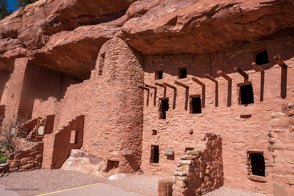
- Manitou Cliff Dwellings – a replica site and museum that offers a close look at ancient Ancestral Puebloan architecture. It’s smaller than Mesa Verde but interesting if you didn’t manage a ranger-led tour earlier in your trip.
- Cave of the Winds Mountain Park – features cave tours and adventure rides, though keep in mind it’s smaller than major cave systems like Carlsbad Caverns.
Explore Garden of the Gods
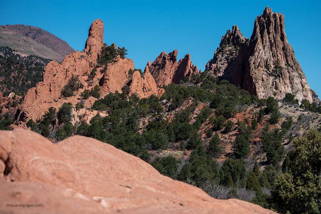
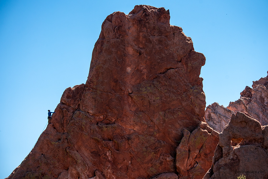
End your day at the stunning Garden of the Gods, located just a few miles north of Manitou Springs. This public park is filled with towering red sandstone formations set against the backdrop of snowcapped Pikes Peak.
Admission is free, and there’s a scenic loop drive with plenty of overlooks and trailheads. Plan at least 2–3 hours to enjoy the park. Some great short trails include:
- Perkins Central Garden Trail – an easy 1.5-mile loop through the heart of the formations.
- Siamese Twins Trail – 1 mile round trip to a unique rock arch framing Pikes Peak.
You can also visit the Garden of the Gods Visitor and Nature Center to learn more about the geology and history of the area.

Where to Eat
After a full day, treat yourself to a memorable dinner in Colorado Springs or Manitou Springs:
- The Cliff House Dining Room (Manitou Springs) – elegant setting and local cuisine.
- Phantom Canyon Brewing Co. (Colorado Springs) – casual with great food and local beer.
- Paravicini’s Italian Bistro – cozy, family-style Italian.
Where to Stay
You can either spend one more night in Colorado Springs or begin the short drive back to Denver (about 70 miles / 1.5 hours).
- Garden of the Gods Resort and Club – luxury with unbeatable views.
- Mecca Motel – budget-friendly near the park.
- Hotel Clio Denver Cherry Creek – perfect if you choose to return to Denver tonight.
Tomorrow marks the final day of your Colorado itinerary, as you wrap up your two-week adventure and explore a few last highlights in Denver before heading home.
Day 14 – Return to Denver
Your final day of this Colorado itinerary brings you full circle — back to Denver, where your two-week road trip through the Rockies ends. Depending on your schedule, you can either drive straight to the airport or spend a few relaxed hours exploring more of the Mile High City before heading home.
Drive from Colorado Springs to Denver
The drive from Colorado Springs to Denver takes about 1.5 hours (70 miles) via I-25 N. Try to leave early to avoid morning traffic, especially if you’re catching a flight.
If you have time to spare, take the slower, more scenic route through Woodland Park and Deckers, following Highway 67 — a beautiful drive through forests, mountain valleys, and along the South Platte River.
Souvenir and Snack Ideas
Before you leave, stock up on a few Colorado-made favorites:
- Locally roasted Alpine Start Coffee or Coda Coffee.
- Rocky Mountain chocolate or Patsy’s Candies from Colorado Springs.
- A bottle of Colorado wine from the Grand Junction area or craft beer from one of Denver’s many breweries.
Where to Stay (if you have an extra night)
If your flight leaves tomorrow or you just want one more night in the city, choose a convenient spot near downtown or the airport:
- The Maven Hotel – stylish and central in the Dairy Block.
- Hyatt Place Denver Airport – practical and comfortable for an early flight.
- Kimpton Hotel Born – perfect for train travelers, right next to Union Station.
Final Thoughts
After two unforgettable weeks, you’ve seen Colorado from every angle — alpine peaks, desert canyons, ancient cliff dwellings, hot springs, and endless scenic byways.
From Rocky Mountain National Park to the Great Sand Dunes, this itinerary shows why Colorado is one of the most diverse and beautiful states in America.
As we wrapped up our own journey, Chris and I felt that two weeks still weren’t enough. Colorado has a way of pulling you back — for another hike, another mountain pass, and another sunset over the Rockies. Safe travels, and may this road trip inspire your next great adventure.
If you’re exploring more of the state, our Colorado guide includes the best places, routes, and travel tips.
Do You Like It? Pin It For Later!