
Utah Mighty 5 Itinerary: 7 Days Road Trip Through All 5 National Parks (2026)
Planning one week for Utah road trip? You can still see it all. Five national parks. One fast, smart loop. This 7-day Utah Mighty 5 itinerary hits Zion, Bryce Canyon, Capitol Reef, Canyonlands, and Arches. We map every mile, sunrise, and sunset. You’ll get realistic drive times, trail picks by difficulty, and crowd-savvy alternatives. Start in Las Vegas. Sleep where it saves time. Hike early. Chase golden hour. We show you how. You’ll also find 2026 essentials in one place. Angels Landing permits. Arches timed entry. Shuttle seasons. Weather smarts for heat, monsoon, and winter. Use this guide to plan a trip that feels epic, not rushed. Seven days. Five parks. Maximum wow.
This article may contain affiliate / compensated links. For full information, please see our disclaimer here.
Utah’s Mighty 5 at a Glance
Utah’s “Mighty 5” are packed into one state—five parks so different that each feels like a new world. Towering cliffs, glowing hoodoos, sandstone arches, and deep canyons make this one of the most scenic road trips in America.
Chris and I have explored these parks many times during our Utah travels—sometimes in rented cars, sometimes in our camper truck. We’ve hiked through snow in Bryce, baked under summer heat in Arches, and watched the Milky Way rise over Canyonlands.
Each visit taught us something new about timing, light, and pacing. That’s why this 7-day itinerary includes only what truly works—distances you can handle, hikes worth the effort, and photo stops that never disappoint.
We love Utah’s national parks for their diversity—for landscapes that change every hour, for trails that suit every fitness level, and for those breathtaking sunrises and sunsets that never get old. Best of all, the parks are close enough to each other to form an easy one-week loop filled with unforgettable views.
This itinerary starts and ends in Las Vegas, which we’ve found to be the most convenient and affordable gateway. Las Vegas offers excellent flight connections, a wide range of rental cars, and the fastest access to Zion—the first park on our route.
Starting from Salt Lake City or Denver is also possible, but Las Vegas keeps driving times balanced and the loop perfectly efficient for one week on the road.
Utah Mighty 5 Road Trip Itinerary Overwiew and Map
This itinerary is intense but absolutely doable if you start early each day. It’s designed to show you the highlights—the very best trails, overlooks, and drives that make Utah’s Mighty 5 unforgettable.
Each of these parks could easily fill a week on its own, but since you have one week for all five, we’ve chosen the top experiences that capture what each park has to offer.
- Total distance: about 1015 miles (1,600 km).
- Best time: April–May and September–October for mild weather and fewer crowds. For summer months—June, July, and August—be prepared for hot weather and more visitors, but don’t worry: we’ll share smart tips on how to handle both heat and crowds like a pro.
- Ideal for: hikers, photographers, and first-time visitors who want to experience the very best of Utah.
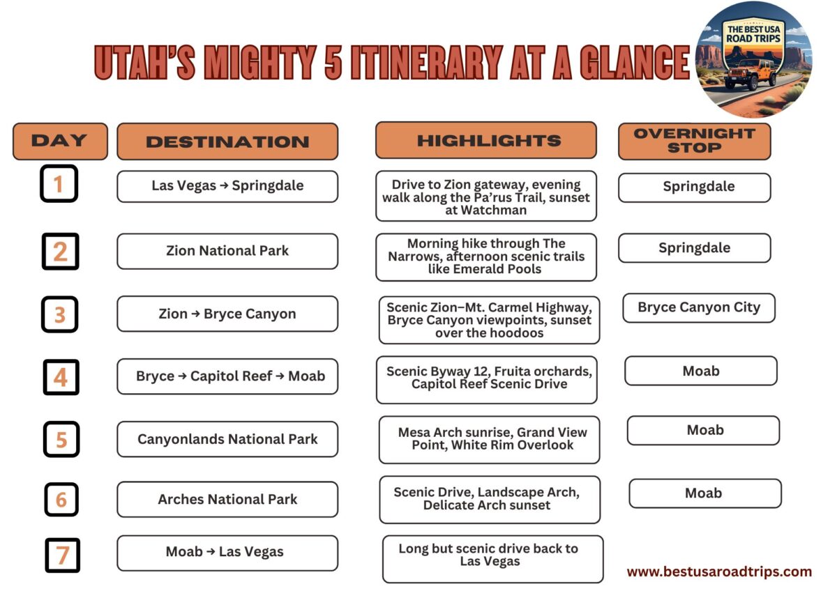
Here’s a map of the entire route through Utah’s national parks — a scenic loop that begins and ends in Las Vegas.
2026 Reservations & Utah National Parks Rules: What’s New
Planning ahead is important. Some activities regure reservations. Here’s what you need to know before you hit the road.
Zion National Park — Angels Landing Permits & Shuttle Season
To hike the famous Angels Landing in Zion National Park, you’ll need a permit. The National Park Service continues its two-lottery system for 2026:
- Seasonal Lottery: Opens about three months in advance for each quarter of the year.
- Day-Before Lottery: Closes the day before your hike at 3 p.m. MST. Permits are $6 per application (non-refundable) plus $3 per person if selected. Apply through Recreation.gov – Angels Landing.
From spring through late fall, private vehicles are not allowed on the Zion Canyon Scenic Drive. You must use the free park shuttle from the Visitor Center or catch the Springdale town shuttle, which connects hotels to the park entrance.
The Narrows & Water Hikes
The Narrows hike doesn’t require a permit if you start bottom-up from the Temple of Sinawava (bus stop #9), but it does if you plan a top-down day or overnight trip.
Always check conditions before hiking—especially in spring and summer when flash floods or cyanobacteria advisories can close the river. Current updates are available on the Current Conditions page.
Bryce Canyon National Park — Shuttle & Parking Updates
Bryce Canyon allows private cars inside the park year-round, but from mid-April through mid-October, the Bryce Canyon Shuttle is the easiest way to get around. Parking fills early at popular viewpoints. The shuttle is free with park admission and stops at all major overlooks and trailheads along the rim.
Capitol Reef National Park — Fruita District & Backcountry Access
Capitol Reef doesn’t require reservations, but facilities in the Fruita Historic District operate seasonally. The Gifford House Museum and Pie Shop typically opens from mid-March to late November, offering local treats and handmade goods.
If you plan to explore Cathedral Valley or the Waterpocket Fold, a high-clearance 4×4 vehicle is essential, and you should check road conditions at the Visitor Center before driving.
Canyonlands National Park — Island in the Sky & Needles
No timed entries or permits are needed for day visits to the Island in the Sky or Needles districts, but campsites and backcountry permits book up early. Canyonlands remains one of Utah’s quieter parks, though it’s growing in popularity each year. Book campsites as soon as reservations open on Recreation.gov.
Oversize Vehicles & Zion–Mt. Carmel Tunnel
If you plan to drive an RV or large vehicle through the Zion–Mt. Carmel Tunnel, know the limits before you go. Vehicles over 11’4″ high or 7’10” wide require an escort through the tunnel for a $15 one-way fee, collected at the entrance station. Check the latest updates on Zion Tunnel Information.
America the Beautiful Pass
If you plan to visit three or more parks in a year, the America the Beautiful Annual Pass is the best deal. It covers entry for the driver and all passengers in one vehicle.
Best Time to Visit Utah’s National Parks
Utah’s Mighty 5 are open year-round, and each season offers a completely different experience. After visiting these parks in every possible month, Chris and I can honestly say there’s no bad time to go—but the right season depends on what kind of traveler you are.
Spring – April and May
Spring is one of our favorite times to explore Utah’s national parks. Temperatures are mild, wildflowers start to bloom, and waterfalls flow after winter snowmelt. Hiking is comfortable, and you can enjoy longer daylight hours without the summer crowds.
- Pros: Ideal weather for hiking; fewer people than summer; perfect for photos.
- Cons: Some trails, like The Narrows in Zion, can be closed or limited by high water levels.
Agnes’ Advice: Bring layers. Mornings and evenings can still be chilly, especially at Bryce Canyon’s high elevation.
Summer – June, July, and August
Summer brings long days and the widest access—but also the most heat. Daytime temperatures in southern Utah often climb over 100°F (38°C). Crowds peak in July, and parking lots fill early. Still, this is the only time many families can travel, and it’s absolutely doable with smart planning.
- Pros: All roads and services open; great for families and photographers chasing golden sunsets.
- Cons: Hot afternoons, crowded trails, and limited parking.
Agnes’ Advice: Start your hikes before 8 a.m., carry at least ¾ gallon (3 liters) of water per person, wear a wide-brim hat, and use sun protection. We’ll share our favorite shady hikes and cool spots later in this guide to help you handle the heat.
Fall – September and October
Fall is magical in Utah. The air turns crisp, the crowds thin out, and the golden light makes the red rocks glow even deeper. We’ve spent many autumn weeks here—especially in October—and it’s often the most rewarding time to visit.
- Pros: Perfect temperatures; great lighting for photography; fewer people.
- Cons: Shorter days mean earlier sunsets and cooler nights.
Winter – November to March
Winter transforms Utah’s landscapes into a quiet wonderland. Bryce Canyon’s orange hoodoos dusted with snow are breathtaking, and Zion’s cliffs glow against icy rivers. It’s also the most peaceful time to visit—but you’ll need to prepare for cold weather and possible snow or road closures.
- Pros: Few crowds; lower lodging rates; dramatic snowy scenery.
- Cons: Some roads and trails close; short daylight hours; freezing temperatures at high elevations.

Where to Start Your Utah Mighty 5 Road Trip
For most travelers, Las Vegas, Nevada, is the smartest and most time-efficient place to begin a Utah Mighty 5 adventure. You’ll land in a major airport with excellent flight options, competitive rental car prices, and fast access to the first park on your route—Zion National Park, only about 165 miles (265 km) away.
Chris and I have started several of our Utah road trips from Las Vegas, and it’s always been the smoothest option. The route is scenic and easy to follow, with plenty of grocery stores and outdoor outfitters along the way to stock up before entering the parks.
If you prefer to start elsewhere, here are your main alternatives:
- Salt Lake City, Utah – Roughly 300 miles (480 km) to Arches National Park or 270 miles (435 km) to Zion. This route works well if you plan to add northern Utah or Colorado stops.
- Denver, Colorado – About 460 miles (740 km) to Arches National Park. It’s a great choice if you want to include Colorado’s national parks or scenic mountain drives on the same trip.
This itinerary is designed as a loop starting and ending in Las Vegas. Driving distances are much shorter this way, so you can spend more time exploring and sightseeing instead of sitting behind the wheel. If you decide to start from another city, simply adjust the plan to allow for longer drive times.
One Week Utah Mighty 5 Itinerary: Day-by-Day
Now, let’s move into the Day-by-Day Itinerary, starting with Zion National Park—the first stop on your Utah Mighty 5 road trip and one of the most breathtaking places in the Southwest.
Day 1 – Las Vegas to Zion National Park
Your Utah Mighty 5 adventure begins in Las Vegas, one of the most convenient gateways to the Southwest. Pick up your rental car early, stock up on groceries and water, and hit the road toward Zion National Park. It’s about 165 miles (265 km) and takes roughly 2.5 to 3 hours of driving.
We’ve done this route many times, and even though it’s a travel day, it’s also your first taste of desert scenery. Once you leave the city behind, the landscape quickly changes—red rock cliffs, open valleys, and wide desert skies.
Route Options
- Fastest route: Take I-15 North all the way to Springdale, the gateway town to Zion.
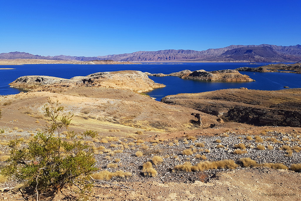
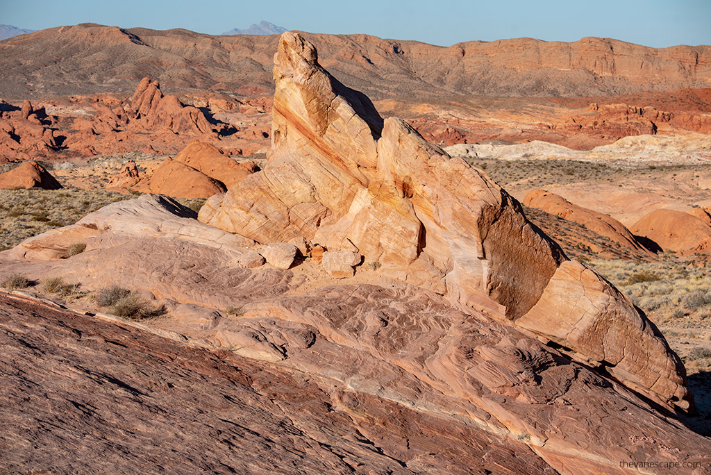
- Scenic route (longer): If you have extra time, detour through Valley of Fire State Park or Lake Mead National Recreation Area. The Valley of Fire loop adds about 2 hours and is worth it if you love short hikes and photography—its red sandstone formations are stunning.
Afternoon – Arrive in Springdale
By midafternoon, you’ll reach Springdale, a charming small town right at Zion’s south entrance. Check into your hotel or campground, then stretch your legs on an easy walk along the Pa’rus Trail. This paved path runs beside the Virgin River and gives you your first glimpse of Zion’s cliffs glowing in late-day light.
If you arrive early enough, you can also take the Zion Canyon Shuttle into the park for a quick sunset visit. The shuttle usually operates from spring through late fall—times vary each year, so check current hours before your trip.
Evening – Sunset and Dinner
For sunset, head to the Watchman viewpoint near the Visitor Center. It’s one of our favorite spots—the view of the Watchman Peak with the Virgin River in the foreground never disappoints.
Springdale has plenty of good food options for your first night. After a day of travel, we like something casual—Oscar’s Café for burgers and tacos or Cafe Soleil for wraps and coffee are both solid choices.
Where to Stay
We recommend two nights in Springdale. Staying close to the park saves time in the mornings, and the views from most hotels are spectacular.
- Zion Lodge – The only accommodation inside the park; peaceful and surrounded by cliffs.
- Cable Mountain Lodge – Steps from the park entrance with comfortable rooms and pool access.
- Zion Canyon Campground & RV Park – Great location with full hookups and river access.
Tomorrow, you’ll spend your first full day exploring Zion National Park, home to famous hikes like Angels Landing and The Narrows—so rest well tonight and get ready for an early start.

Day 2 – Exploring Zion National Park
Zion deserves an early start. Have breakfast in Springdale, grab your packed lunch, and catch one of the park shuttles around 9 a.m. From spring through late fall, this free shuttle is the only way to travel along the main canyon road—and it’s a beautiful ride.
Chris and I love mornings in Zion. The light is soft, cliffs glow golden, and the air is cool—perfect for hiking.
Morning – Hike The Narrows (bottom-up)
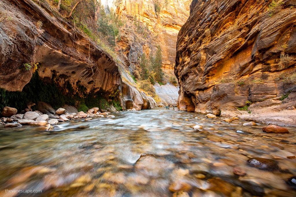
Start your day with The Narrows, Zion’s most unique hike and one of our favorites anywhere in Utah. It begins at Temple of Sinawava—the last shuttle stop (#9)—so you’ll enjoy the full scenic drive through Zion Canyon before the hike even begins.
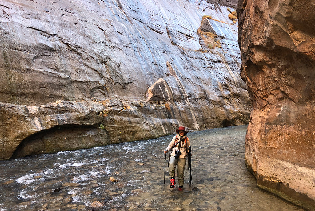
This trail isn’t really a trail at all—you walk in the Virgin River between thousand-foot cliffs.
- Distance: Flexible; most hikers go 2–4 miles (3–6 km) one way before turning back.
- Permit: Not required for the bottom-up route.
- Best time: Start before 8 a.m. for cooler water and fewer people.
Agnes’ Advice: Rent proper river gear in Springdale—water boots, neoprene socks, and waterproof pants—the afternoon before your hike so you can start early. Always check the park’s current conditions page for water levels or flash-flood warnings.
Afternoon – Easy and Scenic Trails
After a few hours in the river, spend your afternoon on shorter dry trails to enjoy more of Zion’s landscapes without overdoing it.
- Kayenta Trail to Emerald Pools – 2.5 miles (4 km) round trip. Shaded sections, waterfalls, and pools.
- Canyon Overlook Trail – 1 mile (1.6 km) round trip. Short, easy, and one of the best panoramic views in the park.
- Pa’rus Trail – Flat, paved 3.5 miles (5.6 km) round trip. Ideal for sunset or a relaxed stroll along the Virgin River.
These hikes are gentle enough to combine in one afternoon and show Zion from different angles—lush riverbanks, high viewpoints, and open canyon vistas.
About Angels Landing
The most famous hike in Zion is Angels Landing—also the most challenging. It climbs a narrow ridge with steep drop-offs and requires a permit, available through seasonal and day-before lotteries.
If you’re lucky to get a permit, start your day with Angels Landing instead of The Narrows, then use the afternoon for lighter walks.
Evening – Sunset in Zion
For sunset, head to the bridge near the Visitor Center to watch the Watchman Peak glow red and orange in the fading light. Springdale’s restaurants are perfect for a relaxed evening after a full day on the trails—Bit & Spur Restaurant & Saloon for Southwest flavors or Oscar’s Café for hearty comfort food.
Overnight: Second night in Springdale
Tomorrow, you’ll leave Zion’s deep canyon walls behind and drive toward Bryce Canyon National Park, where towering spires and cool mountain air await.

Day 3 – Zion to Bryce Canyon National Park
It’s time to trade the towering sandstone walls of Zion for the whimsical hoodoos of Bryce Canyon National Park. The drive itself is part of the adventure, winding through red cliffs, pine forests, and sweeping desert plateaus.
Morning – Scenic Drive out of Zion
Leave Springdale after breakfast and enjoy the Zion–Mt. Carmel Highway—one of the most scenic roads in Utah. The route climbs through switchbacks, past slickrock domes, and through the historic Zion–Mt. Carmel Tunnel. Pull over at the Canyon Overlook Trail if you didn’t do it the previous day—it’s short, easy, and the view is spectacular in the morning light.
Distance: 85 miles (140 km)
Drive time: About 2 hours
Allow extra time for photo stops and possible short delays at the tunnel.
Agnes’ Advice: If you drive an RV or large vehicle, check tunnel restrictions before entering. Vehicles over 11’4″ high or 7’10” wide (3.4 m x 2.4 m) need an escort and pay a $15 one-way fee.
Midday – Arrive at Bryce Canyon National Park
As you gain elevation, you’ll feel the air cool—Bryce sits between 8,000 and 9,000 feet (2,440–2,740 m). Stop by the Visitor Center to check trail conditions and grab a park map.
We always recommend starting with the Bryce Amphitheater area, home to the park’s most famous viewpoints: Sunset Point, Sunrise Point, Inspiration Point, and Bryce Point. Each offers a different perspective of the endless hoodoos that make this park so photogenic.
Afternoon – Easy to Moderate Hikes
Bryce Canyon’s trails descend from the rim into a maze of spires, arches, and red rock towers. You can easily combine a short rim walk with a descent into the canyon.
Our favorite combination for first-timers:
- Navajo Loop and Queen’s Garden Trail – 3 miles (4.8 km) round trip, 2–3 hours
This classic route starts at Sunset Point and ends at Sunrise Point, offering incredible views from both above and below the hoodoos. The orange and pink rock formations change color with every step.
If you prefer something easier, stay on the Rim Trail between Sunset Point and Sunrise Point—a 1 mile (1.6 km) round trip with minimal elevation gain but stunning views.
Agnes’ Advice: Even on cool days, the elevation makes hiking more tiring. Bring plenty of water—at least ¾ gallon (3 liters) per person—and take your time climbing back up. Pack layers.
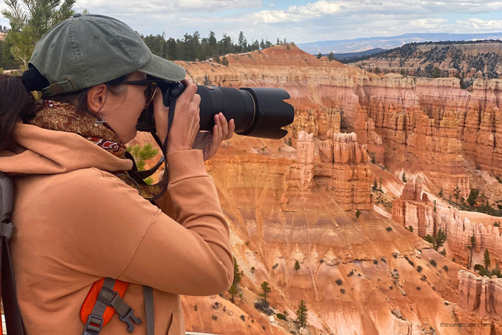
Evening – Sunset Over the Hoodoos
Sunset in Bryce Canyon is unforgettable. The light turns golden, then deep orange, and the hoodoos seem to glow from within. The best spots are Sunset Point and Inspiration Point.
After the sun goes down, stay a bit longer if the sky is clear—Bryce Canyon is an official International Dark Sky Park, and the stargazing here is world-class.
Where to Stay
Plan to spend one night in Bryce Canyon City or near the park entrance.
- Bryce View Lodge – Comfortable mid-range hotel just outside the park gates.
- Best Western Plus Ruby’s Inn – A convenient and classic choice with dining and a small store.
- Bryce Canyon Pines Campground – Great for RVs and tent camping, with beautiful night skies.
Dinner Ideas
Bryce Canyon City is small, but you’ll find a few local favorites:
- Bryce Canyon Pines Restaurant – Try the homemade soup or pie.
- Stone Hearth Grille – Excellent steaks and sunset views from the terrace.
Overnight: Bryce Canyon City
Tomorrow, you’ll follow one of Utah’s most beautiful roads—Scenic Byway 12—to Capitol Reef National Park, another hidden gem in the Mighty 5.

Day 4 – Bryce Canyon to Capitol Reef to Moab
Get ready for a full day on the road—today combines one of Utah’s most beautiful drives with visits to two national parks. You’ll travel from the high plateaus of Bryce Canyon, through red rock canyons and slickrock landscapes, to the fertile valleys and rugged cliffs of Capitol Reef National Park, then continue to Moab, your base for the next few nights.
Morning – Scenic Byway 12
Leave Bryce Canyon early and head east on Scenic Byway 12, one of the most stunning highways in the American Southwest. It’s about 120 miles (190 km) to Capitol Reef, but plan at least 3 hours for the drive—you’ll want to stop often.
Highlights along the route:
- Red Canyon: Just outside Bryce, this short section of red rock tunnels and hoodoos is a photographer’s dream.
- Escalante: A good spot to refuel and grab coffee or snacks.
- Calf Creek Recreation Area: If you have extra time, the Lower Calf Creek Falls Trail (6 miles / 9.6 km round trip) rewards you with a 126-foot (38 m) waterfall hidden in the canyon.
- Boulder Mountain Overlook: Offers panoramic views stretching to Capitol Reef.
Agnes’ Advice: This stretch of Highway 12 climbs to over 9,000 feet (2,740 m)—temperatures can drop quickly even in summer, so keep a light jacket handy.
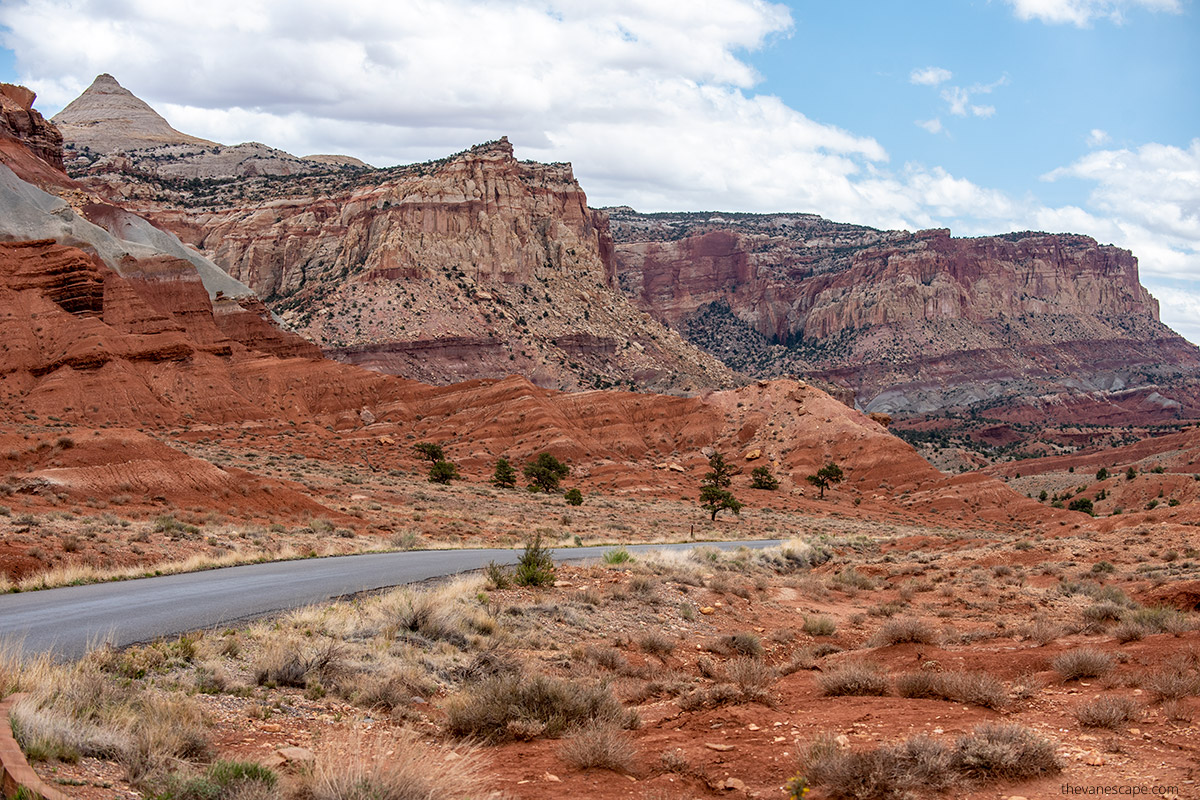
Midday – Capitol Reef National Park
Capitol Reef is often the quietest of Utah’s Mighty 5, and that’s one reason we love it. It’s a park full of surprises—colorful cliffs, orchards, petroglyphs, and a dramatic geological fold called the Waterpocket Fold.
Stop first at the Visitor Center in Fruita, pick up a map, and check road conditions. Then drive the Scenic Drive, an 8-mile (13 km) paved route that winds through red canyons and sandstone domes.
Must-see stops along the way:
- Fruita Orchards: In season (spring through early fall), you can pick fruit—apples, peaches, and cherries—from the historic orchards planted by Mormon settlers.
- Gifford Homestead: Open roughly March through November, it’s famous for its handmade pies and local preserves.
- Grand Wash or Capitol Gorge: Short scenic drives that let you stretch your legs on easy walks surrounded by high canyon walls.
Agnes’ Advice: Capitol Reef’s charm lies in its calm. Even in peak season, you’ll find quiet corners and trails to yourself. Spend 2–3 hours exploring before continuing east.
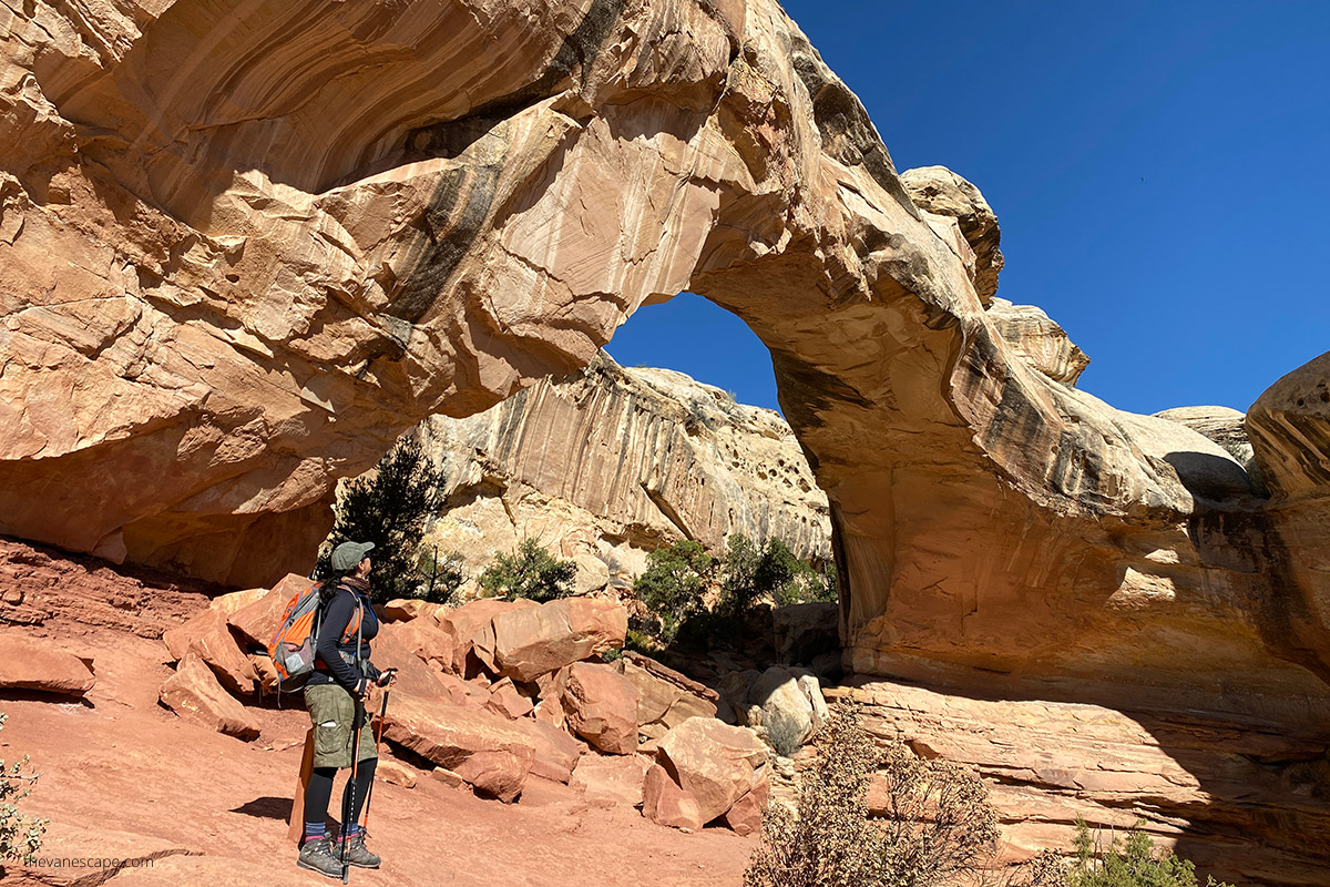
Afternoon – Drive to Moab
From Capitol Reef to Moab is about 145 miles (235 km), roughly 2.5-3 hours of driving via UT-24 East, I-70 East, and US-191 South. The route passes through remote, rugged country—stock up on fuel and snacks before leaving the park.
As you approach Moab, the landscape shifts again—towering cliffs, red mesas, and wide desert valleys set the scene for the next two national parks: Canyonlands and Arches.
Evening – Arrive in Moab
Check into your hotel or campground, then head into town for dinner. After a long but scenic day, you’ll appreciate Moab’s lively atmosphere—outdoor patios, good food, and sunset light bouncing off the cliffs.
Some of our favorite dinner spots:
- Moab Diner – Classic American comfort food, perfect after a big drive.
- Thai Bella – Great for something lighter and flavorful.
- Desert Bistro – A cozy, upscale option with excellent local dishes.
Where to Stay
Plan three nights in Moab—it’s the ideal base for both Arches and Canyonlands.
- The Gonzo Inn – Comfortable, colorful, and centrally located.
- Homewood Suites by Hilton – Spacious rooms and a pool, great for families.
- Canyonlands RV Resort & Campground – Convenient in-town campground with full hookups.
Agnes’ Advice: Book early. Moab fills up fast between March and October, especially on weekends.
Overnight: Moab
Tomorrow, you’ll explore the vast landscapes of Canyonlands National Park, where deep canyons carved by the Colorado River stretch farther than the eye can see.

Day 5 – Exploring Canyonlands National Park
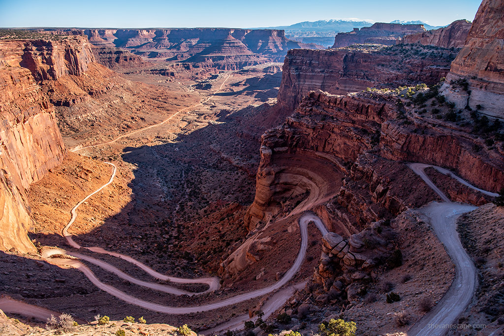
Today is all about wide horizons and deep canyons. Canyonlands National Park is the largest of Utah’s Mighty 5 and one of the least crowded. It’s divided into four districts, but for a short visit, focus on the Island in the Sky section—the most accessible area, located just 32 miles (51 km) from Moab.
Chris and I have explored Canyonlands many times, and no matter how often we return, it still leaves us speechless. Standing at the overlooks feels like looking into another world—layer after layer of red cliffs, mesas, and winding rivers far below.
Morning – Mesa Arch and Grand View Point
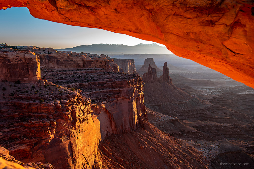
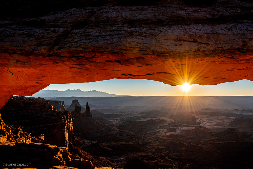
Start early and drive to Mesa Arch, one of Utah’s most photographed spots. At sunrise, the arch glows bright orange as the first light hits the canyon below—it’s pure magic.
- Trailhead: Mesa Arch Trail
- Distance: 0.6 miles (1 km) round trip
- Time: 30–45 minutes
Next, head to Grand View Point Overlook, located at the end of the main scenic drive. The short Grand View Point Trail (2 miles / 3.2 km round trip) follows the canyon rim to breathtaking vistas of the Colorado and Green River canyons.
Agnes’ Advice: Carry plenty of water—at least ¾ gallon (3 liters) per person. There’s no water, food, or gas inside the park.
Midday – White Rim Overlook and Green River Overlook
Continue exploring the scenic drive, stopping at a few key viewpoints.
- White Rim Overlook: A short 1.8-mile (2.9 km) round-trip hike with incredible panoramic views.
- Green River Overlook: Just steps from the parking area, this is one of the best photo stops in the park.
Pack a picnic lunch—there are shaded tables at Upheaval Dome and along the Picnic Area Loop Road.
Afternoon – Short Hike or Detour
If you still have energy, consider a hike to Upheaval Dome, a fascinating geological mystery thought to be either an ancient salt dome or meteor crater.
- Trail Distance: 1.6 miles (2.6 km) round trip to both overlooks
- Time: 1–1.5 hours
Or, if you prefer an easier afternoon, drive to Dead Horse Point State Park (20 minutes from Canyonlands). The overlook there offers one of the most dramatic views in Utah and is often less busy than the main park.
Evening – Return to Moab
Head back to Moab for dinner and a relaxing evening. The sunset along UT-313, as you drive back from the park, paints the cliffs in fiery orange and red—another unforgettable sight.
For dinner, try:
- Zax Restaurant – Pizza, burgers, and a casual vibe.
- Desert Bistro – If you missed it yesterday, it’s worth a visit tonight for a special meal.
Overnight: Moab
Tomorrow, you’ll explore Arches National Park, home to more than 2,000 natural sandstone arches—including the world-famous Delicate Arch.

Day 6 – Exploring Arches National Park
You’ve already seen towering cliffs and deep canyons, but today brings something completely different. Arches National Park is filled with natural stone arches, soaring spires, and balanced rocks that seem to defy gravity. It’s one of Utah’s most photogenic parks—and one of our personal favorites.
From Moab, it’s just a 5-mile (8 km) drive north to the park entrance. But before you go, check if you need a timed-entry reservation—required for the main season from spring through fall. Reservations open three months in advance on Recreation.gov, with a limited number of next-day passes released each morning.
Morning – Scenic Drive and Easy Hikes
Start early—before 8 a.m. if possible—to beat the heat and crowds. Begin with the Arches Scenic Drive, a 36-mile (58 km) round-trip route that passes most of the park’s major viewpoints and trailheads.
Our favorite morning stops:
- Park Avenue Viewpoint – A short 1-mile (1.6 km) stroll between towering sandstone walls.
- Balanced Rock – Easy 0.3-mile (0.5 km) loop. A great quick stop for photos.
- The Windows Section – Includes North and South Windows and Turret Arch. Plan 1 hour to explore this area—early morning light is perfect for photography.
Midday – Landscape Arch & Devils Garden
Drive to the far end of the park for the Devils Garden area, home to some of the park’s most remarkable formations.
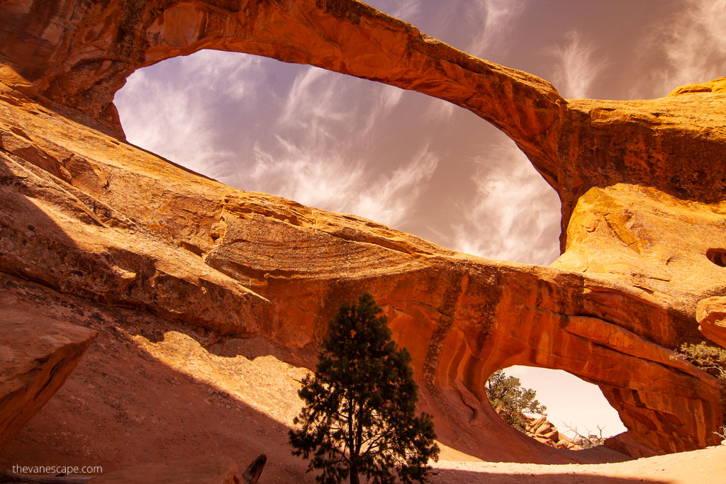
- Landscape Arch Trail: Easy 1.6 miles (2.6 km) round trip to one of the longest natural arches in North America—spanning 306 feet (93 m).
- If you want a challenge, continue to Double O Arch—a 4.5-mile (7.2 km) round trip that climbs over slickrock and rewards you with sweeping views.
Afternoon – Rest or Optional Side Stops
Return toward Moab in the afternoon heat. Stop at the Delicate Arch Viewpoint for an easy look at Utah’s most famous landmark from a distance. If you’re saving energy for sunset, rest at your hotel or enjoy a late lunch in town.
Evening – Hike to Delicate Arch for Sunset
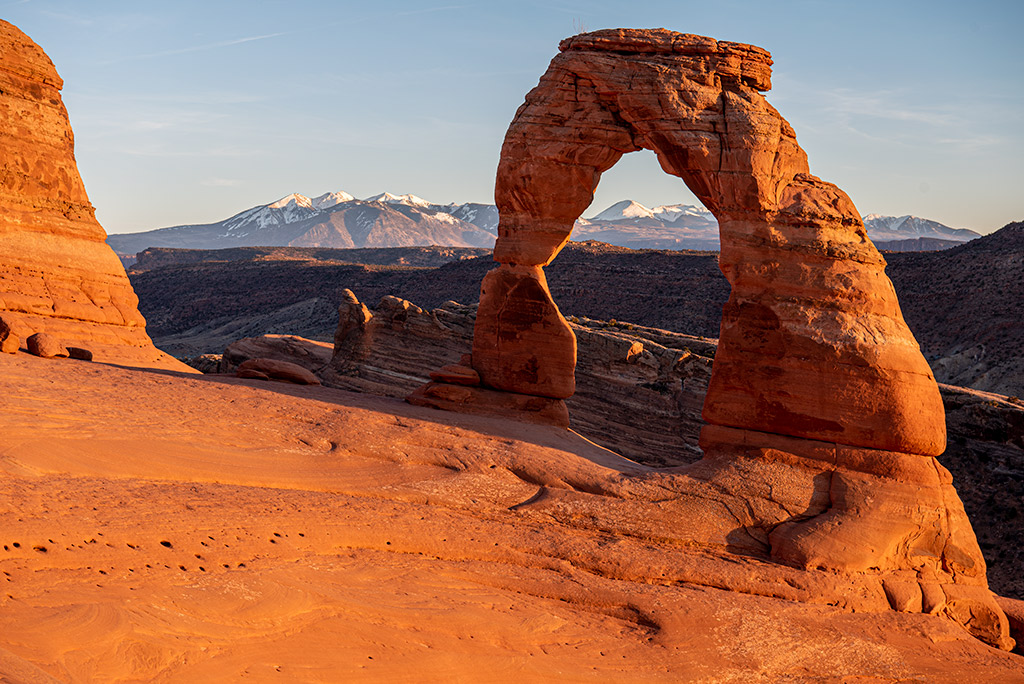
No trip to Arches is complete without standing beneath Delicate Arch—Utah’s iconic symbol.
- Trail Distance: 3 miles (4.8 km) round trip
- Elevation gain: 480 feet (146 m)
- Time: 2–3 hours
Agnes’ Advice: Start your hike about 2 hours before sunset to reach the arch in time for golden light and avoid hiking back in darkness. Bring a headlamp for the return.
Where to Stay
Spend your third night in Moab. After a long day in the park, enjoy dinner and a well-earned rest.
Dinner ideas:
- 98 Center Moab – Fresh sandwiches, Asian-inspired dishes, and local beer.
- The Broken Oar Restaurant – Cozy spot with hearty portions and friendly service.
Overnight: Moab
Tomorrow is your final day of the loop—you’ll head back toward Las Vegas, passing more incredible desert landscapes along the way.
Day 7 – Moab to Las Vegas
Your final day on the road ties everything together—towering red cliffs, open desert, and wide western skies. The drive from Moab back to Las Vegas is long but beautiful, crossing a mix of high plateaus and desert valleys. Take your time, enjoy the scenery, and reflect on all the incredible landscapes you’ve seen this week.
The Route
From Moab, follow US-191 South to I-70 West, then connect with I-15 South toward Las Vegas.
- Distance: about 460 miles (740 km)
- Driving time: around 7 hours without long stops
Leave Moab early—around sunrise if possible—to make the most of the day. You can break up the drive with a few memorable stops along the way.
Optional Stops Along the Route
If you’re not in a rush to reach Las Vegas, these spots are worth stretching your legs:
- Goblin Valley State Park – About 30 miles (48 km) from Hanksville, famous for its mushroom-shaped hoodoos.
- Cedar Breaks National Monument – A short detour near Cedar City; its amphitheater resembles a smaller, high-altitude Bryce Canyon.
- Kolob Canyons (Zion National Park) – A peaceful section of Zion, just off I-15, often missed by travelers.
Adjusting to Your Schedule
Driving time from Moab to Las Vegas is about 7 hours without stops, so adjust this plan to match your flight and rental car return schedule. If your flight departs on Day 7, consider staying two nights in Moab instead of three. That way, you can leave Arches National Park in the late afternoon or just after sunset on Day 6, drive a few hours west, and stop for the night.
The best halfway stop is Richfield, Utah—a small town with several comfortable hotels, restaurants, and gas stations. From Richfield, it’s about 270 miles (435 km) or 4 hours and 15 minutes to Las Vegas, making the next morning’s drive easy and relaxed.
Evening – Return to Las Vegas
By late afternoon or evening, you’ll roll back into Las Vegas, completing your Utah Mighty 5 loop. The neon lights feel worlds away from the quiet canyons you’ve explored—but that contrast is part of what makes this road trip unforgettable.
Agnes’ Advice: If you have flexibility, spend one extra night in Las Vegas instead of rushing to catch a flight. It gives you time to rest, clean gear, and celebrate finishing one of the most scenic road trips in the U.S.
Practical Tips for Your Utah Mighty 5 Road Trip
After exploring Utah’s national parks many times—by car, and camper truck—Chris and I have learned that good preparation makes all the difference. Here are our best practical tips to help you plan your own Mighty 5 adventure smoothly and safely.
1. Book Early
Utah’s parks are extremely popular, especially between April and October. Book lodging, campgrounds, and rental cars as soon as you can. If you’re visiting during spring break or summer, reserve your Arches timed-entry ticket and Angels Landing permit several months ahead.
2. Start Early Every Day
Mornings are the best time for hiking, photography, and avoiding crowds. Most trailheads fill up by midmorning, and afternoon heat can be intense. Plan your longest hikes between 6 a.m. and 10 a.m.
3. Stay Hydrated
Desert air is dry and temperatures often exceed 100°F (38°C) in summer. Carry at least ¾ gallon (3 liters) of water per person each day—more if hiking. Refill at park visitor centers and keep extra water in your vehicle.
4. Dress for the Desert
Wear light, breathable fabrics and protect yourself from the sun with a wide-brim hat, sunglasses, and sunscreen SPF 50+. Even short trails offer little shade. Always pack a light jacket—evenings and high elevations like Bryce Canyon can be chilly.
5. Prepare for Elevation
Some parks, especially Bryce Canyon, sit above 8,000 feet (2,440 m). Take it slow on steep hikes and drink more water than usual to help your body adjust.
6. Watch the Weather
Check forecasts daily. Summer brings monsoon storms (July–September) that can cause flash floods in slot canyons like The Narrows. In winter, snow and ice can close sections of Bryce or Capitol Reef. Always check current conditions on official NPS pages before you drive or hike.
7. Use Maps, Not Just Apps
Cell service disappears inside most parks. Bring a paper map or a Utah Road & Recreation Atlas. Download offline maps in Google Maps or Gaia GPS before you go.
8. Plan Fuel and Food Stops
Gas stations are limited between parks, especially on Scenic Byway 12 and UT-24. Top off your tank before leaving each town. Stock up on snacks and plenty of water.
9. Leave No Trace
Utah’s desert landscapes are fragile. Stay on marked trails, pack out trash, and never climb on or carve into arches or rock formations. Respect wildlife—observe from a distance and don’t feed animals.
10. Adjust for Season and Fitness
If summer heat or long hikes aren’t your style, choose shorter trails and scenic overlooks. If you visit in winter, bring traction cleats, warm layers, and check road closures before traveling between high-elevation parks.
Final Thoughts
Utah’s Mighty 5 are more than a collection of parks—they’re a journey through some of the most inspiring landscapes in the American West. Every canyon, arch, and sunrise feels different, and no photo can ever truly capture how vast and peaceful these places are.
Chris and I never get tired of this route. We’ve hiked it in spring when wildflowers bloom along red cliffs, in summer when heat shimmers above slickrock, and in fall when golden light turns the canyons into glowing cathedrals. Each trip reminds us why we keep coming back: the sense of freedom, the silence of desert mornings, and the feeling that nature still shapes this land every single day.
If this is your first Utah road trip, you’re in for something special. Plan ahead, start early, and give yourself time to stop and just take it in. Don’t rush from one viewpoint to another—let the parks surprise you.
When you finish this loop and cross back into Las Vegas, dusty and smiling, you’ll understand why so many travelers call the Mighty 5 the ultimate American road trip. And like us, you’ll probably start planning your return before you’ve even unpacked.
Do You Like It? Pin It For Later!

