Kasha-Katuwe Tent Rocks National Monument Guide: How To Visit and Best Hikes
Kasha-Katuwe Tent Rocks National Monument is one of the most unusual and photogenic places in New Mexico. This protected landscape sits between Santa Fe and Albuquerque and is famous for the Kasha-Katuwe Tent Rocks Hike—a short but spectacular trail that leads through a twisting slot canyon and up to sweeping mesa-top views. The cone-shaped hoodoos, layered volcanic cliffs, and narrow passages create some of the most striking scenery in the Southwest. In this guide, we explain how to visit Kasha-Katuwe Tent Rocks under the current entry system, which now requires advance reservations and a Cochiti Pueblo Tribal Access Pass. We also share what to expect on the Tent Rocks hike, how long it takes, and practical details based on our own experiences exploring the Monument.
This article may contain affiliate / compensated links. For full information, please see our disclaimer here.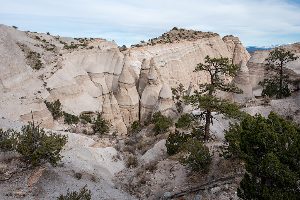
Visiting Kasha-Katuwe Tent Rocks National Monument – Our Experiences
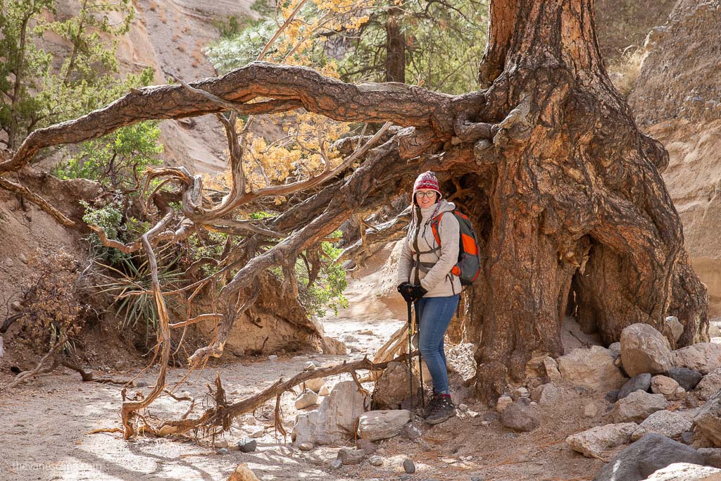
Chris and I first hiked Kasha-Katuwe Tent Rocks on a winter road trip through northern New Mexico. Even in December, the weather was sunny and perfect for hiking, and the contrast between the cool slot canyon and the warm desert light made the whole route unforgettable.
We explored both the Slot Canyon Trail and the Cave Loop Trail, and the views from the mesa top were some of our favorites in the Southwest.
Since then, we’ve returned on later travels through New Mexico because this Monument is one of those places that stays with you.
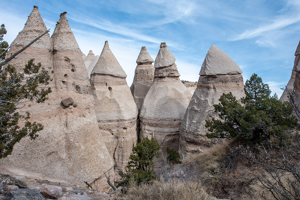
The narrow canyon walls, the unusual hoodoos shaped by ancient volcanic eruptions, and the sweeping vistas toward the Jemez and Sangre de Cristo Mountains make the Tent Rocks hike unique, even if you’ve visited other slot canyons in the region.
In this guide, we share everything we learned during our visits—how to prepare, what to expect on the trail, reservation requirements, and tips that will help you plan a smooth and memorable trip.
Every photo in this guide comes from these trips, and all the tips we share are based on our personal experience hiking Tent Rocks in different seasons and conditions.
Agnes’ Advice: It’s easy to combine a visit to Kasha-Katuwe Tent Rocks with Bandelier National Monument, Santa Fe, or Taos Pueblo since all are in the same region and located close to each other.
Quick Facts & Visitor Basics
Kasha-Katuwe Tent Rocks National Monument is located between Santa Fe and Albuquerque on land managed jointly by the Bureau of Land Management (BLM) and Cochiti Pueblo. The Monument is open Thursday through Monday, and all visits require advance reservations.
Here are the essential details to know before your trip:
- Location: About 40 miles southwest of Santa Fe and 54 miles north of Albuquerque
- Entry Requirements:
BLM reservation through Recreation.gov
Cochiti Pueblo Tribal Access Pass (separate fee) - Opening Hours: 8 a.m. to 4 p.m.; closing procedures start at 3:30 p.m.
- Check-in: All visitors must check in at the Cochiti Visitor Center prior to entry into the Monument. Check-in can begin no earlier than 7:45 a.m. and will continue through 1:00 p.m.
- Closed Days: Several dates each year for Cochiti cultural observances
- Day-Use Only: No camping or overnight access
- Dogs: Not allowed anywhere in the Monument
- Facilities: Restrooms and picnic tables near the parking area
- Elevation: 5,570 to 6,760 feet above sea level
- Trails: Slot Canyon Trail (main hike) and Cave Loop Trail
- Best Time to Visit: Fall, late spring, winter mornings
- Hazards: Flash flooding risk in monsoon season; heat exposure on the mesa top
These quick facts help you prepare for your visit and ensure you understand the Monument’s unique access rules before you go.
Is Kasha-Katuwe Tent Rocks Open?
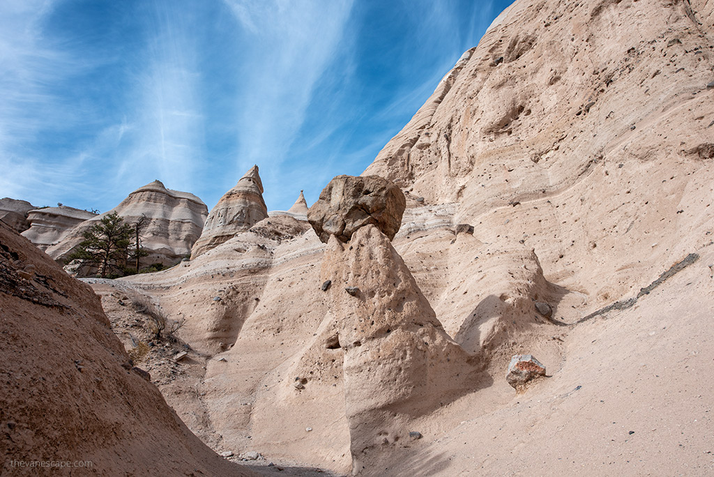
Kasha-Katuwe Tent Rocks National Monument has a unique access system, and its operating status can change. As of 2025, Tent Rocks operates on a reservation-only, pilot-vehicle system, primarily Thursday through Monday. The monument may close for some days each year depending on tribal observances, weather, or maintenance — always check the official site before you go.
Hours are limited, and all visitors must exit the gated area by 4 p.m. Closures may also occur for weather, safety concerns, or Pueblo events. Before planning your hike, always check the latest updates on the official BLM page or the information provided during the Recreation.gov reservation process.
Because the site is located on Cochiti Pueblo land, the Monument also closes several days each year for cultural observances. These dates include:
• New Year’s Day
• January 6
• Easter weekend (Friday–Monday)
• May 3
• July 13–14
• July 25
• November 1
• Thanksgiving Day
• Christmas Day
Always check the official Kasha-Katuwe page before you go. Weather, cultural events, or staffing shortages can affect access with little notice.
If the Monument is closed during your dates, alternative hikes like Bandelier National Monument, Bisti Badlands, and Ah-Shi-Sle-Pah offer excellent options in northern New Mexico.
Reservations & Access Requirements
Access to Kasha-Katuwe Tent Rocks is now reservation-only, and every visitor must complete two separate steps before entering the Monument. Spots are limited each day, so plan ahead—especially on weekends and holidays.
1. BLM Reservation Through Recreation.gov
All visitors must book an entry reservation on Recreation.gov.
• Limited spots are released daily.
• Entry is timed.
• The fee is $5 per person (ages 16+).
• Visitors 16 and under enter free but still need a reservation.
• The America the Beautiful Pass covers the BLM portion for the passholder and up to three guests.
This reservation confirms your arrival window but does not replace tribal access requirements.
2. Cochiti Pueblo Tribal Access Pass
A separate Cochiti Pueblo Tribal Access Pass is required for all visitors. You will receive the link to purchase this pass during your Recreation.gov booking. Fees are:
• $20 per adult (16+)
• $10 per child (ages 2–16)
• Free for children under 2
The America the Beautiful Pass does not waive this tribal fee.
Both passes are mandatory for entry.
3. Check-In & Pilot Vehicle Escort
All visitors must check in at the Cochiti Visitor Center before driving to the Monument.
• Check-in opens at 7:45 a.m.
• Entry begins at 8:00 a.m. with pilot vehicles leading each group.
• The last pilot vehicle departs at 1:00 p.m.
• All visitors must exit by 4:00 p.m.
4. Parking & Crowds
Parking is limited. Guards will not allow cars to enter until a physical parking space is available, so arriving early helps avoid long waits.
Restrooms and picnic tables are available at the trailhead area, but there are no services inside the hiking zone.
How to Get to Kasha-Katuwe Tent Rocks
Kasha-Katuwe Tent Rocks sits between Santa Fe and Albuquerque, which makes it an easy and scenic day trip from either city. The drives are straightforward, but you must plan enough time to check in at the Cochiti Visitor Center before entering the Monument.
From Santa Fe
The drive from Santa Fe takes about 50 minutes.
• Head south on I-25.
• Take Exit 264 for Cochiti Pueblo onto NM-16.
• Continue to NM-22, then follow the signs for Cochiti Pueblo and Kasha-Katuwe Tent Rocks.
This route winds through high desert landscapes with long views toward the Jemez Mountains.
From Albuquerque
The drive from Albuquerque is about one hour.
• Head north on I-25.
• Take Exit 259 for Santo Domingo/Cochiti Lake onto NM-22.
• Follow NM-22 through Cochiti Pueblo to the Monument’s entrance.
It’s a smooth, easy highway drive with wide-open desert scenery.
Road Conditions & Tips
• The access road is paved all the way to the Monument.
• Cell service can be spotty near Cochiti Pueblo and inside the canyon.
• Fuel up before you go—there are no services once you leave the interstate.
Best Things to Do at Kasha-Katuwe Tent Rocks
Kasha-Katuwe Tent Rocks is all about hiking, geology, and desert landscapes. The Monument is small and easy to explore in half a day, but every part of it feels unique. These are the top experiences to focus on during your visit.
Hike the Slot Canyon Trail (the must-do)
The Slot Canyon Trail is the main reason travelers come here. It takes you through a narrow, twisting canyon and up to the mesa top for panoramic views of the Rio Grande Valley and Jemez Mountains. It’s the signature experience and one of the most memorable slot canyon hikes in New Mexico.
Walk the Cave Loop Trail
This short, easy loop branches off from the main route near the trailhead. It features volcanic cliffs, scattered hoodoos, and wide desert views. It’s a great add-on if you want to explore more without adding much distance.
Climb to the Mesa Top Viewpoint
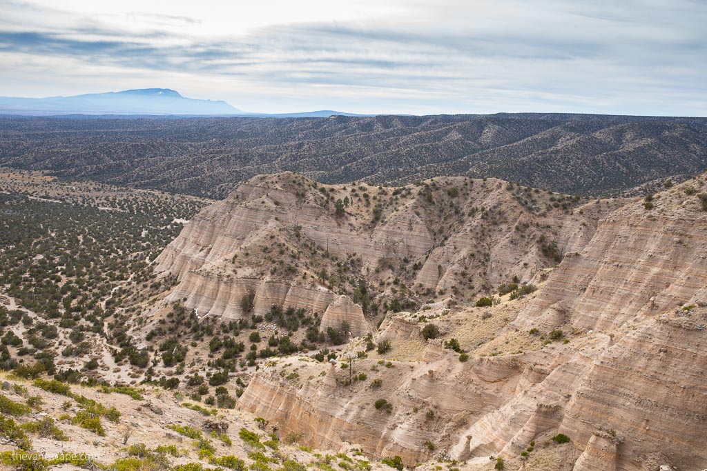
If you continue to the top of the Slot Canyon Trail, you reach a viewpoint overlooking the tent-shaped hoodoos and the surrounding mountains. It’s one of the best overlooks near Santa Fe.
Photograph the Hoodoos and Slot Canyon
The layered volcanic tuff, narrow canyon walls, and cone-shaped formations make Tent Rocks a rewarding spot for photography. Morning and late afternoon offer the best light, and the canyon glows beautifully when the sun reflects off the walls.
Look for Desert Wildlife
Keep an eye out for birds, lizards, and the region’s desert plants. You may also spot ravens soaring above the mesa tops. Rattlesnakes live in this area, so stay alert and keep to the trail.
Enjoy a Picnic at the Trailhead
The Monument has picnic tables near the parking area. It’s a peaceful spot surrounded by cliffs and desert vegetation, perfect for relaxing after a hike.
Best Hikes at Kasha-Katuwe Tent Rocks National Monument
Kasha-Katuwe offers two main trails that start from the same trailhead. You can do both in a single visit, and together they create one of the most memorable short hikes in New Mexico. Below is a detailed look at what to expect on each trail.
Slot Canyon Trail
• Distance: 2.8 miles round trip
• Elevation gain: about 630 feet
• Difficulty: moderate
• Highlights: narrow slot canyon, hoodoos, mesa-top views
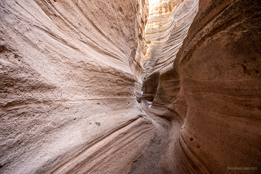
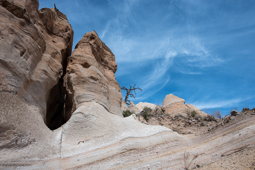
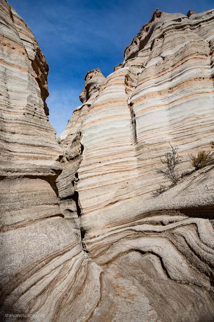
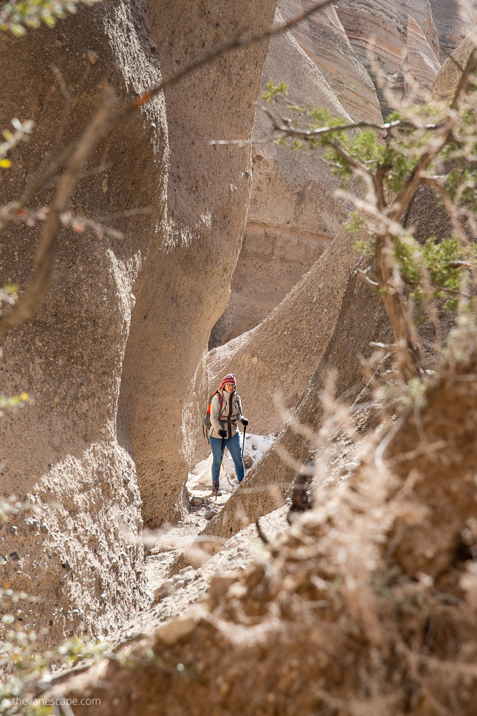
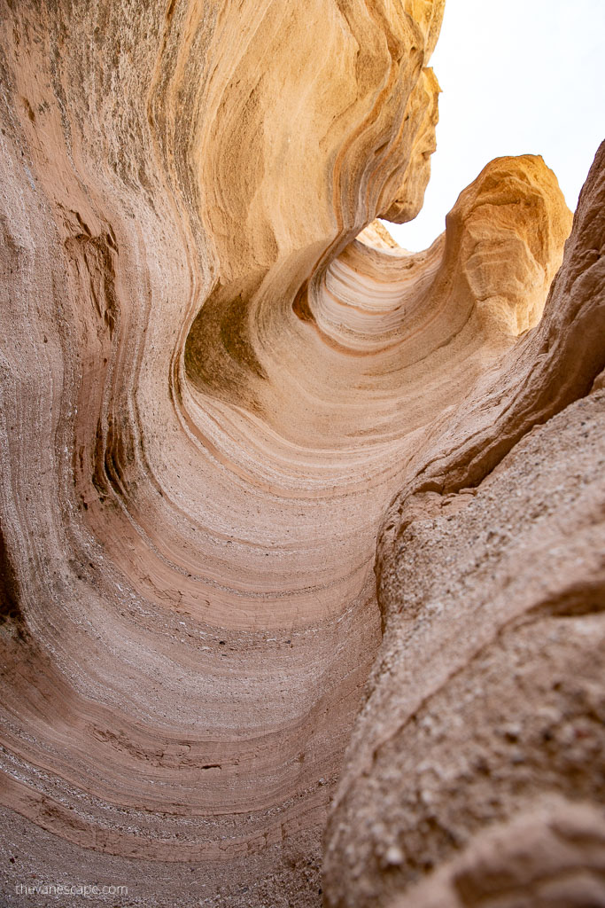
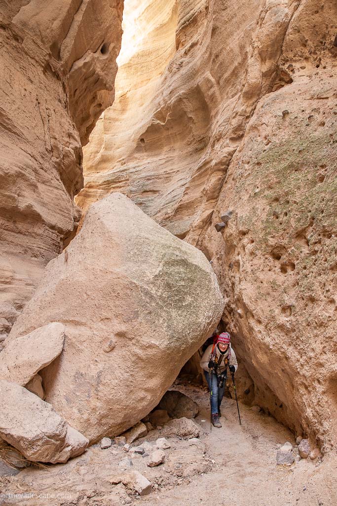
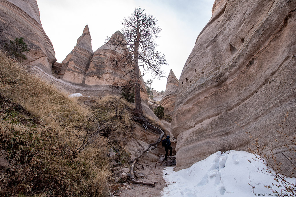
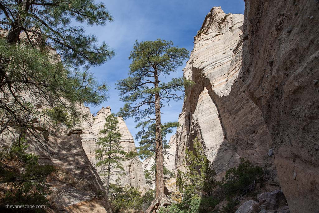
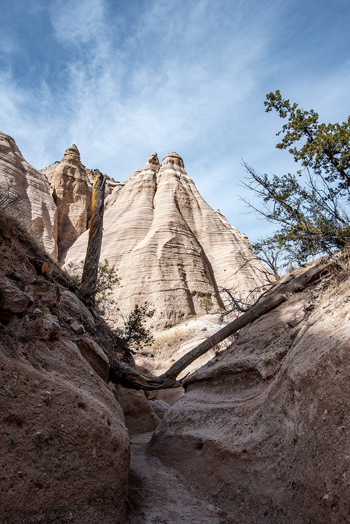
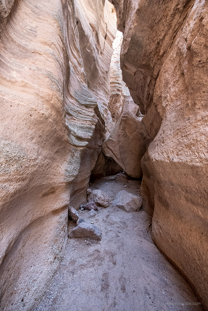
The Slot Canyon Trail is the main experience at Kasha-Katuwe and one of the best slot canyon hikes in the Southwest. The route begins gently before entering a narrow passageway carved by wind and water. In several spots the walls are so tight you may need to turn sideways to pass. The canyon stays shady and cool, which feels refreshing even on hot days.
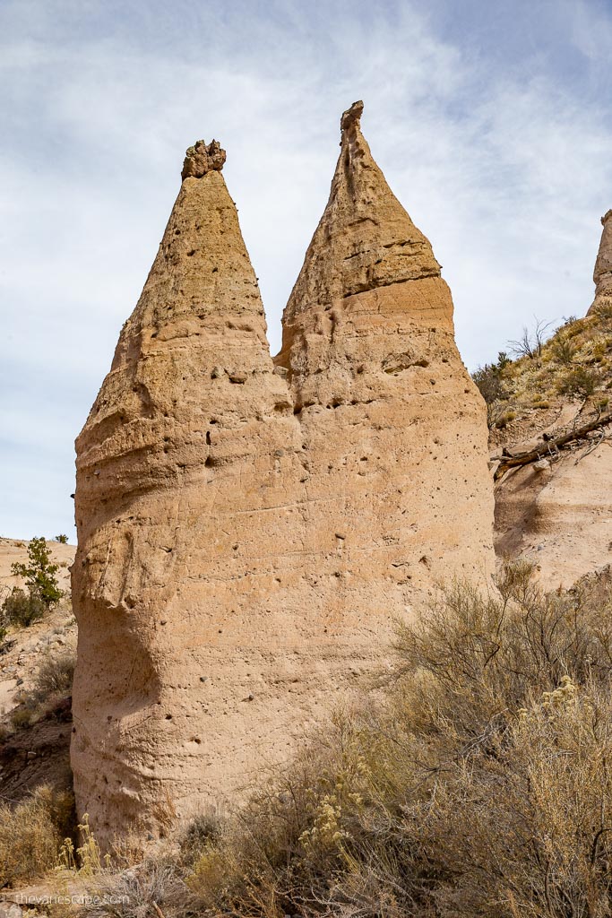
Beyond the slot section, the trail climbs steadily toward the mesa top. The final stretch includes steep switchbacks, loose rock, and short scrambles. Once you reach the top, the views open across the Rio Grande Valley, the Sangre de Cristo Mountains, the Jemez Mountains, and the entire field of cone-shaped hoodoos below.
Plan extra time for photos—this part of the trail is stunning.
Mesa Top Viewpoint
• Part of: Slot Canyon Trail
• Best for: panoramic views and photography
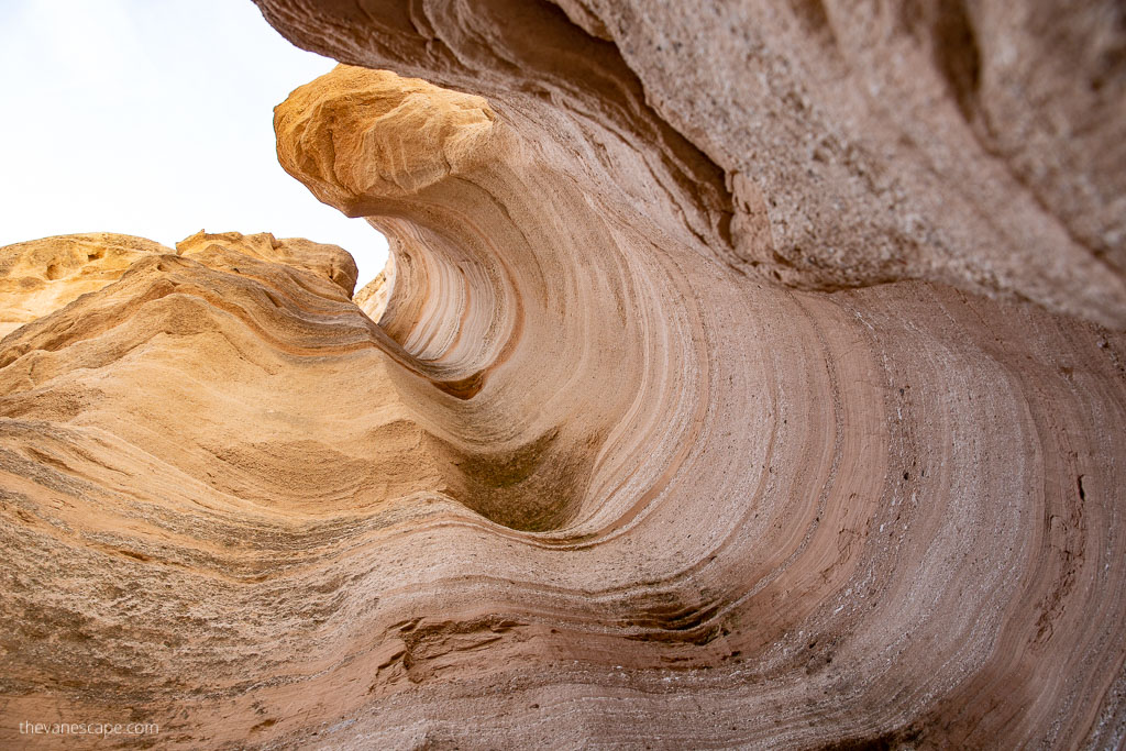
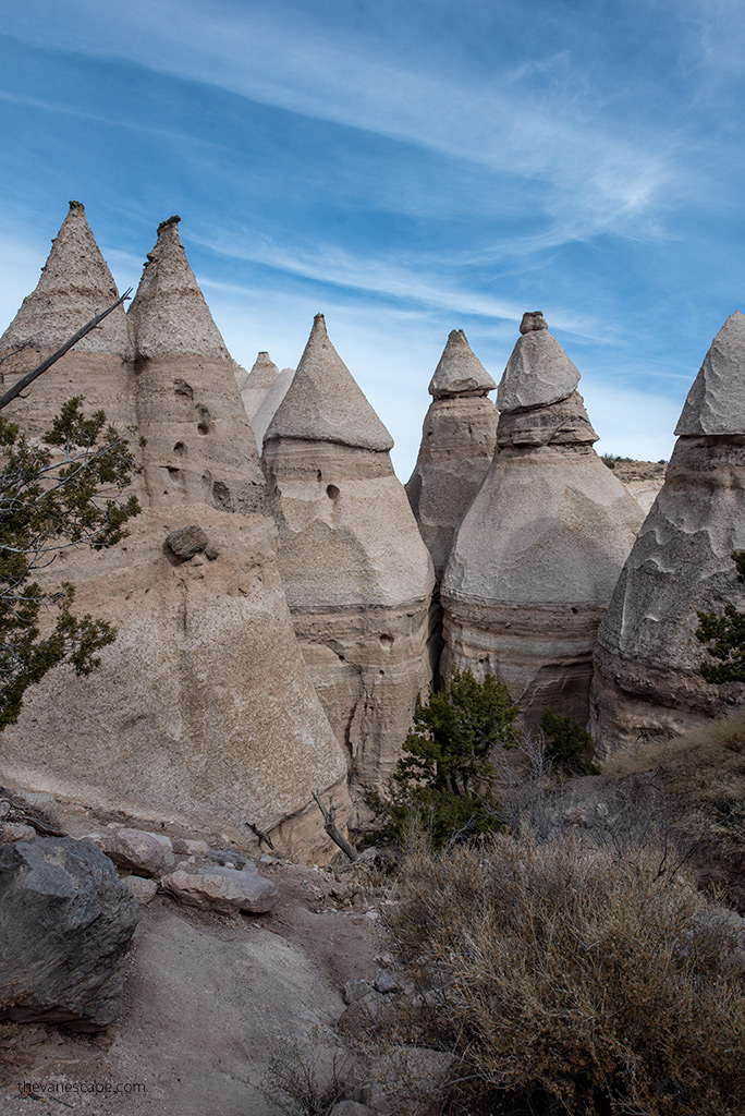
The mesa-top overlook is the reward for hikers who complete the full Slot Canyon Trail. From the top, you look down on the tent-shaped hoodoos, the white volcanic cliffs, and the deep slot canyon you just hiked through. Sunrise and late afternoon bring the best light, and even on a short New Mexico road trip, this viewpoint feels like a highlight.
Why This Trail Stands Out
• It combines a slot canyon, hoodoos, and mesa-top views in one hike.
• The geology—layered ash, tuff, and eroded cones—is unlike anywhere else.
• It’s short but adventurous, accessible for most active hikers.
• The slot canyon provides shade and cooler temperatures even on warm days.

Cave Loop Trail
• Distance: 1.2-mile loop
• Elevation gain: minimal
• Difficulty: easy
• Highlights: volcanic cliffs, scattered hoodoos, open desert views
The Cave Loop Trail is a short, easy loop that branches off from the main path near the trailhead. It offers a quieter, more open walk through the surrounding desert landscape, with views of layered volcanic rock and small hoodoos. It’s a great add-on to the Slot Canyon Trail, especially if you have an extra 30–45 minutes.
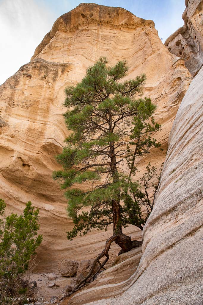
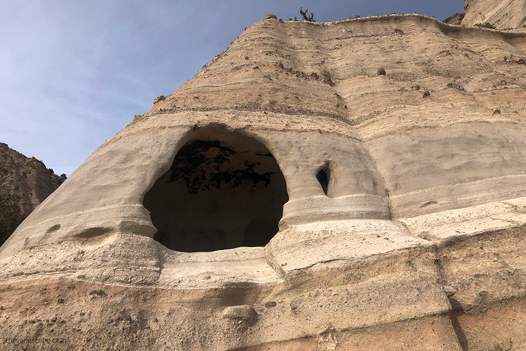
The loop winds through open desert terrain dotted with juniper and pinyon. You’ll pass small eroded alcoves, volcanic layers, and soft rolling formations that give a different perspective than the dramatic slot canyon. Views are wide, the walking is gentle, and it’s a relaxing way to finish your visit if time allows.
Because it’s exposed, mornings and late afternoons offer the most comfortable temperatures and best light for photography.
Weather & Best Time to Visit
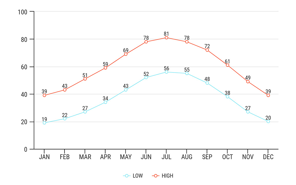
Kasha-Katuwe Tent Rocks can be enjoyed year-round, but conditions vary more than many travelers expect. The Monument sits between 5,570 and 6,760 feet above sea level, so temperatures can shift quickly, and storms can move in fast, especially in the summer.
Best Overall Time: Spring and Fall
The most comfortable months for hiking are March through May and September through early November. Days are mild, nights are cool, and the light is beautiful for photography. These seasons offer the best balance of pleasant weather and smaller crowds.
Summer: Hot Temperatures and Monsoon Season
June through August brings hot days that often reach the upper 80s or 90s (°F). The slot canyon offers shade, but the climb to the mesa top is exposed.
Afternoon thunderstorms are common during the monsoon season (mid-June to mid-September), which increases the risk of flash flooding inside the slot canyon. Always check the weather before heading out, and avoid visiting if storms are in the forecast.
Winter: Cold but Beautiful
Winter can be a wonderful time to visit. Chris and I hiked here in December, and it was sunny, crisp, and quiet. Daytime temperatures often sit in the 30s–40s (°F), but the slot canyon stays cool and shaded, so pack warm layers. Snow is possible but usually light.

Check Current Conditions Before You Go
Because the Monument has strict operating hours and the slot canyon is weather-dependent, always verify:
- opening status
- reservation availability
- weather alerts
- monsoon advisories
The official BLM page provides the most accurate updates.
What to Bring for Visiting Kasha-Katuwe Tent Rocks
Even though the trails at Kasha-Katuwe are relatively short, the terrain, elevation, and narrow slot canyon make preparation important. Here’s what we recommend packing based on our own hikes.
Water
Bring at least 1–2 liters (32–64 oz) of water per person. The slot canyon is shaded, but the mesa climb is fully exposed, and dehydration can happen quickly at higher elevations.
Sturdy Footwear
Wear hiking shoes or trail runners with good traction. The slot canyon has slickrock sections, and the climb to the mesa top includes loose gravel and uneven steps.
Avoid sandals or flip-flops.
Layers for Changing Temperatures
Even in summer, the slot canyon stays cool, and winds on the mesa can be strong. Pack:
- a light jacket or fleece
- sun protection for the exposed sections
Sun Protection
Northern New Mexico sun is intense at this elevation. Bring:
- a hat
- sunscreen
- sunglasses
The upper trail has no shade.
Small Backpack
Use a lightweight daypack to carry water, layers, and snacks. Keep it compact—large packs can be awkward in the slot canyon’s tight squeezes.
Snacks
Carry something salty and high-energy for the climb, especially if you’re hiking in warm weather.
Hiking Poles (optional)
Poles can help on the steep switchbacks, but collapse them before entering the slot canyon—they can get in the way in narrow sections.
Camera or Smartphone
The canyon walls, hoodoos, and mesa-top views are photogenic at any time of day. Morning and late afternoon offer the best light.
Safety Tips for Slot Canyons
Slot canyons are beautiful but require extra caution. Kasha-Katuwe is generally safe when conditions are good, yet weather, terrain, and crowds can create challenges. These tips will help you stay safe on the trail.
Watch the Weather Closely
Flash floods are the biggest risk in any slot canyon. Even distant storms can send water rushing through the canyon with little warning.
Avoid hiking if:
- rain is in the forecast
- thunderstorms are forming
- monsoon conditions are expected
Check conditions before you leave and follow all BLM advisories.
Start Early
Parking fills quickly, and mid-day heat can make the climb to the mesa top more strenuous. Early morning also helps you avoid crowds inside the narrow canyon.
Expect Tight Spaces
Some sections of the canyon are extremely narrow—you may need to turn sideways to pass. Keep your pack small so it doesn’t snag on the rock walls, and be patient with other hikers.
Be Careful on Loose Rock
The climb to the mesa has loose gravel and steep switchbacks. Take your time, especially on the descent.
Stay on Marked Trails
This is fragile desert terrain, and leaving the trail can damage vegetation or cause erosion. It also increases your chances of encountering rattlesnakes.
Watch for Wildlife
Rattlesnakes live in this area. Make noise with your feet, avoid reaching into shaded rock crevices, and always stay alert on sunny, warm days. Never touch or approach wildlife.
Know Your Limits
This hike feels short, but the elevation and steep climb can be challenging. Rest when needed, drink regularly, and don’t hesitate to turn around if you feel dizzy or overheated.
Geology of Kasha-Katuwe: How the Tent Rocks Formed
The tent-shaped hoodoos at Kasha-Katuwe are some of the most unique volcanic formations in the Southwest. Their story begins millions of years ago, when this entire region was shaped by explosive volcanic activity from the Jemez Mountains.
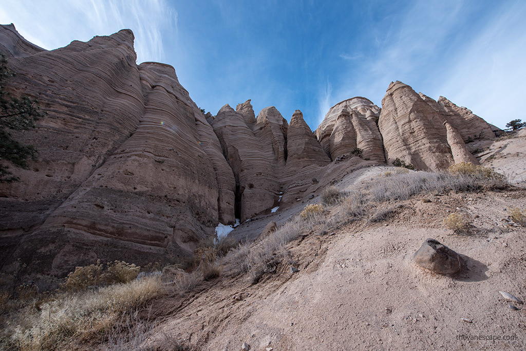
Around 6 to 7 million years ago, massive eruptions filled the area with thick layers of pumice, ash, and tuff. These deposits were more than 1,000 feet deep in places. During the most powerful eruptions, searing-hot gases and rock fragments rushed down the slopes in fast-moving currents called pyroclastic flows, covering the landscape in a uniform layer of volcanic material.
Over time, wind and water carved into these soft layers, cutting narrow slot canyons and leaving behind the pointed hoodoos that resemble teepees or cones. Many formations still have a harder caprock on top — a remnant of stone that erodes slower than the layers beneath it. This protective “cap” helps shape the classic tent-like silhouette.
The name Kasha-Katuwe means “white cliffs” in the Keresan language of Cochiti Pueblo, a reference to the pale volcanic rock that lines the canyon walls and mesa tops. Bands of gray, pink, beige, and cream appear where different eruptions left distinct layers.
Even today, the Monument continues to change. Rainstorms reshape the canyon walls, and the hoodoos slowly soften and erode. Hiking here offers a close-up look at a landscape still being sculpted by nature.
Final Thoughts
Kasha-Katuwe Tent Rocks National Monument offers one of the most unique landscapes in the Southwest. The combination of a twisting slot canyon, towering hoodoos, and wide desert views makes this place unforgettable, even on a short visit. The trails are manageable for most hikers, and the scenery changes constantly, from narrow passages to sweeping vistas.
With the reservation system and split passes now in place, planning ahead is essential. Once you’ve secured entry, the Monument is easy to explore and rewarding at every turn. If you’re road-tripping through New Mexico or looking for a standout day trip from Santa Fe or Albuquerque, Tent Rocks is an experience that stays with you long after you leave.
Do You Like It? Pin It For Later!