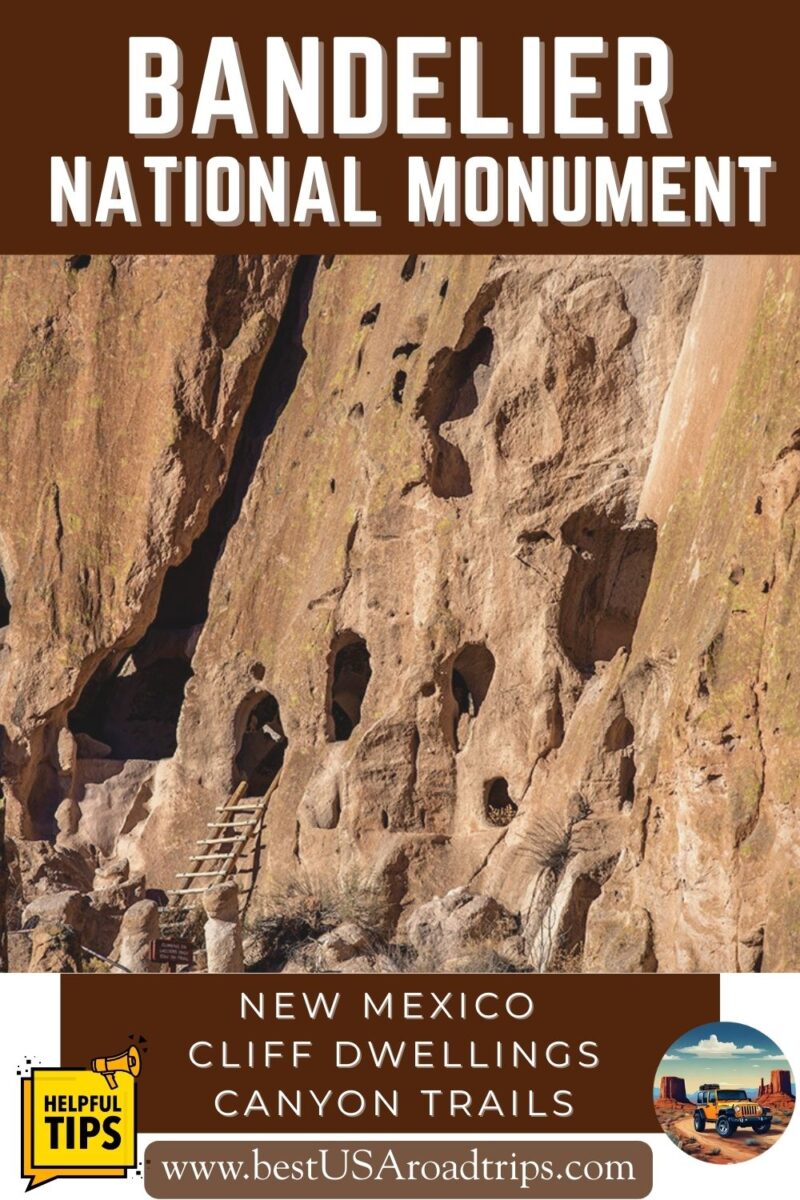
Bandelier National Monument Guide: Things to Do, Hikes, and Travel Tips
Bandelier National Monument is one of the most fascinating places to explore in New Mexico. Here, miles of quiet trails wind through canyons filled with ancient cliff dwellings, kivas, rock art, and the remains of villages built by the Ancestral Pueblo people. Walking these paths feels like stepping into a living history book, surrounded by volcanic cliffs and wide desert skies. This guide helps you plan your visit with confidence. You’ll learn what Bandelier is, where it’s located, the best trails and cliff dwellings to explore, how to use the seasonal park shuttle, what to expect in each season, and how to make the most of your time. All tips come from our firsthand experience hiking and exploring this remarkable monument. Let’s start planning your Bandelier adventure.
This article may contain affiliate / compensated links. For full information, please see our disclaimer here.
Visiting Bandelier – Our Experiences
Chris and I explored Bandelier National Monument during one of our New Mexico road trips, and this place surprised us more than we expected.
We had already visited Taos Pueblo and Mesa Verde National Park on earlier trips, so we were familiar with Ancestral Pueblo history. Still, Bandelier left a huge impression on us. The canyon setting, the quiet trails, and the mix of cliff dwellings and masonry pueblos felt especially powerful.
We visited in December, when the air was crisp and the whole area felt calm and peaceful. The trails were almost empty, which allowed us to take our time, enjoy the scenery, and photograph the ancient dwellings without crowds.
Hiking among the cliff homes and climbing the wooden ladders into the cavates felt like stepping back in time. Every turn in Frijoles Canyon tells a story, and this is what makes Bandelier so unique.
All photos in this guide come from our visits, and all tips are based on our firsthand experience exploring the monument on foot. If you’re building your itinerary, our New Mexico road trip guide can help you connect all the highlights into one route.

What Is Bandelier National Monument?
Bandelier National Monument protects more than 33,000 acres of canyons, mesas, and archaeological sites in northern New Mexico. It is one of the best places in the Southwest to learn about the Ancestral Pueblo people who lived here from about 1150 to 1550 AD.
The monument was established on February 11, 1916, and named after Adolph Bandelier, a Swiss-American anthropologist who studied the cultures of the Southwest and advocated for protecting this area. Today, Bandelier preserves thousands of archaeological features, including:
- cliff dwellings carved into soft volcanic tuff
- masonry homes and multi-room villages
- kivas used for ceremonies
- petroglyphs and pictographs
- ancient trails along the canyon walls
The soft rock in Frijoles Canyon allowed people to carve rooms directly into the cliffs, while harder basalt provided tools for shaping blocks and beams. Corn, beans, squash, and yucca supported daily life here, and trade routes connected this canyon to other Pueblo communities across the region.
The descendants of the people who lived in Bandelier are primarily from Cochiti Pueblo (connected to Frijoles Canyon) and San Ildefonso Pueblo (connected to Tsankawi). Their cultural ties to this land remain strong today.
Bandelier is not only an archaeological treasure. It is also a beautiful hiking destination, with dramatic cliffs, narrow canyons, quiet forests, and easy access to well-marked trails.
Where Is Bandelier National Monument and How to Get There?
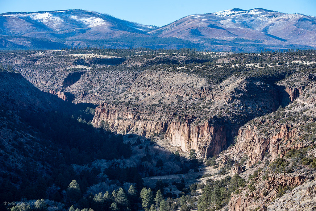
Bandelier National Monument is located in northern New Mexico, between Santa Fe and Los Alamos on the Pajarito Plateau. Its central location makes it easy to add to most New Mexico road trips and perfect for a day trip from Santa Fe, Taos, or Albuquerque.
Here are the main distances and travel times:
- Santa Fe → 40 miles (about 50 minutes)
- Los Alamos → 12 miles (about 20 minutes)
- Taos → 70 miles (about 1 hour 30 minutes)
- Albuquerque → 100 miles (about 1 hour 45 minutes via I-25)
Driving to Bandelier
Most visitors enter through NM-4, which winds across mesas and canyons before dropping into Frijoles Canyon. Travel times can vary due to road curves, winter snow, or summer monsoon storms, so always check road conditions before you go.
Here are the most common routes:
- From Santa Fe:
Take US-84 W → NM-4 W. This is the fastest and most popular route and the one we used during our visit.
- From Albuquerque:
Two options:
Fastest: I-25 N → US-285 → NM-502 → NM-4
More scenic: I-25 N → US-550 → NM-4 through Jemez Springs
- From Taos:
Take US-64 W → NM-68 S → NM-502 → NM-4. This is a beautiful drive with mountain and canyon scenery.
Main Areas of the Monument
Bandelier has two distinct sections:
• Frijoles Canyon – the main area with the Visitor Center, Main Loop Trail, Alcove House, and most archaeological sites.
• Tsankawi – a separate northern section near Los Alamos with unpaved trails, ladders, and preserved petroglyphs.
Both are worth visiting, but Frijoles Canyon is where most travelers start.
Entry Details & Pass Information
Bandelier National Monument is open year-round, but visitor access works differently depending on the season. Here’s what you need to know before arriving.
Entrance Fee
- $25 per private vehicle (valid for 7 days)
- $15 per person for walk-in or bicycle entry
- $20 per motorcycle
Operating Hours
- Open from dawn to dusk, unless weather or emergencies cause temporary closures.
- Visitor Center hours vary seasonally. Always check the NPS website before your trip.
Pets
Pets are not permitted on any trails at Bandelier. They are allowed only in parking areas and campgrounds.
Permits
- Backcountry camping permits are free and available at the Visitor Center.
- Group campsites must be reserved through Recreation.gov.
- No permit is required for day hiking.

Where to Stay Near Bandelier National Monument
Most travelers stay in Santa Fe, which offers the largest selection of hotels, restaurants, and cultural attractions. We recommend Santa Fe if you want a mix of hiking and sightseeing, and we have a detailed Santa Fe itinerary with lodging tips to help you plan your stay.
Best Options Near Bandelier
Santa Fe (40 miles away)
This is the top choice for most visitors. You’ll find hotels in every budget range, excellent food, museums, galleries, and easy access to NM-4.
Los Alamos (12 miles away)
If you want to stay as close as possible to Bandelier, choose Los Alamos. It’s a quiet, convenient base with a few hotels, cafés, grocery stores, and quick access to Frijoles Canyon.
Campgrounds in Bandelier
If you prefer camping, the monument offers several options:
Juniper Family Campground
- Located near the main entrance
- First-come, first-served
- Best for tent campers and small groups (up to 10 people)
- Two sites accommodate small groups of 10–20
Ponderosa Group Campground
- Located on NM-4, 6 miles west of the entrance
- For groups larger than 10
- Reservation required on recreation.gov
- Elevation: 7,600 feet
Backcountry Camping
- Allowed with a free permit from the Visitor Center
- Closest backcountry zone is about 2 miles from Frijoles Canyon
- A great option for experienced hikers looking for solitude
If you prefer more comfort, Farmington-style motels are not available near Bandelier. Santa Fe and Los Alamos remain your best choices for hotels.

Bandelier National Monument Shuttle (How It Works)
Parking in Frijoles Canyon is limited, and during the busy season you may be required to use the free park shuttle to access the main visitor area. The shuttle makes visiting easier and helps protect the canyon from heavy traffic.
When the Shuttle Is Required
The Bandelier shuttle operates seasonally.
Shuttle required: mid-May – mid-October
During this period, private vehicles are not allowed to drive into Frijoles Canyon between 9 a.m. and 3 p.m.
Outside these months and hours, you may drive directly to the Visitor Center unless road conditions or special events say otherwise.
Where the Shuttle Runs
The shuttle runs between:
- White Rock Visitor Center → 25 minutes to Bandelier
- Juniper Campground → 10 minutes to Bandelier
- Bandelier Visitor Center in Frijoles Canyon
Buses run frequently, and the ride is comfortable with nice canyon views along the way.
How the Shuttle Works
- Park for free at the White Rock Visitor Center.
- Board the bus — no ticket needed.
- The bus drops you right at the Bandelier Visitor Center, where most hikes begin.
- For the return trip, simply board the next available shuttle.
Exceptions
You may drive your own vehicle into the canyon if:
- You are staying at Juniper Campground,
- You have a disability placard and require parking access,
- You are traveling outside the seasonal shuttle hours or outside the shuttle season.
Always check for updates on the NPS Bandelier Shuttle page, especially in early spring or late fall.
How to Get Around Bandelier National Monument
Once you’re inside Bandelier, getting around is simple, but planning ahead makes your visit smoother—especially during the busy season.
Walking Is the Best Way to Explore
Most of the archaeological sites and the major trailheads are located in Frijoles Canyon near the Visitor Center. Distances are short, so you can easily explore the Main Loop Trail, Alcove House, and nearby ruins on foot.
Parking Is Limited
Parking near the Visitor Center fills quickly, even outside peak season. If you arrive early or visit during quieter months, you can usually find space, but lots may fill by late morning on weekends and holidays.
Know When the Shuttle Is Required
You already included the shuttle details in the previous section, so here we simply acknowledge it:
During the summer and early fall, many visitors will begin their visit via the required shuttle system from White Rock. Once the shuttle drops you off, you can explore the monument entirely on foot.
Driving the Upper Area
If you’re visiting during the off-season (when the shuttle is not required), you can drive down to the canyon and park next to the Visitor Center. From there, the road continues to the Juniper Campground, trailheads, and scenic overlooks on the mesa.
Tsankawi Requires a Separate Drive
Tsankawi, a detached northern unit of the monument near Los Alamos, is accessed by a separate parking area along NM-4. There is no shuttle service here, and parking is very limited. Arrive early, especially on weekends.
Plan Your Day Around Trail Logistics
Because most trails connect at the Visitor Center:
- Start with the Main Loop Trail early to avoid crowds.
- Add Alcove House, Frey Trail, or Falls Trail depending on weather and energy.
- Save Tsankawi for early morning or late afternoon when lighting is best for photography.
Restrooms, Water & Services
All services in the main area are centered around the Visitor Center. Once you start hiking, there are no restrooms or water sources along the trails. Fill up before you start.

Best Hikes in Bandelier National Monument
Bandelier has more than 70 miles of trails, from short cliff-dwelling walks to long mesa hikes with wide canyon views. Below are the most rewarding routes for first-time visitors, based on our own experience and updated NPS trail information.
1. Main Loop Trail (1.2 miles / 1.9 km)
Difficulty: Easy
Start: Visitor Center
This is the most important trail in Bandelier and the best place to begin your visit. The loop passes Tyuonyi Pueblo, Talus House, the Big Kiva, and several cliff dwellings carved into the volcanic rock.
Short wooden ladders allow you to look inside cavates, giving you a close view of how Ancestral Pueblo people lived between 1150 and 1550 AD.
2. Alcove House Trail (2.2 miles / 3.5 km round trip including Main Loop portion)
Difficulty: Easy to moderate
Start: West end of Main Loop
This short extension leads to Alcove House, a ceremonial cave set 140 feet (43 m) above the canyon floor. Reaching the alcove requires climbing a series of tall wooden ladders. The views from the top are incredible, and you can enter the reconstructed kiva.
If you prefer not to climb, you can admire Alcove House from below.
3. Frey Trail (1.5 miles / 2.4 km one way)
Difficulty: Moderate
Start: Juniper Campground
This quiet trail descends into Frijoles Canyon and connects directly with the Main Loop Trail. It’s less crowded than the canyon floor trails and offers beautiful views of the cliffs, mesas, and forest.
You can hike one way and take the shuttle back to the campground.
4. Falls Trail (3 miles / 4.8 km round trip to Upper Falls)
Difficulty: Moderate
Start: Backpacker Parking Lot
The trail descends about 400 feet (122 m) to a canyon filled with cottonwoods and seasonal waterfalls. In spring, snowmelt creates a powerful flow. In winter, the trail may be icy, especially on the shaded sections.
Past Upper Falls, the route becomes rougher and is often closed due to flood damage — check NPS updates before hiking farther.
5. Frijolito Loop (2.5 miles / 4.0 km)
Difficulty: Strenuous
Start: Cottonwood Picnic Area
This loop climbs steep switchbacks to the top of the mesa, passes the Frijolito Pueblo ruins, and then returns along the Long Trail. The canyon and mesa views are outstanding, but the climb is steep and exposed.
6. Tsankawi Trail (1.6 miles / 2.6 km)
Difficulty: Moderate
Location: Separate northern section near Los Alamos
Tsankawi is one of the most unique places in the monument. You’ll hike carved footpaths worn deep into the tuff, climb short wooden ladders, and explore unexcavated cavates and petroglyphs. The mesa-top views are incredible, especially at sunset.
The trail is exposed and can be icy in winter or slippery after rain.

Best Things to See in Bandelier National Monument
Bandelier protects one of the most complete collections of Ancestral Pueblo dwellings in the Southwest. Even on a short visit, you can see cliff homes, kivas, petroglyphs, and the remains of ancient villages that tell the story of the people who lived here between 1150 and 1550 AD.
These are the highlights you shouldn’t miss.
1. Tyuonyi Pueblo
Tyuonyi is the large circular village you’ll see along the Main Loop Trail. Once two to three stories tall, it held more than 400 rooms and formed the heart of the Frijoles Canyon community. The layout is easy to understand from the overlook above the site.
2. Long House
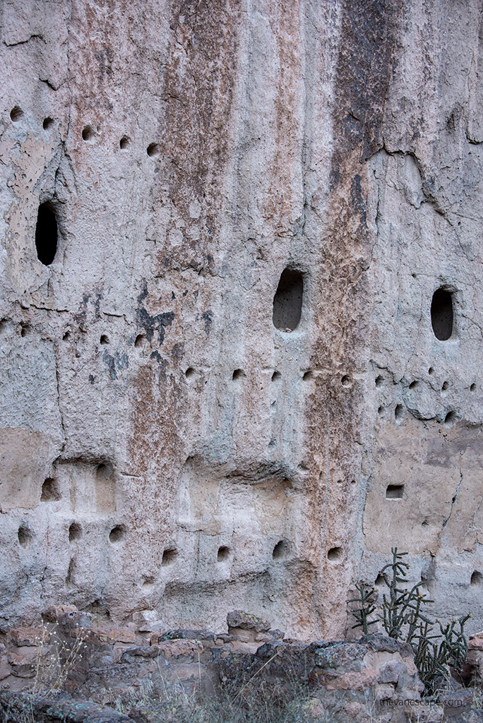
Long House stretches along the base of the canyon cliff. Here you can see cliff dwellings, rows of viga holes where wooden beams once supported upper floors, and faint petroglyphs carved into the soft tuff. It’s one of the most atmospheric places in the entire monument.
3. Cliff Dwellings & Cavates
Small carved rooms called cavates line the canyon walls. Short, sturdy ladders allow you to climb into several of them. Inside, you can still see smoke-blackened ceilings and carved niches where families once stored food and belongings.
4. Big Kiva
Near the start of the Main Loop, the Big Kiva shows the cultural center of the village. These underground ceremonial spaces were used for community gatherings and rituals.
5. Alcove House
This ceremonial cave sits 140 feet (43 m) above the canyon floor and contains a reconstructed kiva. Even if you choose not to climb the tall ladders, the view from below is impressive.
6. Petroglyphs
Look closely along Long House and Tsankawi. You’ll see carved figures, animals, and symbols that have survived centuries of weathering.
7. Frijoles Canyon Scenery
The canyon itself is stunning. Steep volcanic walls, cottonwood trees, and seasonal water create a beautiful contrast of color and texture. In late fall, the cottonwoods turn bright yellow, giving the canyon a golden glow.
8. Wildlife
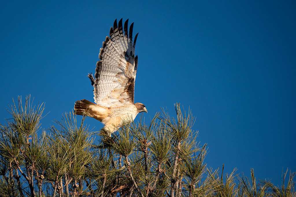
Bandelier is home to mule deer, coyotes, Abert’s squirrels, foxes, and many birds. In winter, animal tracks are easy to spot along the trails.
Tsankawi — The Separate Northern Unit
Most first-time visitors don’t realize Bandelier has two main areas. Tsankawi (pronounced “san-KAH-wee”) is a separate section near Los Alamos, with some of the most unique archaeological features in the monument.
Why Tsankawi Is Special
Tsankawi preserves unexcavated cavates, petroglyphs, mesa-top views, and ancient footpaths carved directly into the tuff. The trail feels more remote, more natural, and often less crowded than Frijoles Canyon.
Trail Details
- Distance: 1.6 miles (2.6 km)
- Difficulty: Moderate
- Features: ladders, narrow carved paths, mesa-top views, cavates, and petroglyphs
The route can be slippery when wet or icy and is fully exposed to sun and weather.
What You’ll See
- Deep footpaths worn into the soft rock from centuries of use
- Mesa-top dwellings used by the Ancestral Pueblo people
- Rock art scattered along the cliffs
- Views of the Jemez Mountains, Frijoles Canyon rims, and the surrounding mesas
Access & Practical Tips
- Tsankawi has its own parking area along NM-4.
- Parking is limited; arrive early.
- There is no shuttle service to this unit.
- Carry plenty of water — shade is minimal.
- Watch your footing on the carved paths and ladders.
Many visitors say that Tsankawi feels like “Bandelier before excavation.” If you want something quieter and more rugged, it’s a must-do.

When to Visit Bandelier National Monument
Bandelier is open year-round, and each season offers a different experience. Weather in northern New Mexico can shift quickly, so planning around seasonal conditions helps you enjoy the trails safely and comfortably.
Spring (March–May)
Best for: mild temperatures, fewer crowds, quiet hiking
Average highs: 55–70°F (13–21°C)
Average lows: 25–40°F (-4–4°C)
Spring is one of the best times to visit Bandelier. Days are cool and pleasant, trails are usually quiet, and canyon views are crisp before summer heat arrives. Early spring can still bring occasional snow or windy days, so dress in layers.
Summer (June–August)
Best for: long daylight, full access to trails, family trips
Average highs: 80–90°F (27–32°C)
Average lows: 50–60°F (10–16°C)
Summer is the busiest season in Bandelier. Mornings are cool and comfortable, but midday heat can be strong inside Frijoles Canyon. Afternoon thunderstorms are common from mid-July through mid-September, so start your hikes early and plan indoor breaks in the afternoon.
The required shuttle system operates during this period, which helps reduce traffic in the canyon.
Fall (September–November)
Best for: ideal hiking weather, fall colors, fewer visitors
Average highs: 55–75°F (13–24°C)
Average lows: 30–45°F (-1–7°C)
Fall is our favorite time to visit Bandelier. The cottonwoods along Frijoles Creek glow bright yellow, and the canyon feels peaceful once summer crowds thin out. Temperatures drop quickly in late October, especially on the mesas.
Winter (December–February)
Best for: solitude, photography, peaceful trails
Average highs: 40–50°F (4–10°C)
Average lows: 15–25°F (-9– -4°C)
Winter is cold but beautiful. Trails can be icy in shaded sections, especially Alcove House, Falls Trail, and Tsankawi. The monument is very quiet in winter, making it a perfect time for reflective hikes or photography.
Snow is possible but usually light in Frijoles Canyon; higher elevations may have deeper accumulation.
Best Time Overall
- Fall (September–October) for weather, colors, and fewer visitors
- Spring (April–May) for mild temperatures and quiet trails
- Summer works well if you start early and plan around the shuttle
- Winter is great for solitude if you’re prepared for cold conditions
Safety & Cultural Respect
Bandelier protects fragile archaeological sites and sacred ancestral lands. Staying safe and being respectful helps preserve this monument for future visitors.
Protect Archaeological Sites
- The cliff dwellings, cavates, petroglyphs, and masonry walls are extremely fragile.
- Do not touch carvings or pictographs. Oils from your hands cause permanent damage.
- Never enter rooms or climb on walls unless ladders or signs clearly show visitor access.
Use Ladders Carefully
- Many trails include short wooden ladders, especially at Alcove House and the cavates.
- Keep both hands free while climbing.
- Do not rush or pass other visitors.
- Avoid ladders during wet, icy, or high-wind conditions.
Stay on Marked Trails
- The soft volcanic tuff erodes easily, and unmarked paths may lead to unsafe cliff edges.
- Always follow designated routes to protect both yourself and the archaeological sites.
- Do not step off the trail to explore openings in the canyon walls unless the trail signs indicate access.
Wildlife Safety
- Bandelier is home to mule deer, squirrels, foxes, coyotes, and many bird species.
- Keep your distance and never feed wildlife.
- Store snacks securely and watch for animals crossing trails during early morning and late afternoon.
Honor Cultural Significance
- Bandelier preserves the ancestral homes of people whose descendants still live in nearby pueblos.
- Treat all structures, artifacts, and rock art with respect.
- Leave everything exactly as you found it.
What to Pack for Bandelier National Monument
Bandelier’s trails include ladders, exposed mesas, and rocky canyon paths. Packing smart keeps your visit safe and comfortable.
Daypack Essentials
- Lightweight daypack
- Water
- Snacks or a simple lunch
- Small first-aid kit
- Phone with offline maps
- Portable charger
Clothing & Footwear
- Sturdy hiking shoes with good tread
- Moisture-wicking layers
- Light jacket or fleece
- Sun hat, sunglasses, sunscreen
- Rain jacket in summer monsoon season
- Warm hat and gloves in winter
Helpful Extras
- Hiking poles for uneven or icy sections
- Headlamp if you start early or hike late
- Reusable water bottle
- Camera gear if you plan to photograph ruins or wildlife
Seasonal Items
Summer: extra water, sun sleeves
Fall: warm layers for cool mornings
Winter: microspikes, insulated layers
Spring: waterproof jacket, quick-dry socks
What Not to Bring
- Flip-flops or open shoes
- Drones
- Pets on trails

Geology of Bandelier National Monument
Understanding the geology of Bandelier makes the entire experience richer — and surprisingly few guides explain it well. Bandelier sits within the Jemez Volcanic Field, one of the most powerful volcanic regions in North America.
The Landscape Was Formed by Massive Eruptions
About 1.2 million and 1.6 million years ago, two enormous eruptions created the Valles and Toledo Calderas. These explosions blanketed the region with thick layers of volcanic tuff — the soft, weldable rock you see throughout Frijoles Canyon.
Why Cliff Dwellings Exist Here
The walls of the canyon are made of tuff, a rock soft enough for the Ancestral Pueblo people to carve by hand. That’s why Bandelier has so many:
- cavates
- carved rooms
- petroglyphs
- multi-story dwellings built directly into the cliffs
The tuff also holds heat and cools quickly, helping ancient families live comfortably in both summer and winter.
Canyons, Mesas & Erosion
Wind, water, and time carved the tuff into the steep-walled canyons and high mesas you hike today:
- Frijoles Canyon was carved by Frijoles Creek.
- Tsankawi’s mesa-top paths were carved not only by erosion but also by centuries of human footsteps.
A Living Geological Classroom
If you pay attention on the trails, you’ll see:
- crystal fragments embedded in the tuff
- deep footpaths worn through centuries of use
- black basalt boulders carried here by ancient lava flows
- ladder-like erosional patterns along the canyon walls
Bandelier is one of the best places in New Mexico to see volcanic geology and human history interacting in the same landscape.
Final Thoughts
Bandelier National Monument is one of the most rewarding places to explore in New Mexico. The mix of cliff dwellings, carved footpaths, mesa views, and ancient village sites creates an experience you won’t find anywhere else in the Southwest. Even after visiting Taos Pueblo and Mesa Verde, Bandelier still impressed us with its peaceful canyon, its accessible archaeological sites, and the feeling of walking through a living piece of history.
Whether you hike the Main Loop Trail, climb to Alcove House, explore the quiet routes around Frijoles Canyon, or add Tsankawi to your day, you’ll leave with a deeper understanding of the people who lived here for centuries. Take your time, respect the land, and enjoy one of New Mexico’s most meaningful cultural landscapes.
If your New Mexico road trip includes Santa Fe, Taos, or the Jemez Mountains, make sure Bandelier is part of your itinerary. It’s a destination that rewards curiosity, invites slow exploration, and stays with you long after you leave the canyon.
Do You Like It? Pin It For Later!