Driving Pikes Peak Highway: Ultimate Guide to America’s Mountain Road
Driving the Pikes Peak Highway is one of those classic Colorado adventures that every road trip lover should experience at least once. Rising to 14,115 feet (4,302 m), it’s one of the highest paved roads in North America — and one of the most scenic. Every twist and turn brings a new view: alpine lakes, deep forests, and the vast Rocky Mountains stretching to the horizon. In this guide, you’ll find everything you need to plan your drive up Pikes Peak Highway — from practical tips and fees to the best stops and viewpoints. You’ll also learn what to expect at the summit and how to stay safe along the way. Whether you’re an experienced driver, a family traveler, or someone chasing Colorado’s best mountain views, this guide will help you make the most of your trip. Get ready for an unforgettable ride up “America’s Mountain.”
This article may contain affiliate / compensated links. For full information, please see our disclaimer here.
Why Drive the Pikes Peak Highway?
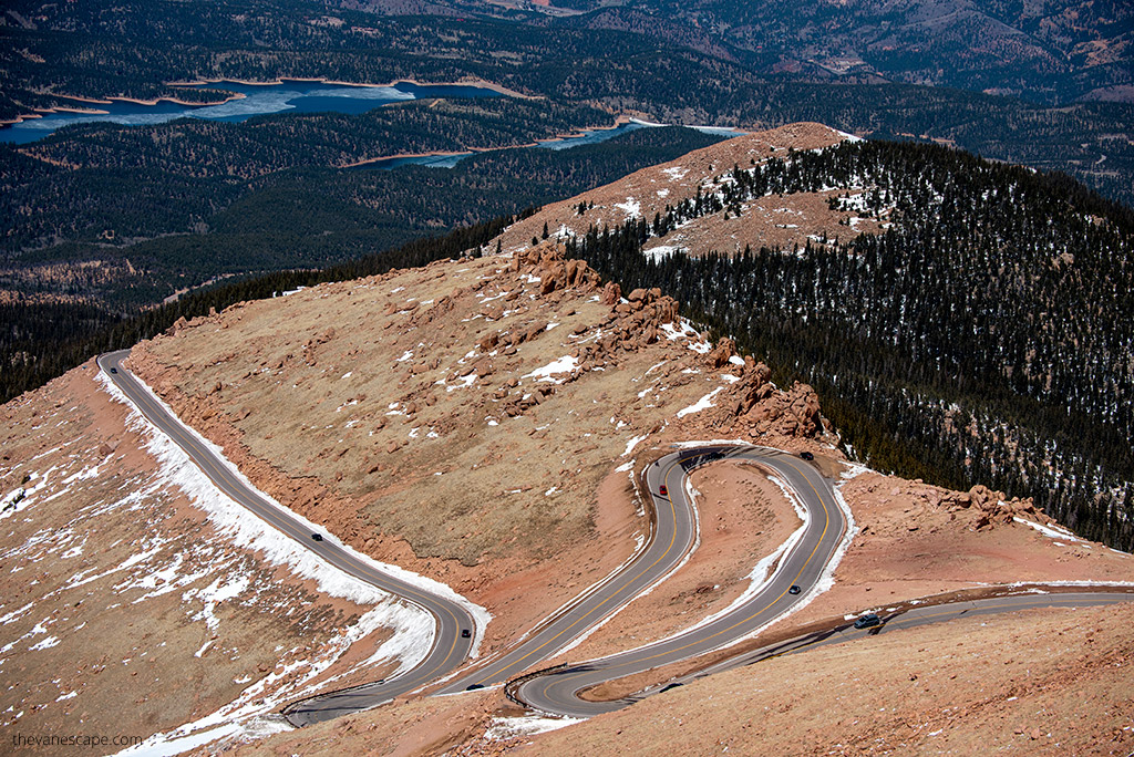
The Pikes Peak Highway is more than just a road — it’s one of Colorado’s most iconic drives. Stretching 19 miles from Cascade to the summit at 14,115 feet, this scenic route takes you from pine-covered foothills to the rugged alpine world above the clouds.
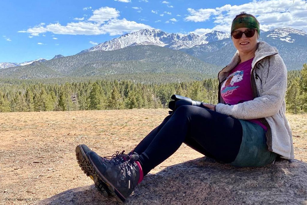
Chris and I made this drive during our Colorado road trip, and it quickly became one of our favorite memories. The road is steep, full of curves, and absolutely breathtaking. It’s not just a drive — it’s a journey through changing landscapes and climates, from warm valleys to icy mountain peaks.
Unlike most “Fourteeners,” you don’t need to hike to reach the top. You can drive all the way to the summit, making this adventure accessible to almost everyone. Families, photographers, and road trip enthusiasts all love it because it combines thrill and beauty in one short trip.
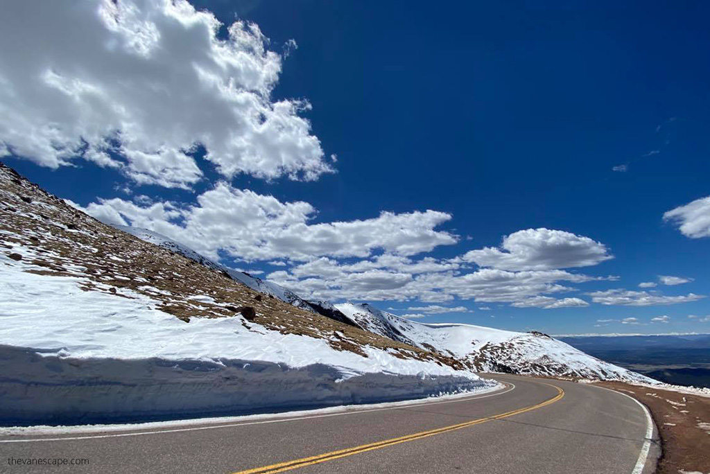
The highway is completely paved and well-maintained, with more than 156 turns and plenty of pull-offs for photos and breaks. Along the way, you’ll pass crystal-clear lakes, wildflower meadows, and panoramic viewpoints that will stop you in your tracks.
Pikes Peak is often called “America’s Mountain,” and for good reason. From the top, you can see as far as five states on a clear day — a view that inspired the famous song “America the Beautiful.”
If you love scenic drives like the Million Dollar Highway or Trail Ridge Road, Pikes Peak Highway deserves a spot on your Colorado bucket list. It’s not just one of the best drives in Colorado, but one of the most unforgettable mountain experiences in the entire U.S.
Agnes’ Advice: If you’re nervous about the altitude or switchbacks, don’t worry — the road is wide, paved, and full of safe pullouts. Take your time, stop often, and enjoy the journey. The climb is steep but perfectly manageable for any careful driver.
Basic Pikes Peak Highway Facts at a Glance
Before you start your drive, here are the most important details about the Pikes Peak Highway — short, clear, and practical.
- Total distance: 19 miles (31 km) one way
- Elevation gain: 6,715 feet from base to summit
- Summit elevation: 14,115 feet (4,302 m)
- Number of turns: More than 156
- Average grade: Around 6.7%
- Surface: Fully paved
- Location: Starts in Cascade, Colorado, just 15 miles west of Colorado Springs
You’ll find the Pikes Peak Highway entrance at 5089 Pikes Peak Highway, Cascade, CO 80809. From Colorado Springs, take US-24 West for about 25 minutes until you see clear signs for “Pikes Peak Toll Road.”
Entrance Fees and Hours
Pikes Peak is not part of the National Park System, so national park passes are not valid here. You’ll need to pay a toll fee at the entrance gate:
- May 1 – Nov 30: $18 per adult (age 16+), $8 per child (6–15), or $65 per car (up to 5 people)
- Dec 1 – Apr 30: $10 per adult (age 16+), $5 per child, or $35 per car
(Check the official Pikes Peak website for updates and seasonal coupons.)
The road is open year-round, weather permitting.
- Summer: uphill gate opens at 7:30 am and closes at 6 pm
- Fall/Spring: 7:30 am to 5 pm
- Winter: 9 am to 3 pm
Always check current road conditions before you go by calling 719-385-7325 (option 1) or visiting the official site.
Driving Time
The round-trip drive takes about 2–4 hours, depending on stops. Driving uphill takes roughly 1–1.5 hours, while the return downhill takes about 30–45 minutes. But don’t rush — the beauty of Pikes Peak is in the journey.
Agnes’ Advice: Start early in the morning to avoid crowds, get clearer skies, and enjoy the calm before the afternoon mountain winds roll in.

Preparing Your Vehicle and Yourself
Before you start your climb up Pikes Peak Highway, take a few minutes to prepare — it makes a big difference. The drive is safe and well-paved, but the altitude, steep grades, and long descent can challenge both your car and your body.
Check Your Vehicle
- Brakes: Make sure they’re in excellent condition. You’ll rely on them heavily during the descent.
- Fuel: Fill up before entering. There are no gas stations on the highway, and the nearest one is in Manitou Springs.
- Tires: Check air pressure. Cold temperatures at high altitude can cause tire pressure to drop.
- Gears: Use low gear on the way down to protect your brakes from overheating.
- Fluids: Check coolant and oil levels. Engines work harder in thin mountain air.
There’s a mandatory brake checkpoint on the way down where rangers will check your brake temperature. If they’re too hot, you’ll be asked to wait and cool them before continuing — safety first!
Prepare Yourself
The summit is at 14,115 feet (4,302 m) — and that’s high enough to cause altitude sickness, even for healthy people.
- Hydrate well before and during the drive.
- Avoid alcohol the night before.
- Bring snacks and water with electrolytes.
- Take your time — stop at scenic pullouts to let your body adjust.
- If you feel dizzy or short of breath, descend slowly to a lower elevation.
Dress for the Mountain
The temperature at the summit is often 30°F colder (17°C) than at the base. You might start your day in a T-shirt and end up wearing a jacket and gloves at the top.
Pack:
- Layers (light sweater or fleece + windproof jacket)
- Hat and gloves
- Sunglasses and sunscreen (the sun is stronger at altitude)
Agnes’ Advice: Even in summer, always bring a warm layer and water. We’ve seen sunshine, snow, and fog all in the same day on Pikes Peak! The key to a great experience is taking it slow, staying safe, and enjoying every stop along the way.

The Drive Up Pikes Peak Highway: Best Stops and Viewpoints
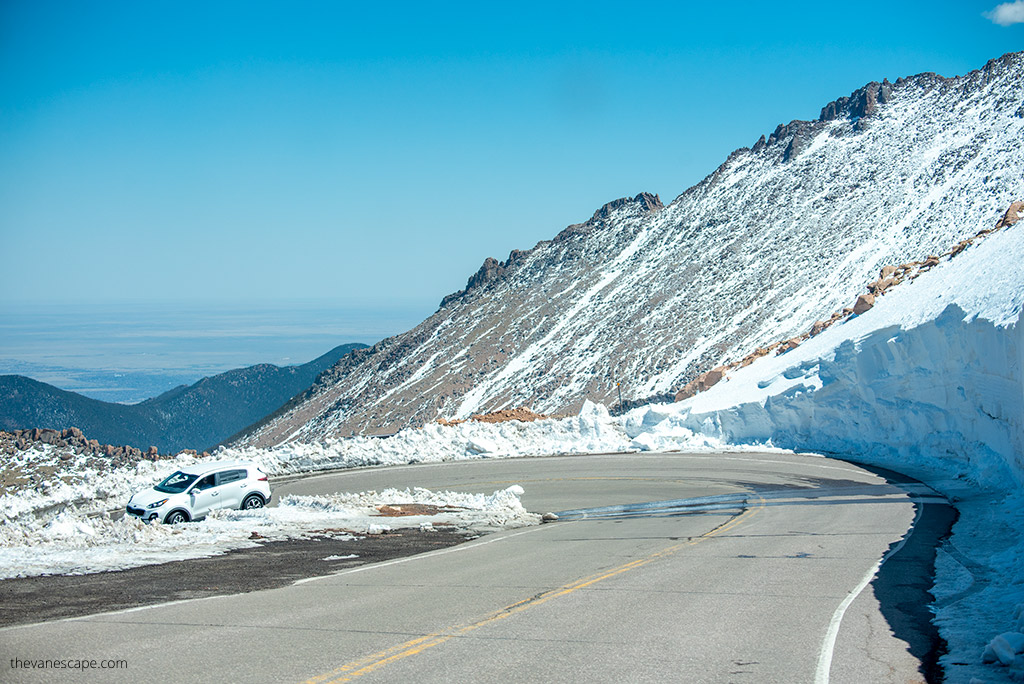
The Pikes Peak Highway is much more than a road to the summit — it’s a scenic experience from start to finish. Every few miles, you’ll find places worth stopping to take photos, rest, or simply breathe in the mountain air. The road climbs through several distinct zones: forest, alpine tundra, and rocky summit terrain. Here are the best stops along the way.
Crystal Reservoir Visitor Center (Mile 6)
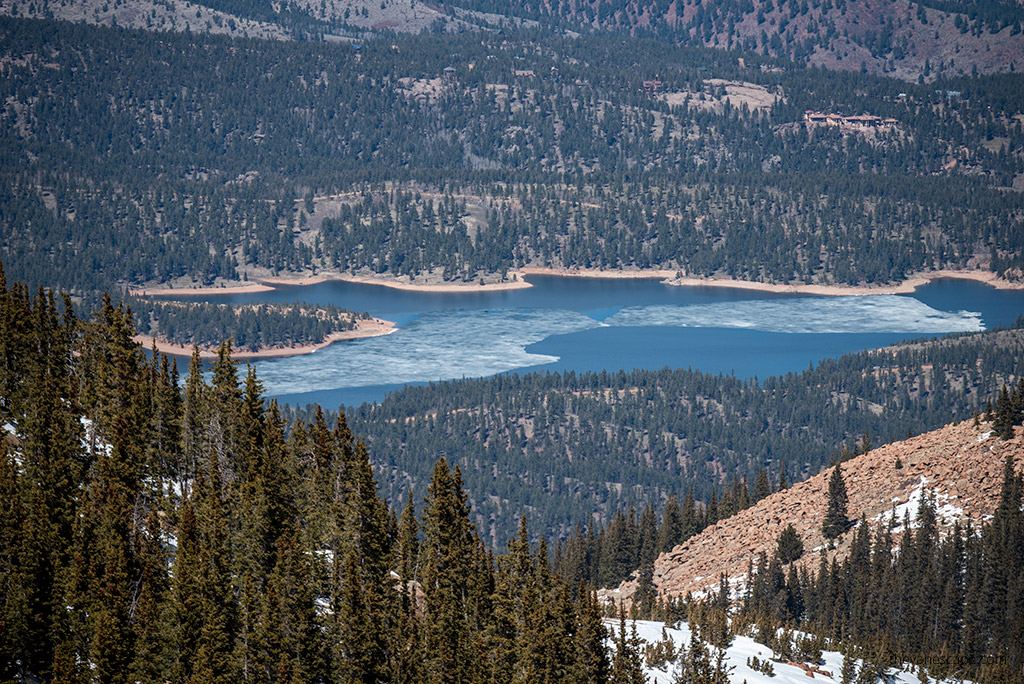
This is your first major stop and a perfect warm-up for the drive ahead. The lake sits at 9,200 feet and offers incredible reflections of Pikes Peak on calm mornings. There’s a gift shop, restrooms, picnic area, and sometimes kayak rentals. Stop here to stretch and grab photos before the climb gets steeper.
Halfway Picnic Area (Mile 9)
A quiet and relaxing spot surrounded by trees. Picnic tables and grills make it ideal for lunch or a short break. The views begin to open up here as the tree line starts to thin.
Glen Cove Inn (Mile 13)
This is a must-stop halfway up. It has restrooms, snacks, and a restaurant — perfect for warming up or cooling down depending on the season. There’s also a ranger station nearby where your brakes will be checked on the descent. Take a short walk around and enjoy the views before the serious climb begins.
Devil’s Playground (Mile 16)
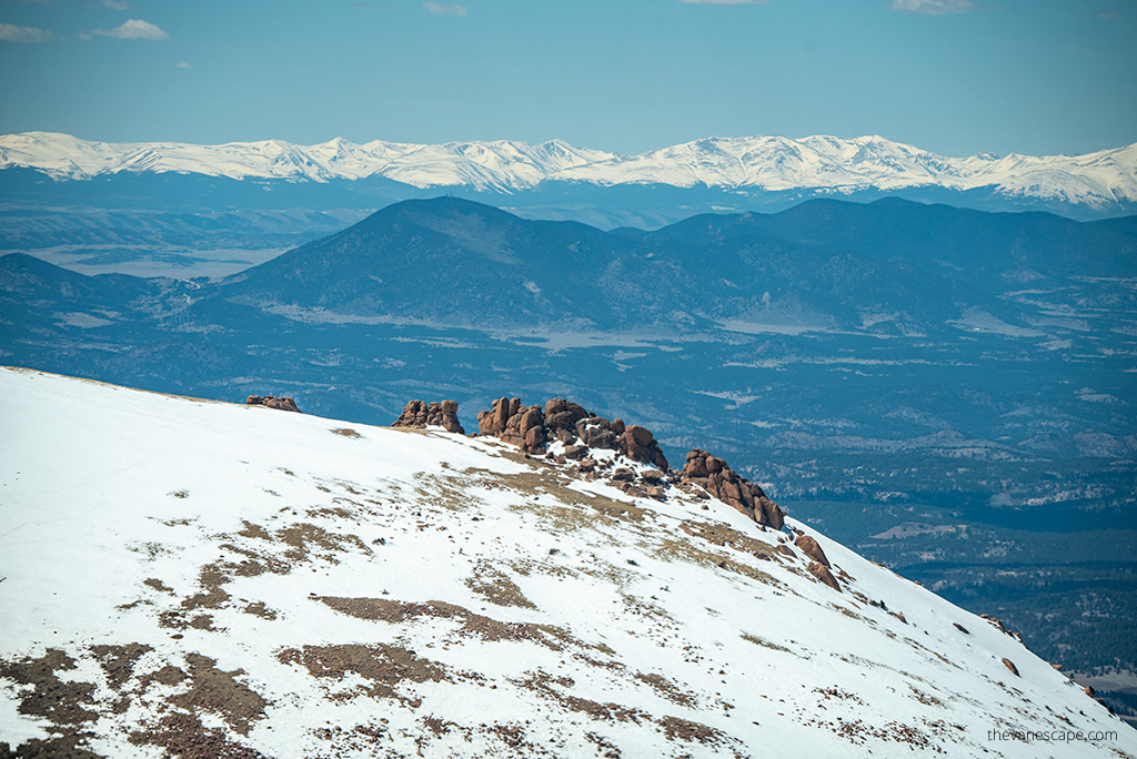
The road above Glen Cove becomes steep and full of curves, leading to this famous viewpoint. The name comes from how lightning bounces dramatically across the rocks during storms. From here, the views stretch endlessly over the Continental Divide. If you feel up for it, take the short trail up to the rocks for even better photos.
Pikes Peak Summit (Mile 19)
You made it! At 14,115 feet, you’ll be standing on one of the highest accessible summits in the United States. Spend time walking around the summit area, take photos from multiple viewing platforms, and don’t miss the new Pikes Peak Summit Visitor Center — a modern building with exhibits, restrooms, and a café.
And yes, you must try the famous hot donut at the Summit House — they’re made fresh daily and taste even better in the thin mountain air.
Agnes’ Advice: Stop often. Each viewpoint gives you new perspectives and lets your body adjust to the altitude. Don’t rush to the top — the journey is just as rewarding as the summit itself.
At the Summit
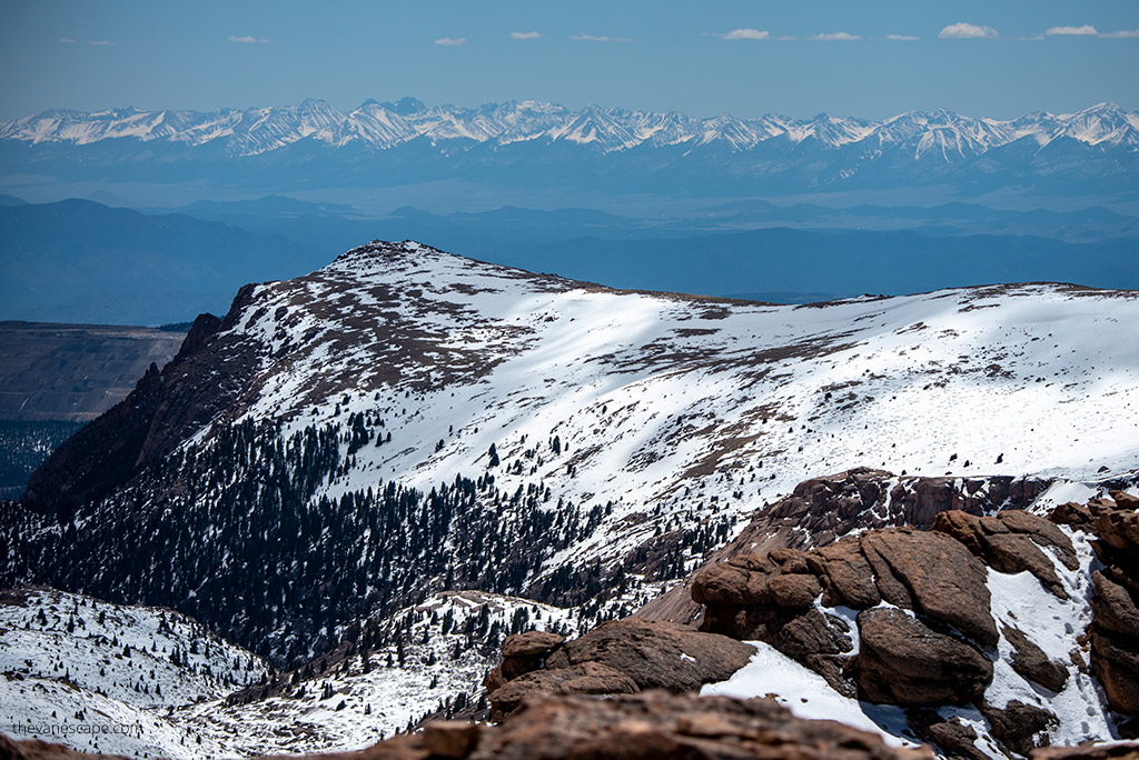
Reaching the top of Pikes Peak feels like standing on the roof of America. The views are massive — you can see across the plains of Colorado, the Sangre de Cristo Mountains, and even parts of New Mexico, Utah, and Kansas on clear days.
At the summit, you’ll find:
- The Pikes Peak Summit Visitor Center, open year-round (weather permitting)
- A gift shop and summit café
- Several viewing platforms with interpretive signs about the mountain’s history and geology
Spend at least 30–40 minutes up here to take in the scenery, grab a donut, and enjoy the fresh (and very thin) air.
Remember, it’s easy to get lightheaded or dizzy at this altitude. Move slowly, stay hydrated, and dress warmly — even in summer, it can be windy and cold.
Agnes’ Advice: Don’t plan to hike far at the top unless you’ve already adjusted to the elevation. Take your time, enjoy the views, and soak in the sense of accomplishment — you’ve just driven one of America’s most iconic roads.
Returning Down: Safety and Scenic Tips
The drive down Pikes Peak Highway can be just as thrilling as the climb — but it requires more attention. The road’s steep grade and sharp turns make braking technique and patience essential.
Take It Slow
Shift into a low gear before starting your descent. Avoid riding your brakes continuously — it’s the number one mistake drivers make here. Instead, let your engine do most of the work and gently tap your brakes when needed.
Brake Check at Glen Cove
About halfway down, you’ll stop at the Glen Cove brake checkpoint. Rangers will check your brake temperature to ensure it’s within a safe range. If your brakes are too hot, you’ll need to park and wait for them to cool — usually just 10 to 20 minutes. It’s a great excuse to rest, grab a snack, and enjoy the view.
Watch for Wildlife and Weather Changes
Deer, marmots, and even foxes often cross the road, especially in the cooler hours of the day. Also, weather can shift quickly — sunshine at the summit can turn into fog or rain halfway down. Keep your headlights on and stay alert.
Take Advantage of Pullouts
There are several scenic pullouts on the way down that you may have missed during your climb. Stop to enjoy those views, take photos, and give your brakes another break.
Agnes’ Advice: On our first drive down from Pikes Peak, we stopped several times to admire the views and let the brakes cool naturally — it made the descent stress-free. Don’t rush. The best way to enjoy Pikes Peak is to treat it like an experience, not just a drive.
Is Driving Up Pikes Peak Dangerous?
Many travelers wonder whether driving up Pikes Peak Highway is safe. The short answer is yes — it’s safe if you drive carefully and follow the rules. The road is fully paved, wide enough for two-way traffic, and has plenty of pullouts where you can stop, rest, or let faster cars pass.
However, it’s still a mountain road, and that means you need to stay alert. The drive includes 156 turns and climbs 6,715 feet in just 19 miles. The air gets thinner, the temperature drops, and you’ll face a few steep drop-offs without guardrails. But as long as you drive slowly and pay attention, you’ll be fine.
Here are a few important safety tips:
- Obey speed limits — most sections are posted at 25 mph.
- Use low gear on the descent to prevent brake overheating.
- Never ride your brakes continuously on the way down; tap them gently when needed.
- Pull over only at designated areas — never stop in the middle of the road.
- Uphill traffic always has the right of way.
- Watch for cyclists and wildlife, especially near wooded areas and open ridges.
There’s a mandatory brake check station near Glen Cove on the way down. Rangers measure your brake temperature — if it’s too high, they’ll ask you to wait until they cool. It might sound strict, but it’s for your safety and your car’s.
In our experience, the drive isn’t scary. It’s thrilling, yes — steep and winding — but never dangerous if you respect the mountain and drive with care.
Other Ways to Reach the Pikes Peak Summit
Driving isn’t the only way to stand on the summit of Pikes Peak. If you prefer to sit back, hike, or join a tour, there are several great alternatives. Each option gives a different perspective of the mountain — from the ground, from the rails, or even on two wheels.
Pikes Peak Cog Railway
This is one of the most unique train rides in the United States and one of the highest railways in the world. The Pikes Peak Cog Railway, originally opened in 1891, climbs more than 7,000 feet over 9 miles from Manitou Springs to the summit.
The round trip takes about 3 hours: roughly one hour up, 40 minutes at the summit, and one hour down. Large panoramic windows let you enjoy the changing scenery — from pine forests to alpine tundra — without the stress of mountain driving.
Tickets start around $58 for adults and should be booked in advance, especially during summer. The train runs from May through late fall, depending on weather.
Guided Jeep or Van Tours
If you’d rather someone else do the driving, a guided tour is an excellent choice. Several local companies offer half-day Jeep or van tours to the summit. They include plenty of stops for photos, stories about the region, and a stress-free way to experience the mountain.
These tours are ideal if you’re short on time, not used to mountain driving, or traveling with family members who prefer a more relaxed ride.
Hiking to the Summit
If you’re an experienced hiker and ready for a challenge, you can hike to the top via the Barr Trail, which starts in Manitou Springs. It’s about 13 miles one way with a 7,400-foot elevation gain. Most hikers start before sunrise and take 6–10 hours to reach the top.
Because of the distance and altitude, this hike is strenuous and requires preparation, layers, and plenty of water. Some hikers spend the night at Barr Camp, about halfway up, to break the journey into two days.
Biking to the Summit
Cycling to the top of Pikes Peak is possible but demanding. The highway’s steep grade and thin air make it a serious challenge, even for seasoned cyclists. Helmets are required, and riders must start early to avoid heavy traffic.
Agnes’ Advice: We’ve done the drive and the cog railway — both are amazing but very different experiences. The train gives you time to relax and enjoy the scenery, while driving offers the freedom to stop anywhere along the way. If you have time, try both — one for the views, the other for the thrill.
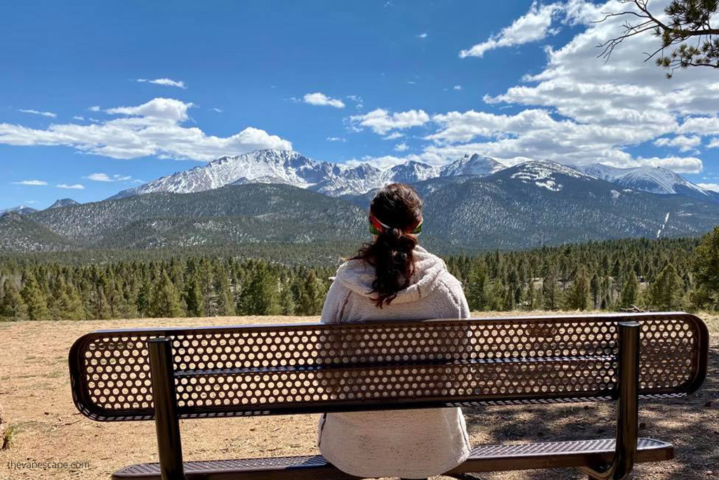
Final Thoughts
Driving up Pikes Peak Highway is one of the most unforgettable adventures in Colorado. Few places let you climb from forested foothills to over 14,000 feet in under an hour, surrounded by sweeping views at every turn. It’s a rare chance to experience the beauty of the Rockies without needing hiking gear or mountaineering skills.
Whether you drive your own car, ride the cog railway, or join a guided tour, this mountain offers something for everyone. Take your time, stop often, and enjoy the small moments — from the reflections at Crystal Reservoir to the crisp air at the summit.
Pick the experience that fits your travel style and comfort level. Driving gives you freedom and excitement, while the railway lets you relax and take in the scenery. However you go, plan for the weather, stay hydrated, and prepare for cooler temperatures at the top.
Pikes Peak is called “America’s Mountain” for a reason — it captures the adventurous spirit of the country. Reaching its summit is more than a scenic drive; it’s a reminder of how vast and beautiful the American landscape truly is.
If you’re building your itinerary, our Colorado road trip guide can help you connect all the highlights into one route.
Do You Like It? Pin It For Later!